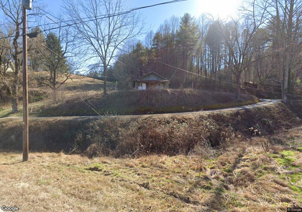
43 Pecan Ln Rabun Gap, GA 30568
Estimated Value: $129,720 - $330,000
3
Beds
1
Bath
1,056
Sq Ft
$234/Sq Ft
Est. Value
About This Home
This home is located at 43 Pecan Ln, Rabun Gap, GA 30568 and is currently estimated at $247,240, approximately $234 per square foot. 43 Pecan Ln is a home with nearby schools including Rabun County Primary School and Rabun County High School.
Ownership History
Date
Name
Owned For
Owner Type
Purchase Details
Closed on
Dec 7, 2023
Sold by
Billingsley William Vaughn
Bought by
Kilby Jerry Mack and Kilby Tammy B
Current Estimated Value
Purchase Details
Closed on
May 29, 2019
Sold by
Billingsley Lillie Savannah
Bought by
Billingsley William Vaughn
Purchase Details
Closed on
Jun 1, 1998
Bought by
Billingsley Lillie S
Purchase Details
Closed on
Mar 1, 1924
Create a Home Valuation Report for This Property
The Home Valuation Report is an in-depth analysis detailing your home's value as well as a comparison with similar homes in the area
Home Values in the Area
Average Home Value in this Area
Purchase History
| Date | Buyer | Sale Price | Title Company |
|---|---|---|---|
| Kilby Jerry Mack | -- | -- | |
| Billingsley William Vaughn | -- | -- | |
| Billingsley William Vaughn | -- | -- | |
| Billingsley Lillie S | -- | -- | |
| Billingsley Lillie S | -- | -- | |
| -- | -- | -- | |
| -- | -- | -- |
Source: Public Records
Tax History Compared to Growth
Tax History
| Year | Tax Paid | Tax Assessment Tax Assessment Total Assessment is a certain percentage of the fair market value that is determined by local assessors to be the total taxable value of land and additions on the property. | Land | Improvement |
|---|---|---|---|---|
| 2025 | $441 | $27,489 | $21,632 | $5,857 |
| 2024 | $435 | $27,100 | $21,632 | $5,468 |
| 2023 | $463 | $25,284 | $20,360 | $4,924 |
| 2022 | $436 | $23,823 | $19,087 | $4,736 |
| 2021 | $410 | $21,873 | $17,814 | $4,059 |
| 2020 | $414 | $21,341 | $17,814 | $3,527 |
| 2019 | $417 | $21,341 | $17,814 | $3,527 |
| 2018 | $418 | $21,341 | $17,814 | $3,527 |
| 2017 | $401 | $21,341 | $17,814 | $3,527 |
| 2016 | $402 | $21,341 | $17,814 | $3,527 |
| 2015 | $405 | $21,052 | $17,814 | $3,238 |
| 2014 | $408 | $21,052 | $17,814 | $3,238 |
Source: Public Records
Map
Nearby Homes
- 0 Sylvan Lake Dr Unit 47,48 10485897
- 46 Clare Ln
- 0 Crest Ln Unit LOT 5 10572844
- 0 Pitts Way Unit 10592369
- 189 Elm Ln
- 0 Black Rock Estates Unit 25 10374676
- 153 Coleman Heights Ln
- 1422 Wolffork Rd
- 373 Western Way
- 0 Alto Ln Unit 10533235
- 52 Lucky Ln
- 784 Wolffork Church Rd
- 5192 Wolffork Rd
- 548 Black Rock Mountain Pkwy
- 5019 Wolffork Rd
- 36 Maple Springs Ln
- 230 Majors Ln
- 243 Degroff Ln
- 0 Forest Canopy Way Unit 11
- 786 Hope Haven Ln
- 421 Taylors Chapel Rd
- 28 Mayflower Ln
- 122 Loop Way
- 398 Taylors Chapel Rd
- 557 Taylors Chapel Rd
- 132 Mayflower Ln
- 184 Pecan Ln
- 559 Taylors Chapel Rd
- 79 Loop Way
- 346 Taylors Chapel Rd
- 587 Whisper Wind Dr
- 690 Taylors Chapel Rd
- 49 Loop Way
- 276 Taylors Chapel Rd
- 73 Loop Way
- 701 Taylors Chapel Rd
- 702 Taylors Chapel Rd
- 272 Sylvan Lake Dr
- 318 Sylvan Lake Dr
- 21 Loop Way