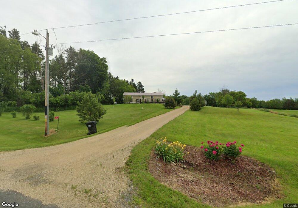
43 Polk Barron St Clear Lake, WI 54005
Estimated Value: $219,000 - $286,849
4
Beds
2
Baths
1,380
Sq Ft
$186/Sq Ft
Est. Value
About This Home
This home is located at 43 Polk Barron St, Clear Lake, WI 54005 and is currently estimated at $256,462, approximately $185 per square foot. 43 Polk Barron St is a home located in Barron County with nearby schools including Clear Lake High School and Sunnyside Elementary School.
Ownership History
Date
Name
Owned For
Owner Type
Purchase Details
Closed on
Jun 10, 2021
Sold by
Evenson Brett
Bought by
Marik Steven L
Current Estimated Value
Home Financials for this Owner
Home Financials are based on the most recent Mortgage that was taken out on this home.
Interest Rate
2.9%
Purchase Details
Closed on
Jun 5, 2013
Sold by
Federal National Mortgage Association
Bought by
Maloney Kent
Create a Home Valuation Report for This Property
The Home Valuation Report is an in-depth analysis detailing your home's value as well as a comparison with similar homes in the area
Home Values in the Area
Average Home Value in this Area
Purchase History
| Date | Buyer | Sale Price | Title Company |
|---|---|---|---|
| Marik Steven L | $214,000 | -- | |
| Marik Steven L | $214,000 | -- | |
| Maloney Kent | $151,800 | -- |
Source: Public Records
Mortgage History
| Date | Status | Borrower | Loan Amount |
|---|---|---|---|
| Closed | Marik Steven L | -- |
Source: Public Records
Tax History Compared to Growth
Tax History
| Year | Tax Paid | Tax Assessment Tax Assessment Total Assessment is a certain percentage of the fair market value that is determined by local assessors to be the total taxable value of land and additions on the property. | Land | Improvement |
|---|---|---|---|---|
| 2024 | $1,426 | $114,800 | $9,200 | $105,600 |
| 2023 | $1,242 | $95,800 | $6,000 | $89,800 |
| 2022 | $1,303 | $79,900 | $5,000 | $74,900 |
| 2021 | $1,280 | $61,500 | $3,900 | $57,600 |
| 2020 | $1,306 | $61,500 | $3,900 | $57,600 |
| 2019 | $1,137 | $61,500 | $3,900 | $57,600 |
| 2018 | $1,132 | $61,500 | $3,900 | $57,600 |
| 2017 | $1,089 | $61,500 | $3,900 | $57,600 |
| 2016 | $1,176 | $61,500 | $3,900 | $57,600 |
| 2015 | $1,272 | $61,500 | $3,900 | $57,600 |
| 2014 | $1,188 | $61,500 | $3,900 | $57,600 |
| 2013 | $1,197 | $61,500 | $3,900 | $57,600 |
Source: Public Records
Map
Nearby Homes
- 41 County Line Ave
- 30 10th St
- 319 1st Ave
- 338 40th St
- TBD Lot 1 1270th Ave
- TBD Lot 2 1270th Ave
- 67 60th Ave
- 230 1st Ave E
- Lot 2 1240th Ave
- Lot 1 1240th Ave
- 1920 Cty Rd P
- TBD County Highway Pi
- 990 3rd St SW
- Xxx County Road P
- 245 1st Ave W
- 240 3rd Ave
- 260 Pershing Ave
- 385 1st Ave W
- 2389 Us Highway 63
- 13969 250th St
- 43 Polk-Barron St
- 43 Barron-Polk St
- 97 Polk Barron St
- 59 County Line St
- 67 Polk Barron St
- 23 County Line St Unit A
- 23 County Line St Unit A
- 6 Barron Dunn Ave
- 74 10th St
- E156 1450th Ave
- E148 1450th Ave
- 14 10th Ave
- 11 1st Ave
- 10 Ac 1st Ave
- 10 1st Ave
- 32 10th Ave
- 44 Barron Dunn Ave
- 34 10th Ave
- E250 1450th Ave
- 48 Barron Dunn Ave