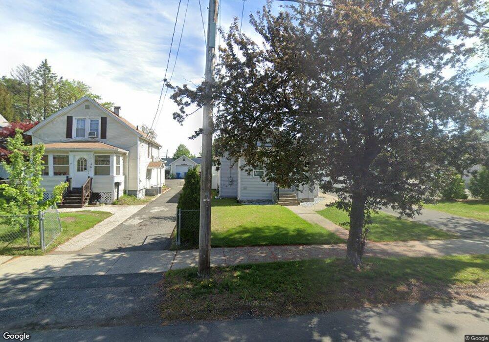
43 Roanoke Ave West Springfield, MA 01089
Estimated Value: $242,000 - $257,389
2
Beds
1
Bath
881
Sq Ft
$286/Sq Ft
Est. Value
About This Home
This home is located at 43 Roanoke Ave, West Springfield, MA 01089 and is currently estimated at $252,347, approximately $286 per square foot. 43 Roanoke Ave is a home located in Hampden County with nearby schools including West Springfield High School, Hampden Charter School of Science West, and St Thomas The Apostle School.
Ownership History
Date
Name
Owned For
Owner Type
Purchase Details
Closed on
May 25, 2012
Sold by
Chavez-Andres Teodora
Bought by
Chavez Brenda X and Chavez Patricia E
Current Estimated Value
Purchase Details
Closed on
Jul 1, 1994
Sold by
Commercial Credit
Bought by
Chavez Andres and Chavez Teodora
Home Financials for this Owner
Home Financials are based on the most recent Mortgage that was taken out on this home.
Original Mortgage
$29,333
Interest Rate
8.55%
Mortgage Type
Purchase Money Mortgage
Purchase Details
Closed on
May 3, 1994
Sold by
Hollis Joseph E
Bought by
Commercial Credit Corp
Home Financials for this Owner
Home Financials are based on the most recent Mortgage that was taken out on this home.
Original Mortgage
$29,333
Interest Rate
8.55%
Mortgage Type
Purchase Money Mortgage
Create a Home Valuation Report for This Property
The Home Valuation Report is an in-depth analysis detailing your home's value as well as a comparison with similar homes in the area
Home Values in the Area
Average Home Value in this Area
Purchase History
| Date | Buyer | Sale Price | Title Company |
|---|---|---|---|
| Chavez Brenda X | -- | -- | |
| Chavez Andres | $25,000 | -- | |
| Commercial Credit Corp | $13,370 | -- |
Source: Public Records
Mortgage History
| Date | Status | Borrower | Loan Amount |
|---|---|---|---|
| Previous Owner | Commercial Credit Corp | $32,000 | |
| Previous Owner | Commercial Credit Corp | $29,333 | |
| Previous Owner | Commercial Credit Corp | $13,310 | |
| Previous Owner | Commercial Credit Corp | $10,100 |
Source: Public Records
Tax History Compared to Growth
Tax History
| Year | Tax Paid | Tax Assessment Tax Assessment Total Assessment is a certain percentage of the fair market value that is determined by local assessors to be the total taxable value of land and additions on the property. | Land | Improvement |
|---|---|---|---|---|
| 2025 | $3,044 | $204,700 | $85,300 | $119,400 |
| 2024 | $2,938 | $198,400 | $85,300 | $113,100 |
| 2023 | $2,760 | $177,600 | $85,300 | $92,300 |
| 2022 | $2,531 | $160,600 | $77,400 | $83,200 |
| 2021 | $2,249 | $133,100 | $61,900 | $71,200 |
| 2020 | $2,258 | $132,900 | $61,900 | $71,000 |
| 2019 | $2,254 | $132,900 | $61,900 | $71,000 |
| 2018 | $2,266 | $132,900 | $61,900 | $71,000 |
| 2017 | $2,266 | $132,900 | $61,900 | $71,000 |
| 2016 | $2,258 | $132,900 | $59,500 | $73,400 |
| 2015 | $2,132 | $125,500 | $58,300 | $67,200 |
| 2014 | $516 | $125,500 | $58,300 | $67,200 |
Source: Public Records
Map
Nearby Homes
- 369 Cold Spring Ave
- 31 Colony Rd
- 32 Colony Rd Unit 1
- 56 Exposition Terrace
- Lot 10 Ahiska Rd
- 44 Spring St
- 67 Suffield St
- 51 Reed St
- 21 High St
- 120 Hampden St
- 138 Suffield St
- 25 Hillcrest St
- 121 Reed St
- 11 Stanley Place
- 27 Park Avenue Ct Unit 8
- 25 Damato Way
- 95 Park Ave Unit 1
- 44 Spring St
- 30 Chestnut St
- 37 Day St
- 39 Roanoke Ave
- 35 Roanoke Ave
- 47 Roanoke Ave
- 156 Heywood Ave
- 29 Roanoke Ave
- 170 Heywood Ave
- 178 Heywood Ave
- 25 Roanoke Ave
- 50 Roanoke Ave
- 182 Heywood Ave
- 19 Roanoke Ave
- 64 Roanoke Ave
- 36 Roanoke Ave
- 395 Cold Spring Ave
- 15 Roanoke Ave
- 190 Heywood Ave
- 389 Cold Spring Ave
- 20 Roanoke Ave
- 387 Cold Spring Ave
- 11 Roanoke Ave