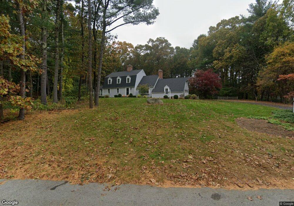
43 Robert Best Rd Sudbury, MA 01776
Estimated Value: $1,066,000 - $1,292,000
4
Beds
3
Baths
2,690
Sq Ft
$449/Sq Ft
Est. Value
About This Home
This home is located at 43 Robert Best Rd, Sudbury, MA 01776 and is currently estimated at $1,208,567, approximately $449 per square foot. 43 Robert Best Rd is a home located in Middlesex County with nearby schools including Israel Loring Elementary School, Ephraim Curtis Middle School, and Lincoln-Sudbury Regional High School.
Ownership History
Date
Name
Owned For
Owner Type
Purchase Details
Closed on
Jun 8, 2005
Sold by
Gennaro Dorothy B and Gennaro Louis R
Bought by
Tabasky Jonathan and Tabasky Kerri
Current Estimated Value
Home Financials for this Owner
Home Financials are based on the most recent Mortgage that was taken out on this home.
Original Mortgage
$550,000
Outstanding Balance
$287,687
Interest Rate
5.79%
Mortgage Type
Purchase Money Mortgage
Estimated Equity
$920,880
Create a Home Valuation Report for This Property
The Home Valuation Report is an in-depth analysis detailing your home's value as well as a comparison with similar homes in the area
Home Values in the Area
Average Home Value in this Area
Purchase History
| Date | Buyer | Sale Price | Title Company |
|---|---|---|---|
| Tabasky Jonathan | $755,000 | -- |
Source: Public Records
Mortgage History
| Date | Status | Borrower | Loan Amount |
|---|---|---|---|
| Open | Tabasky Jonathan | $550,000 |
Source: Public Records
Tax History Compared to Growth
Tax History
| Year | Tax Paid | Tax Assessment Tax Assessment Total Assessment is a certain percentage of the fair market value that is determined by local assessors to be the total taxable value of land and additions on the property. | Land | Improvement |
|---|---|---|---|---|
| 2025 | $16,966 | $1,158,900 | $510,000 | $648,900 |
| 2024 | $16,346 | $1,118,800 | $495,600 | $623,200 |
| 2023 | $15,228 | $965,600 | $443,600 | $522,000 |
| 2022 | $15,016 | $831,900 | $407,600 | $424,300 |
| 2021 | $14,386 | $764,000 | $407,600 | $356,400 |
| 2020 | $14,096 | $764,000 | $407,600 | $356,400 |
| 2019 | $13,683 | $764,000 | $407,600 | $356,400 |
| 2018 | $13,603 | $758,700 | $433,200 | $325,500 |
| 2017 | $13,342 | $752,100 | $429,600 | $322,500 |
| 2016 | $12,937 | $726,800 | $413,600 | $313,200 |
| 2015 | $12,478 | $709,000 | $402,000 | $307,000 |
| 2014 | $12,464 | $691,300 | $390,400 | $300,900 |
Source: Public Records
Map
Nearby Homes
- 143 Peakham Rd
- 30 Rolling Ln
- 7 Saddle Ridge Rd
- 12 Hickory Rd
- 54 Stone Rd
- 0 Robbins Rd
- 21 Summer St
- 0 Boston Post Rd
- 123 Dutton Rd
- 89 Bridle Path
- 7 Adams Rd
- 24 Woodland Rd
- 270 Old Lancaster Rd
- 128 Nobscot Rd
- 1011 Boston Post Rd
- 47 Fairbank Rd
- 36 Old Forge Ln
- 30 Nobscot Rd Unit 14
- 100 Nobscot Dr
- 4 Elderberry Cir
- 33 Robert Best Rd
- 53 Robert Best Rd
- 56 Robert Best Rd
- 36 Robert Best Rd
- 34 Robert Best Rd
- 16 Curtis Cir
- 11 Colburn Cir
- 24 Curtis Cir
- 6 Colburn Cir
- 64 Robert Best Rd
- 5 Curtis Cir
- 25 Robert Best Rd
- 19 Colburn Cir
- 12 Colburn Cir
- 15 Curtis Cir
- 21 Curtis Cir
- 185 Peakham Rd
- 173 Peakham Rd
- 20 Robert Best Rd
- 161 Peakham Rd