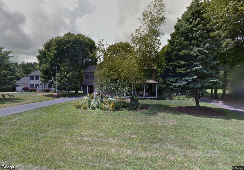
43 S Walnut St Mansfield, MA 02048
Estimated Value: $859,000 - $1,098,583
4
Beds
4
Baths
3,352
Sq Ft
$296/Sq Ft
Est. Value
About This Home
This home is located at 43 S Walnut St, Mansfield, MA 02048 and is currently estimated at $993,396, approximately $296 per square foot. 43 S Walnut St is a home located in Bristol County with nearby schools including Everett W. Robinson Elementary School, Jordan/Jackson Elementary School, and Harold L. Qualters Middle School.
Ownership History
Date
Name
Owned For
Owner Type
Purchase Details
Closed on
May 2, 2007
Sold by
Lajoie O Conrad and Lajoie Omer C
Bought by
Catherine M Harding Re
Current Estimated Value
Purchase Details
Closed on
Jul 14, 2004
Sold by
Lajoie Omer C and Conrad Lajoie O
Bought by
Lajoie Omer C and Lajoie Patricia M
Create a Home Valuation Report for This Property
The Home Valuation Report is an in-depth analysis detailing your home's value as well as a comparison with similar homes in the area
Home Values in the Area
Average Home Value in this Area
Purchase History
| Date | Buyer | Sale Price | Title Company |
|---|---|---|---|
| Catherine M Harding Re | $460,000 | -- | |
| Lajoie Omer Conrad | -- | -- | |
| Lajoie Omer C | -- | -- |
Source: Public Records
Tax History
| Year | Tax Paid | Tax Assessment Tax Assessment Total Assessment is a certain percentage of the fair market value that is determined by local assessors to be the total taxable value of land and additions on the property. | Land | Improvement |
|---|---|---|---|---|
| 2025 | $13,394 | $1,017,000 | $254,200 | $762,800 |
| 2024 | $12,949 | $959,200 | $254,200 | $705,000 |
| 2023 | $12,254 | $869,700 | $254,200 | $615,500 |
| 2022 | $11,798 | $777,700 | $235,600 | $542,100 |
| 2021 | $11,804 | $768,500 | $206,300 | $562,200 |
| 2020 | $11,151 | $726,000 | $196,500 | $529,500 |
| 2019 | $11,097 | $729,100 | $163,900 | $565,200 |
| 2018 | $212 | $707,100 | $156,500 | $550,600 |
| 2017 | $10,349 | $689,000 | $152,100 | $536,900 |
| 2016 | $9,758 | $633,200 | $144,800 | $488,400 |
| 2015 | $9,357 | $603,700 | $144,800 | $458,900 |
Source: Public Records
Map
Nearby Homes
Your Personal Tour Guide
Ask me questions while you tour the home.