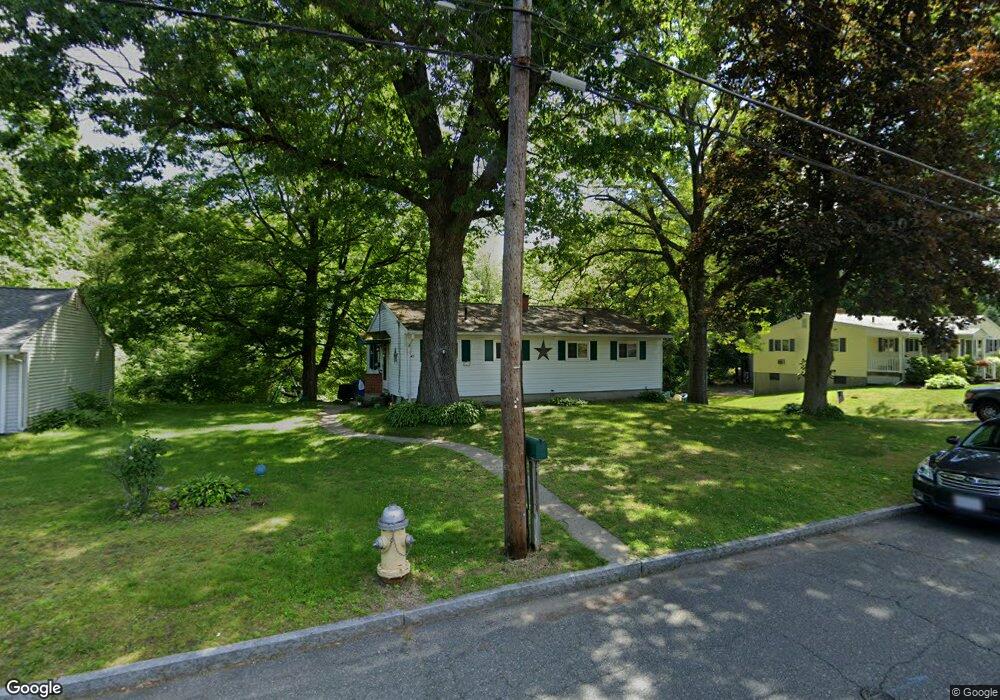
43 Shady Brook Ln Springfield, MA 01118
East Forest Park NeighborhoodEstimated Value: $278,000 - $295,000
3
Beds
1
Bath
1,040
Sq Ft
$276/Sq Ft
Est. Value
About This Home
This home is located at 43 Shady Brook Ln, Springfield, MA 01118 and is currently estimated at $287,229, approximately $276 per square foot. 43 Shady Brook Ln is a home located in Hampden County with nearby schools including Frederick Harris Elementary School, M Marcus Kiley Middle, and Springfield High School of Science and Technology.
Ownership History
Date
Name
Owned For
Owner Type
Purchase Details
Closed on
Apr 27, 2004
Sold by
Morrissey Brian J and Morrissey Donna M
Bought by
Austin John F
Current Estimated Value
Home Financials for this Owner
Home Financials are based on the most recent Mortgage that was taken out on this home.
Original Mortgage
$78,155
Outstanding Balance
$36,386
Interest Rate
5.4%
Mortgage Type
Purchase Money Mortgage
Estimated Equity
$250,843
Purchase Details
Closed on
Oct 29, 1998
Sold by
Winn Jeannette A
Bought by
Morrissey Brian J and Morrissey Donna M
Home Financials for this Owner
Home Financials are based on the most recent Mortgage that was taken out on this home.
Original Mortgage
$56,000
Interest Rate
6.68%
Mortgage Type
Purchase Money Mortgage
Purchase Details
Closed on
Dec 21, 1989
Sold by
Winn Robert E
Bought by
Bond Angela M
Home Financials for this Owner
Home Financials are based on the most recent Mortgage that was taken out on this home.
Original Mortgage
$88,000
Interest Rate
9.69%
Mortgage Type
Purchase Money Mortgage
Create a Home Valuation Report for This Property
The Home Valuation Report is an in-depth analysis detailing your home's value as well as a comparison with similar homes in the area
Home Values in the Area
Average Home Value in this Area
Purchase History
| Date | Buyer | Sale Price | Title Company |
|---|---|---|---|
| Austin John F | $79,400 | -- | |
| Morrissey Brian J | $70,000 | -- | |
| Bond Angela M | $118,000 | -- |
Source: Public Records
Mortgage History
| Date | Status | Borrower | Loan Amount |
|---|---|---|---|
| Open | Austin John F | $78,155 | |
| Previous Owner | Bond Angela M | $56,000 | |
| Previous Owner | Bond Angela M | $88,000 |
Source: Public Records
Tax History Compared to Growth
Tax History
| Year | Tax Paid | Tax Assessment Tax Assessment Total Assessment is a certain percentage of the fair market value that is determined by local assessors to be the total taxable value of land and additions on the property. | Land | Improvement |
|---|---|---|---|---|
| 2025 | $3,515 | $224,200 | $59,200 | $165,000 |
| 2024 | $3,180 | $198,000 | $59,200 | $138,800 |
| 2023 | $3,412 | $200,100 | $56,400 | $143,700 |
| 2022 | $3,333 | $177,100 | $56,400 | $120,700 |
| 2021 | $3,075 | $162,700 | $51,300 | $111,400 |
| 2020 | $2,869 | $146,900 | $51,300 | $95,600 |
| 2019 | $2,710 | $137,700 | $51,300 | $86,400 |
| 2018 | $2,698 | $137,100 | $51,300 | $85,800 |
| 2017 | $2,642 | $134,400 | $51,300 | $83,100 |
| 2016 | $2,507 | $127,500 | $51,300 | $76,200 |
| 2015 | $2,585 | $131,400 | $51,300 | $80,100 |
Source: Public Records
Map
Nearby Homes
- 54 Shady Brook Ln
- 55 Allen St
- 43 Sunridge Dr
- 17 Pebble Mill Rd
- 196 Sawmill Rd
- 86 Talmadge Dr
- 5 Manor Ct Unit 5
- 19 Manor Ct Unit 19
- 125 Manor Ct Unit 125
- 82 Louis Rd
- 101 Regal St
- 206 Treetop Ave
- 392 Gifford St
- 290 Newton Rd
- 157 Canterbury Rd
- 27 Regal St
- 41 Hillside Dr
- 77 W Allen Ridge Rd
- 99 W Crystal Brook Dr
- 331 Newhouse St
- 51 Shady Brook Ln
- 33 Shady Brook Ln
- 25 Shady Brook Ln
- 44 Shady Brook Ln
- 63 Shady Brook Ln
- 36 Shady Brook Ln
- 50 Cornflower St
- 58 Cornflower St
- 26 Shady Brook Ln
- 64 Shady Brook Ln
- 15 Shady Brook Ln
- 16 Cornflower St
- 41 Corcoran Blvd
- 16 Shady Brook Ln
- 68 Cornflower St
- 31 Corcoran Blvd
- 49 Corcoran Blvd
- 77 Shady Brook Ln
- 5 Shady Brook Ln
- 23 Corcoran Blvd