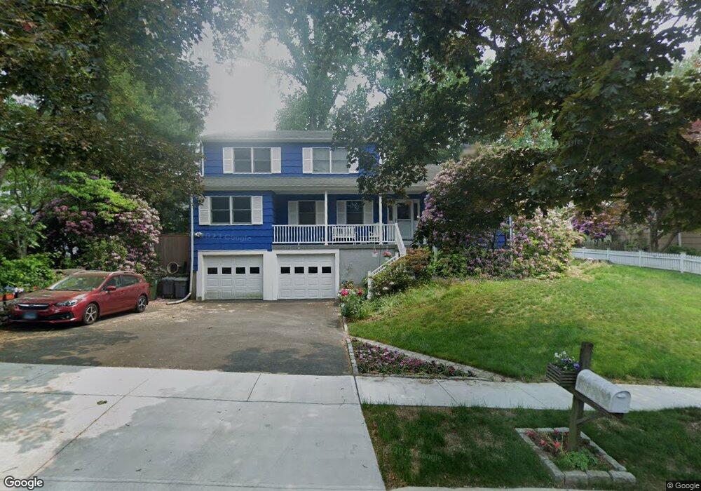
43 Shagbark Ln Fairfield, CT 06824
University NeighborhoodEstimated Value: $864,000 - $1,041,000
3
Beds
3
Baths
2,309
Sq Ft
$408/Sq Ft
Est. Value
About This Home
This home is located at 43 Shagbark Ln, Fairfield, CT 06824 and is currently estimated at $942,745, approximately $408 per square foot. 43 Shagbark Ln is a home located in Fairfield County with nearby schools including Holland Hill Elementary, Fairfield Woods Middle School, and Fairfield Ludlowe High School.
Ownership History
Date
Name
Owned For
Owner Type
Purchase Details
Closed on
Jul 24, 2003
Sold by
Darby Vivian J
Bought by
Essea Paul F and Essea Margaret A
Current Estimated Value
Home Financials for this Owner
Home Financials are based on the most recent Mortgage that was taken out on this home.
Original Mortgage
$300,000
Outstanding Balance
$127,641
Interest Rate
5.27%
Estimated Equity
$815,104
Purchase Details
Closed on
Nov 30, 1988
Sold by
Dempsey Robert J
Bought by
Datby Jerome S
Home Financials for this Owner
Home Financials are based on the most recent Mortgage that was taken out on this home.
Original Mortgage
$250,000
Interest Rate
10.19%
Mortgage Type
Purchase Money Mortgage
Create a Home Valuation Report for This Property
The Home Valuation Report is an in-depth analysis detailing your home's value as well as a comparison with similar homes in the area
Home Values in the Area
Average Home Value in this Area
Purchase History
| Date | Buyer | Sale Price | Title Company |
|---|---|---|---|
| Essea Paul F | $550,000 | -- | |
| Essea Paul F | $550,000 | -- | |
| Datby Jerome S | $280,000 | -- |
Source: Public Records
Mortgage History
| Date | Status | Borrower | Loan Amount |
|---|---|---|---|
| Open | Datby Jerome S | $300,000 | |
| Closed | Datby Jerome S | $300,000 | |
| Previous Owner | Datby Jerome S | $215,000 | |
| Previous Owner | Datby Jerome S | $250,000 |
Source: Public Records
Tax History
| Year | Tax Paid | Tax Assessment Tax Assessment Total Assessment is a certain percentage of the fair market value that is determined by local assessors to be the total taxable value of land and additions on the property. | Land | Improvement |
|---|---|---|---|---|
| 2025 | $11,737 | $413,420 | $236,110 | $177,310 |
| 2024 | $11,534 | $413,420 | $236,110 | $177,310 |
| 2023 | $11,373 | $413,420 | $236,110 | $177,310 |
| 2022 | $11,262 | $413,420 | $236,110 | $177,310 |
| 2021 | $11,154 | $413,420 | $236,110 | $177,310 |
| 2020 | $11,713 | $437,220 | $232,680 | $204,540 |
| 2019 | $11,713 | $437,220 | $232,680 | $204,540 |
| 2018 | $11,525 | $437,220 | $232,680 | $204,540 |
| 2017 | $11,289 | $437,220 | $232,680 | $204,540 |
| 2016 | $11,127 | $437,220 | $232,680 | $204,540 |
| 2015 | $9,683 | $390,600 | $205,800 | $184,800 |
| 2014 | $9,531 | $390,600 | $205,800 | $184,800 |
Source: Public Records
Map
Nearby Homes
- 41 Pepperbush Ln
- 28 Country Rd
- 12 Sugar Plum Ln
- 245 Reid St
- 11 Tuckahoe Ln
- 21 Boroskey Rd
- 359 Reid St
- 196 Robin Ln
- 109 Katona Dr Unit 18
- 115 Mayfair Rd
- 42 Robin Cir
- 108 Roseville St
- 158 Mayfair Rd
- 68 Figlar Ave
- 214 York Rd
- 12 Reynolds Dr
- 706 Judd St
- 240 Sunnyridge Ave Unit 63
- 274 High St
- 206 Sterling St
Your Personal Tour Guide
Ask me questions while you tour the home.