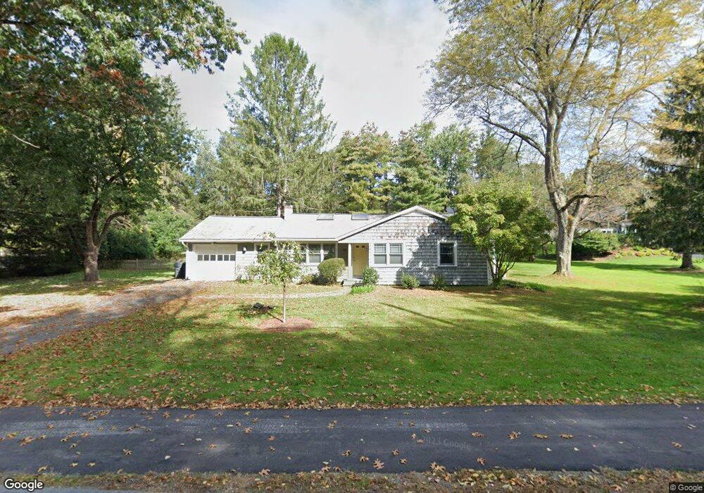
43 Sherman Bridge Rd Unit 43 Wayland, MA 01778
Estimated Value: $929,000 - $1,085,000
3
Beds
2
Baths
1,750
Sq Ft
$576/Sq Ft
Est. Value
About This Home
This home is located at 43 Sherman Bridge Rd Unit 43, Wayland, MA 01778 and is currently estimated at $1,008,173, approximately $576 per square foot. 43 Sherman Bridge Rd Unit 43 is a home located in Middlesex County with nearby schools including Wayland High School, Willow Hill School, and Corwin-Russell School at Broccoli Hall.
Ownership History
Date
Name
Owned For
Owner Type
Purchase Details
Closed on
Aug 20, 2004
Sold by
Flathers Lisa C and Flathers Scott M
Bought by
Kokate Charulata
Current Estimated Value
Home Financials for this Owner
Home Financials are based on the most recent Mortgage that was taken out on this home.
Original Mortgage
$452,000
Outstanding Balance
$224,587
Interest Rate
6.03%
Mortgage Type
Purchase Money Mortgage
Estimated Equity
$783,586
Create a Home Valuation Report for This Property
The Home Valuation Report is an in-depth analysis detailing your home's value as well as a comparison with similar homes in the area
Home Values in the Area
Average Home Value in this Area
Purchase History
| Date | Buyer | Sale Price | Title Company |
|---|---|---|---|
| Kokate Charulata | $565,000 | -- | |
| Kokate Charulata | $565,000 | -- |
Source: Public Records
Mortgage History
| Date | Status | Borrower | Loan Amount |
|---|---|---|---|
| Open | Kokate Charulata | $452,000 | |
| Closed | Kokate Charulata | $452,000 | |
| Previous Owner | Kokate Charulata | $86,000 | |
| Previous Owner | Kokate Charulata | $100,000 |
Source: Public Records
Tax History Compared to Growth
Tax History
| Year | Tax Paid | Tax Assessment Tax Assessment Total Assessment is a certain percentage of the fair market value that is determined by local assessors to be the total taxable value of land and additions on the property. | Land | Improvement |
|---|---|---|---|---|
| 2025 | $12,885 | $824,400 | $524,500 | $299,900 |
| 2024 | $12,196 | $785,800 | $499,600 | $286,200 |
| 2023 | $12,078 | $725,400 | $454,300 | $271,100 |
| 2022 | $10,942 | $596,300 | $376,300 | $220,000 |
| 2021 | $20,427 | $560,500 | $342,100 | $218,400 |
| 2020 | $9,954 | $560,500 | $342,100 | $218,400 |
| 2019 | $18,013 | $537,900 | $325,900 | $212,000 |
| 2018 | $9,157 | $507,900 | $325,900 | $182,000 |
| 2017 | $8,930 | $492,300 | $310,300 | $182,000 |
| 2016 | $8,432 | $486,300 | $304,300 | $182,000 |
| 2015 | $8,943 | $486,300 | $304,300 | $182,000 |
Source: Public Records
Map
Nearby Homes
- 15 Lewis Path
- 134 Chestnut Cir
- 93 Old Sudbury Rd
- 244 Lincoln Rd
- Lot 5 Sailaway Ln
- 45 N Crescent Cir
- Lot 4 Sailaway Ln
- 2 Betts Way
- 8 Mina Way
- 0 Elm Unit 73282184
- Lot 9 Sailaway Ln
- 4 Betts Way
- 122 Sand Gully Rd N Unit B
- 941 Concord Rd
- 192 Concord Rd
- 152 S Great Rd
- 17 Glezen Ln
- 56 Rookery Ln Unit 4
- 401 Emery Ln Unit 304
- 9 River Rock Way Unit 9
- 43 Sherman Bridge Rd
- 45 Sherman's Bridge Rd
- 39 Sherman Bridge Rd
- 45 Sherman Bridge Rd
- 44 Sherman Bridge Rd
- 213 Oxbow Rd
- 40 Sherman Bridge Rd
- 33 Sherman Bridge Rd
- 47 Sherman Bridge Rd
- 47 Sherman's Bridge Rd
- 46 Sherman Bridge Rd
- 36 Sherman Bridge Rd
- 211 Oxbow Rd
- 220 Oxbow Rd
- 51 Sherman Bridge Rd
- 34 Sherman Bridge Rd
- 209 Oxbow Rd
- 52 Sherman Bridge Rd
- 216 Oxbow Rd
- 205 Oxbow Rd