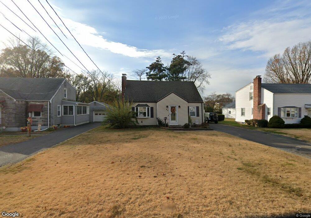
43 Tiffany Rd East Hartford, CT 06108
Estimated Value: $299,908 - $321,000
3
Beds
2
Baths
1,388
Sq Ft
$223/Sq Ft
Est. Value
About This Home
This home is located at 43 Tiffany Rd, East Hartford, CT 06108 and is currently estimated at $308,977, approximately $222 per square foot. 43 Tiffany Rd is a home located in Hartford County with nearby schools including Anna E. Norris School, East Hartford Middle School, and East Hartford High School.
Ownership History
Date
Name
Owned For
Owner Type
Purchase Details
Closed on
May 19, 2025
Sold by
Foster Edward P
Bought by
Foster Edward P and Foster Ada I
Current Estimated Value
Home Financials for this Owner
Home Financials are based on the most recent Mortgage that was taken out on this home.
Original Mortgage
$253,968
Outstanding Balance
$252,879
Interest Rate
6.83%
Mortgage Type
New Conventional
Estimated Equity
$56,098
Purchase Details
Closed on
May 29, 2007
Sold by
Ocasio Carlos
Bought by
Foster Edward
Home Financials for this Owner
Home Financials are based on the most recent Mortgage that was taken out on this home.
Original Mortgage
$239,900
Interest Rate
6.14%
Purchase Details
Closed on
Apr 15, 2004
Sold by
Department Of Housing & Urban Dev
Bought by
Ocasio Carlos
Purchase Details
Closed on
Jul 1, 2002
Sold by
711 Burnside Ave Llc
Bought by
Velez Michael A and Velezx Nelly
Purchase Details
Closed on
Mar 25, 2002
Sold by
Alampi Raffale and Alampi Maria R
Bought by
Burnside Ave Llc
Create a Home Valuation Report for This Property
The Home Valuation Report is an in-depth analysis detailing your home's value as well as a comparison with similar homes in the area
Home Values in the Area
Average Home Value in this Area
Purchase History
| Date | Buyer | Sale Price | Title Company |
|---|---|---|---|
| Foster Edward P | -- | None Available | |
| Foster Edward P | -- | None Available | |
| Foster Edward | $239,900 | -- | |
| Foster Edward | $239,900 | -- | |
| Ocasio Carlos | $130,000 | -- | |
| Ocasio Carlos | $130,000 | -- | |
| Velez Michael A | $145,000 | -- | |
| Velez Michael A | $145,000 | -- | |
| Burnside Ave Llc | $104,000 | -- | |
| Burnside Ave Llc | $104,000 | -- |
Source: Public Records
Mortgage History
| Date | Status | Borrower | Loan Amount |
|---|---|---|---|
| Open | Foster Edward P | $253,968 | |
| Closed | Foster Edward P | $253,968 | |
| Previous Owner | Burnside Ave Llc | $245,425 | |
| Previous Owner | Burnside Ave Llc | $239,900 |
Source: Public Records
Tax History Compared to Growth
Tax History
| Year | Tax Paid | Tax Assessment Tax Assessment Total Assessment is a certain percentage of the fair market value that is determined by local assessors to be the total taxable value of land and additions on the property. | Land | Improvement |
|---|---|---|---|---|
| 2025 | $6,187 | $134,800 | $39,050 | $95,750 |
| 2024 | $5,931 | $134,800 | $39,050 | $95,750 |
| 2023 | $5,734 | $134,800 | $39,050 | $95,750 |
| 2022 | $5,527 | $134,800 | $39,050 | $95,750 |
| 2021 | $4,868 | $98,650 | $32,870 | $65,780 |
| 2020 | $4,925 | $98,650 | $32,870 | $65,780 |
| 2019 | $4,845 | $98,650 | $32,870 | $65,780 |
| 2018 | $4,702 | $98,650 | $32,870 | $65,780 |
| 2017 | $4,641 | $98,650 | $32,870 | $65,780 |
| 2016 | $4,625 | $100,840 | $32,870 | $67,970 |
| 2015 | $4,625 | $100,840 | $32,870 | $67,970 |
| 2014 | $4,578 | $100,840 | $32,870 | $67,970 |
Source: Public Records
Map
Nearby Homes
- 39 Tiffany Rd
- 110 Goodwin St
- 67 Laurel St
- 50 Northbrook Ct
- 29 Joanne Dr Unit 29
- 89 Henderson Dr
- 22 Matthew Rd
- 15 Michael Ave
- 1589 Main St
- 51 Wood Dr
- 51 Daniel St
- 453 Burnside Ave
- 577 Goodwin St
- 103 Sparrowbush Rd
- 506 Burnside Ave
- 421 Tolland St
- 265 Burnside Ave
- 509 Burnside Ave Unit A18
- 10 Kenyon Place
- 181 Burnside Ave