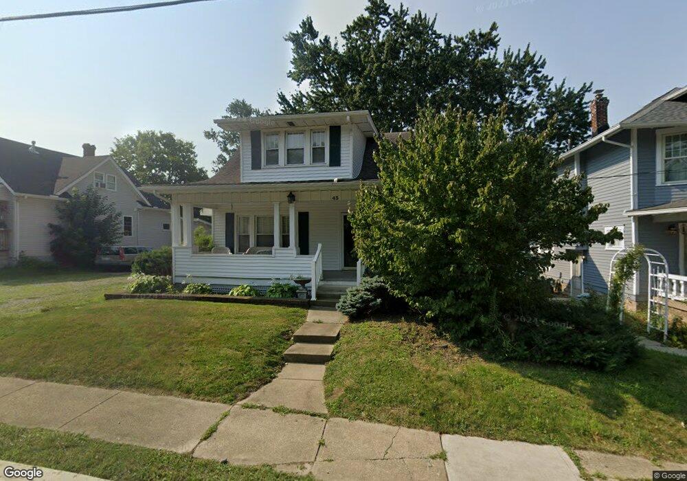
43 W Cherry St Sunbury, OH 43074
Estimated Value: $177,000 - $298,000
2
Beds
2
Baths
1,037
Sq Ft
$228/Sq Ft
Est. Value
About This Home
This home is located at 43 W Cherry St, Sunbury, OH 43074 and is currently estimated at $236,612, approximately $228 per square foot. 43 W Cherry St is a home with nearby schools including Big Walnut Intermediate School, Big Walnut Middle School, and Big Walnut High School.
Ownership History
Date
Name
Owned For
Owner Type
Purchase Details
Closed on
Mar 10, 2015
Sold by
Porter Pamels K and Porter Robert C
Bought by
The Pamela K Porter Trust and Porter Pamela K
Current Estimated Value
Purchase Details
Closed on
Jun 6, 2008
Sold by
Arthurs Marcine C and Snow Karen
Bought by
Porter Pamela K and Porter Robert C
Home Financials for this Owner
Home Financials are based on the most recent Mortgage that was taken out on this home.
Original Mortgage
$61,200
Interest Rate
6.09%
Mortgage Type
Purchase Money Mortgage
Create a Home Valuation Report for This Property
The Home Valuation Report is an in-depth analysis detailing your home's value as well as a comparison with similar homes in the area
Home Values in the Area
Average Home Value in this Area
Purchase History
| Date | Buyer | Sale Price | Title Company |
|---|---|---|---|
| The Pamela K Porter Trust | -- | None Available | |
| Porter Pamela K | $76,500 | None Available |
Source: Public Records
Mortgage History
| Date | Status | Borrower | Loan Amount |
|---|---|---|---|
| Previous Owner | Porter Pamela K | $61,200 |
Source: Public Records
Tax History Compared to Growth
Tax History
| Year | Tax Paid | Tax Assessment Tax Assessment Total Assessment is a certain percentage of the fair market value that is determined by local assessors to be the total taxable value of land and additions on the property. | Land | Improvement |
|---|---|---|---|---|
| 2024 | $2,106 | $51,380 | $14,980 | $36,400 |
| 2023 | $2,057 | $51,380 | $14,980 | $36,400 |
| 2022 | $1,813 | $39,380 | $9,940 | $29,440 |
| 2021 | $1,822 | $39,380 | $9,940 | $29,440 |
| 2020 | $1,829 | $39,380 | $9,940 | $29,440 |
| 2019 | $1,585 | $32,840 | $8,300 | $24,540 |
| 2018 | $1,495 | $32,840 | $8,300 | $24,540 |
| 2017 | $1,383 | $32,410 | $7,210 | $25,200 |
| 2016 | $1,331 | $32,410 | $7,210 | $25,200 |
| 2015 | $1,340 | $32,410 | $7,210 | $25,200 |
| 2014 | $1,389 | $32,410 | $7,210 | $25,200 |
| 2013 | $1,445 | $31,220 | $7,210 | $24,010 |
Source: Public Records
Map
Nearby Homes
- 202 N Columbus St
- 408 Village Ln
- 399 Village Ln
- 285 E Granville St
- 291 Hawthorne Rd
- 0 W Cherry St
- 239 Millpond Rd Unit 239
- 219 Millpond Rd Unit 219
- 732 N State Route 61
- 789 S Old 3c Rd
- 300 Fox Trail Dr
- 0 Hartford Rd Unit 8.65 acres 225028911
- 0 Hartford Rd Unit 8.17 acres 225016432
- 956 N State Route 61
- 561 Fields Meadow Dr
- 761 Buckeye Cir Unit Lot 2392
- 634 Mill Stone Dr
- 515 Cheshire Rd
- 659 Mill Stone Dr Unit Lot 2264
- 646 Village Mill Dr
- 49 W Cherry St
- 33 W Cherry St
- 29 W Cherry St
- 5 S Columbus St
- 20 W Cherry St
- 38 Evening St
- 67 W Cherry St
- 11 S Columbus St
- 73 W Cherry St
- 15 N Columbus St
- 25 N Columbus St
- 22 W Granville St Unit A,B
- 22 W Granville St Unit B
- 79 W Cherry St
- 35 N Columbus St
- 6 E Cherry St
- 41 N Columbus St
- 14 E Cherry St
- 47 N Columbus St
- 20 N Columbus St