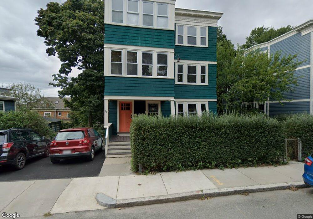
43 Wachusett St Unit 3 Jamaica Plain, MA 02130
Jamaica Plain NeighborhoodEstimated Value: $617,000 - $663,000
2
Beds
1
Bath
1,057
Sq Ft
$611/Sq Ft
Est. Value
About This Home
This home is located at 43 Wachusett St Unit 3, Jamaica Plain, MA 02130 and is currently estimated at $645,669, approximately $610 per square foot. 43 Wachusett St Unit 3 is a home located in Suffolk County with nearby schools including The Croft School - Jamaica Plain.
Ownership History
Date
Name
Owned For
Owner Type
Purchase Details
Closed on
Apr 1, 2002
Sold by
Wachusett St Rt 43
Bought by
Seletsky Lynda
Current Estimated Value
Home Financials for this Owner
Home Financials are based on the most recent Mortgage that was taken out on this home.
Original Mortgage
$178,400
Interest Rate
6.88%
Mortgage Type
Purchase Money Mortgage
Create a Home Valuation Report for This Property
The Home Valuation Report is an in-depth analysis detailing your home's value as well as a comparison with similar homes in the area
Home Values in the Area
Average Home Value in this Area
Purchase History
| Date | Buyer | Sale Price | Title Company |
|---|---|---|---|
| Seletsky Lynda | $226,000 | -- |
Source: Public Records
Mortgage History
| Date | Status | Borrower | Loan Amount |
|---|---|---|---|
| Open | Seletsky Lynda | $183,000 | |
| Closed | Seletsky Lynda | $201,000 | |
| Closed | Seletsky Lynda | $178,400 |
Source: Public Records
Tax History Compared to Growth
Tax History
| Year | Tax Paid | Tax Assessment Tax Assessment Total Assessment is a certain percentage of the fair market value that is determined by local assessors to be the total taxable value of land and additions on the property. | Land | Improvement |
|---|---|---|---|---|
| 2025 | $6,628 | $572,400 | $0 | $572,400 |
| 2024 | $5,697 | $522,700 | $0 | $522,700 |
| 2023 | $5,345 | $497,700 | $0 | $497,700 |
| 2022 | $5,108 | $469,500 | $0 | $469,500 |
| 2021 | $4,714 | $441,800 | $0 | $441,800 |
| 2020 | $4,212 | $398,900 | $0 | $398,900 |
| 2019 | $4,041 | $383,400 | $0 | $383,400 |
| 2018 | $3,902 | $372,300 | $0 | $372,300 |
| 2017 | $3,720 | $351,300 | $0 | $351,300 |
| 2016 | $3,611 | $328,300 | $0 | $328,300 |
| 2015 | $3,661 | $302,300 | $0 | $302,300 |
| 2014 | $3,587 | $285,100 | $0 | $285,100 |
Source: Public Records
Map
Nearby Homes
- 58 Weld Hill St Unit 2
- 64 Hyde Park Ave Unit 3
- 11 Weld Hill St Unit 2
- 143-171 Hyde Park Ave Unit 169A
- 140 Wachusett St
- 178 Hyde Park Ave Unit 3
- 26 Tower St
- 158 Wachusett St Unit 3
- 31 Rodman St Unit 2
- 31 Rodman St Unit 1
- 1 Catenaccia Way Unit 47
- 18-20 Northbourne Rd Unit 18
- 50 Southbourne Rd
- 5 Hampstead Ln Unit 1
- 19 Delford St
- 19 Delford St Unit 1
- 4012 Washington St
- 156A South St Unit 1L
- 5 View South Ave Unit 1
- 348-350 Hyde Park Ave Unit 2
- 43 Wachusett St Unit 2
- 43 Wachusett St Unit 1
- 43 Wachusett St Unit 2,43
- 37 Wachusett St Unit 3
- 37 Wachusett St Unit 2
- 37 Wachusett St Unit 1
- 37 Wachusett St Unit 1,37
- 37 Wachusett St
- 33 Wachusett St Unit 2
- 33 Wachusett St Unit 1
- 55 Wachusett St Unit 1
- 55 Wachusett St
- 55 Wachusett St Unit 2
- 55 Wachusett St
- 55 Wachusett St
- 57 Wachusett St Unit 1
- 57 Wachusett St Unit 3
- 57 Wachusett St Unit 2
- 57 Wachusett St
- 7 Craft Place Unit 2