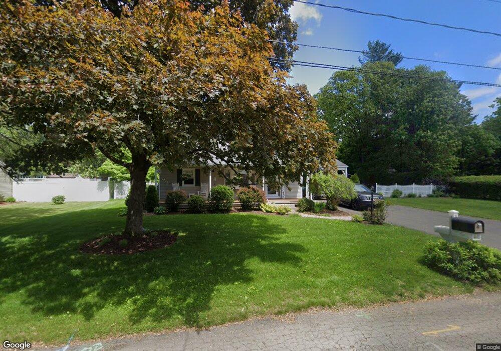
43 Ward Rd Westfield, MA 01085
Estimated Value: $373,426 - $381,000
3
Beds
2
Baths
1,700
Sq Ft
$222/Sq Ft
Est. Value
About This Home
This home is located at 43 Ward Rd, Westfield, MA 01085 and is currently estimated at $377,107, approximately $221 per square foot. 43 Ward Rd is a home located in Hampden County with nearby schools including Westfield High School and Saint Mary High School.
Ownership History
Date
Name
Owned For
Owner Type
Purchase Details
Closed on
Jul 22, 2015
Sold by
Wolanin David L
Bought by
Wolanin David L and Wolanin Donna J
Current Estimated Value
Purchase Details
Closed on
Aug 25, 2014
Sold by
Wolanin Tracey L
Bought by
Wolanin David L
Home Financials for this Owner
Home Financials are based on the most recent Mortgage that was taken out on this home.
Original Mortgage
$181,000
Interest Rate
4.14%
Mortgage Type
New Conventional
Purchase Details
Closed on
Aug 1, 2000
Sold by
Feldman Jack S and Feldman Maureen D
Bought by
Wolanin David L and Wolanin Tracey L
Home Financials for this Owner
Home Financials are based on the most recent Mortgage that was taken out on this home.
Original Mortgage
$118,400
Interest Rate
8.18%
Mortgage Type
Purchase Money Mortgage
Purchase Details
Closed on
May 15, 1992
Sold by
Trench David R and Trench Pamela E
Bought by
Feldman Jack S and Feldman Maureen D
Create a Home Valuation Report for This Property
The Home Valuation Report is an in-depth analysis detailing your home's value as well as a comparison with similar homes in the area
Home Values in the Area
Average Home Value in this Area
Purchase History
| Date | Buyer | Sale Price | Title Company |
|---|---|---|---|
| Wolanin David L | -- | -- | |
| Wolanin David L | -- | -- | |
| Wolanin David L | $148,000 | -- | |
| Feldman Jack S | $127,000 | -- |
Source: Public Records
Mortgage History
| Date | Status | Borrower | Loan Amount |
|---|---|---|---|
| Previous Owner | Wolanin David L | $181,000 | |
| Previous Owner | Feldman Jack S | $118,500 | |
| Previous Owner | Feldman Jack S | $118,400 |
Source: Public Records
Tax History Compared to Growth
Tax History
| Year | Tax Paid | Tax Assessment Tax Assessment Total Assessment is a certain percentage of the fair market value that is determined by local assessors to be the total taxable value of land and additions on the property. | Land | Improvement |
|---|---|---|---|---|
| 2025 | $4,710 | $310,300 | $118,000 | $192,300 |
| 2024 | $4,702 | $294,400 | $107,400 | $187,000 |
| 2023 | $4,555 | $266,600 | $102,400 | $164,200 |
| 2022 | $4,365 | $236,100 | $91,300 | $144,800 |
| 2021 | $4,227 | $223,900 | $86,200 | $137,700 |
| 2020 | $4,108 | $213,400 | $86,200 | $127,200 |
| 2019 | $4,013 | $204,000 | $82,100 | $121,900 |
| 2018 | $3,478 | $204,000 | $82,100 | $121,900 |
| 2017 | $3,876 | $199,600 | $83,000 | $116,600 |
| 2016 | $3,880 | $199,600 | $83,000 | $116,600 |
| 2015 | $3,571 | $192,600 | $83,000 | $109,600 |
| 2014 | -- | $192,600 | $83,000 | $109,600 |
Source: Public Records
Map
Nearby Homes
- 31 Family Ln
- 22 Rosewood Ln
- 42 Rosewood Ln
- 1037 Shaker Rd
- 69 Beveridge Blvd
- 451 Falley Dr
- 112 Sunnyside Rd
- 929 Shaker Rd Unit 18
- 7 Sawgrass Ln
- 386 Hillside Rd
- 360 Falley Dr
- 172 Valley View Dr
- 82 S Maple St Unit 43
- 82 S Maple St Unit 11
- 74 S Maple St
- 20 Raymond Cir
- 70 S Maple St
- 240 Hillside Rd
- 2 Gableview
- 70-74 S Maple St
- 33 Ward Rd
- 4 Brentwood Dr
- 166 Apple Blossom Ln
- 148 Apple Blossom Ln
- 23 Ward Rd
- 44 Ward Rd
- 1 Brentwood Dr
- 34 Ward Rd
- 136 Apple Blossom Ln
- 180 Apple Blossom Ln
- 8 Brentwood Dr
- 7 Brentwood Dr
- 188 Apple Blossom Ln
- 15 Ward Rd
- 24 Ward Rd
- 120 Apple Blossom Ln
- 167 Apple Blossom Ln
- 143 Apple Blossom Ln
- 196 Apple Blossom Ln
- 14 Ward Rd