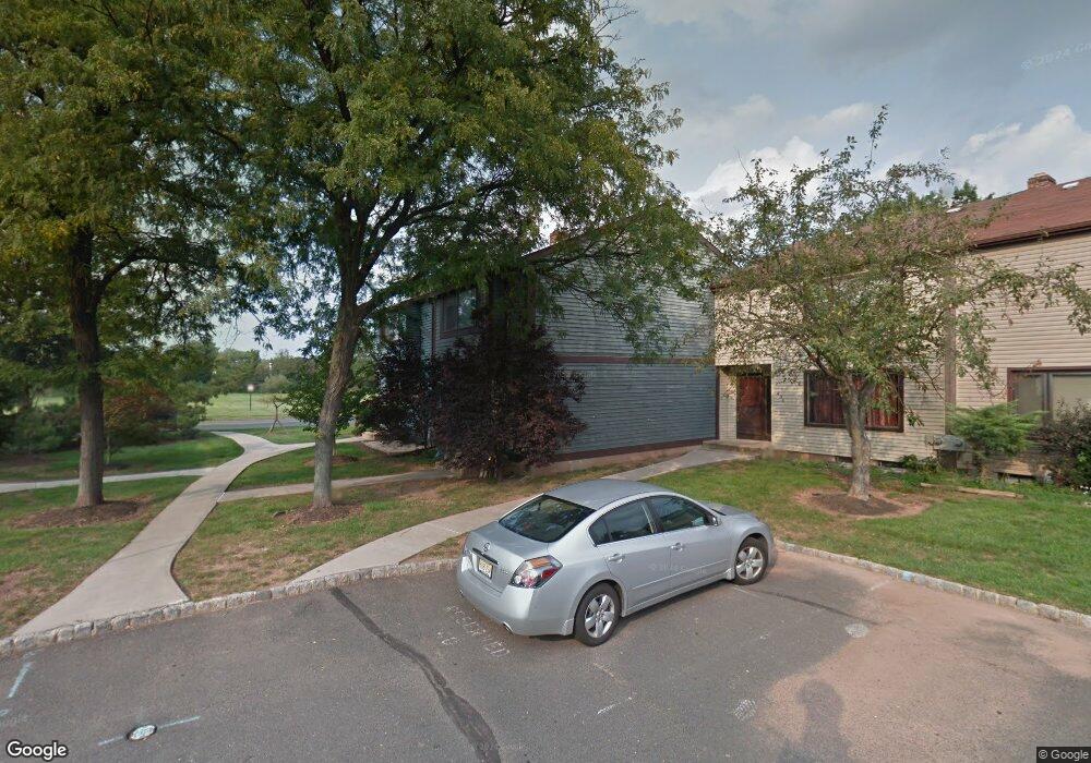
430 Brookside Ln Hillsborough, NJ 08844
Estimated Value: $418,869 - $512,000
--
Bed
--
Bath
1,386
Sq Ft
$343/Sq Ft
Est. Value
About This Home
This home is located at 430 Brookside Ln, Hillsborough, NJ 08844 and is currently estimated at $475,467, approximately $343 per square foot. 430 Brookside Ln is a home located in Somerset County with nearby schools including Hillsborough High School and Brighthorizons at Hillsborough.
Ownership History
Date
Name
Owned For
Owner Type
Purchase Details
Closed on
Mar 22, 2002
Sold by
Jasinski Steven
Bought by
Zadzilko Piotr and Zadzilko Dorota
Current Estimated Value
Home Financials for this Owner
Home Financials are based on the most recent Mortgage that was taken out on this home.
Original Mortgage
$115,500
Outstanding Balance
$47,636
Interest Rate
6.88%
Estimated Equity
$427,831
Purchase Details
Closed on
Mar 6, 1999
Sold by
Schmidt Warren
Bought by
Jasinski Steven
Home Financials for this Owner
Home Financials are based on the most recent Mortgage that was taken out on this home.
Original Mortgage
$109,279
Interest Rate
6.78%
Mortgage Type
FHA
Create a Home Valuation Report for This Property
The Home Valuation Report is an in-depth analysis detailing your home's value as well as a comparison with similar homes in the area
Home Values in the Area
Average Home Value in this Area
Purchase History
| Date | Buyer | Sale Price | Title Company |
|---|---|---|---|
| Zadzilko Piotr | $165,000 | -- | |
| Jasinski Steven | $109,900 | -- |
Source: Public Records
Mortgage History
| Date | Status | Borrower | Loan Amount |
|---|---|---|---|
| Open | Zadzilko Piotr | $115,500 | |
| Previous Owner | Jasinski Steven | $109,279 |
Source: Public Records
Tax History Compared to Growth
Tax History
| Year | Tax Paid | Tax Assessment Tax Assessment Total Assessment is a certain percentage of the fair market value that is determined by local assessors to be the total taxable value of land and additions on the property. | Land | Improvement |
|---|---|---|---|---|
| 2025 | $7,297 | $366,100 | $200,000 | $166,100 |
| 2024 | $7,297 | $340,500 | $185,000 | $155,500 |
| 2023 | $6,920 | $321,400 | $165,000 | $156,400 |
| 2022 | $6,534 | $292,600 | $170,000 | $122,600 |
| 2021 | $5,727 | $263,400 | $140,000 | $123,400 |
| 2020 | $5,822 | $244,200 | $130,000 | $114,200 |
| 2019 | $5,527 | $229,900 | $120,000 | $109,900 |
| 2018 | $5,259 | $217,400 | $105,000 | $112,400 |
| 2017 | $4,919 | $203,700 | $95,000 | $108,700 |
| 2016 | $4,934 | $204,400 | $95,000 | $109,400 |
| 2015 | $4,890 | $205,100 | $95,000 | $110,100 |
| 2014 | $4,712 | $201,900 | $95,000 | $106,900 |
Source: Public Records
Map
Nearby Homes
- 2301 Trafalgar Square
- 614 Robin Rd
- 3301 Astor Close
- 213 Brookside Ln
- 3203 Astor Close
- 524 Andria Ave Unit 225
- 528 Andria Ave Unit 253
- 528 Andria Ave Unit 255
- 180 Wildflower Ln
- 351 Doctors Way
- 920 Robin Rd
- 18 Deanna Dr Unit 37
- 6 Crestwood Ave
- 17 Old Somerville Rd
- 12 Cranbrook Ave
- 42 Falcon Rd
- 23 Cranbrook Ave
- 78 Valley Rd
- 115 Valley Rd
- 77 Norton Rd
- 432 Brookside Ln
- 434 Brookside Ln
- 436 Brookside Ln
- 438 Brookside Ln
- 428 Brookside Ln
- 426 Brookside Ln
- 440 Brookside Ln
- 424 Brookside Ln
- 442 Brookside Ln
- 422 Brookside Ln
- 420 Brookside Ln
- 444 Brookside Ln
- 492 Brookside Ln
- 488 Brookside Ln
- 490 Brookside Ln
- 418 Brookside Ln
- 486 Brookside Ln
- 446 Brookside Ln
- 494 Brookside Ln
- 496 Brookside Ln