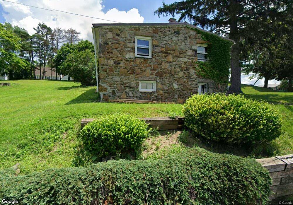
430 Clark St Somerset, PA 15501
Estimated Value: $113,080 - $203,000
1
Bed
1
Bath
700
Sq Ft
$219/Sq Ft
Est. Value
About This Home
This home is located at 430 Clark St, Somerset, PA 15501 and is currently estimated at $153,020, approximately $218 per square foot. 430 Clark St is a home with nearby schools including Maple Ridge Elementary School, Eagle View Elementary School, and Somerset Area Junior/Senior High School.
Ownership History
Date
Name
Owned For
Owner Type
Purchase Details
Closed on
Jan 7, 2016
Sold by
Luteri Robert P and Luteri Mindy J
Bought by
Luteri Robert P
Current Estimated Value
Purchase Details
Closed on
May 9, 2008
Sold by
Luteri Julia A and Luteri Robert A
Bought by
Luteri Robert P
Home Financials for this Owner
Home Financials are based on the most recent Mortgage that was taken out on this home.
Original Mortgage
$55,000
Interest Rate
5.93%
Mortgage Type
Purchase Money Mortgage
Create a Home Valuation Report for This Property
The Home Valuation Report is an in-depth analysis detailing your home's value as well as a comparison with similar homes in the area
Home Values in the Area
Average Home Value in this Area
Purchase History
| Date | Buyer | Sale Price | Title Company |
|---|---|---|---|
| Luteri Robert P | -- | None Available | |
| Luteri Robert P | -- | None Available |
Source: Public Records
Mortgage History
| Date | Status | Borrower | Loan Amount |
|---|---|---|---|
| Closed | Luteri Robert P | $55,000 |
Source: Public Records
Tax History Compared to Growth
Tax History
| Year | Tax Paid | Tax Assessment Tax Assessment Total Assessment is a certain percentage of the fair market value that is determined by local assessors to be the total taxable value of land and additions on the property. | Land | Improvement |
|---|---|---|---|---|
| 2025 | $2,035 | $25,570 | $0 | $0 |
| 2024 | $2,035 | $25,570 | $0 | $0 |
| 2023 | $1,990 | $25,570 | $0 | $0 |
| 2022 | $1,853 | $25,570 | $0 | $0 |
| 2021 | $1,853 | $25,570 | $0 | $0 |
| 2020 | $1,827 | $25,570 | $0 | $0 |
| 2019 | $3,087 | $25,570 | $0 | $0 |
| 2018 | $1,801 | $25,570 | $11,460 | $14,110 |
| 2017 | $1,739 | $25,570 | $11,460 | $14,110 |
| 2016 | -- | $24,860 | $8,540 | $16,320 |
| 2015 | -- | $24,850 | $8,535 | $16,315 |
| 2014 | -- | $24,850 | $8,535 | $16,315 |
Source: Public Records
Map
Nearby Homes
- 527 N Edgewood Ave
- 348 W Catherine St
- 120 W Catherine St
- 158 W Union St
- 129 Missoura St
- 331 W Main St
- 127 W Main St
- 620 N Franklin Ave
- 213 Stoystown Rd
- 218 Missoura St
- 506 Tayman Ave
- 336 W Sanner St
- 403 Rebecca St
- 629 Clover Hill Rd
- 344 W Garrett St
- 678 W Main St
- 611 S Ankeny Ave
- 549 W Race St
- 0 E Garrett St
- 0 Clark St
- 15 & 17 Clark St
- 427 Clark St
- 116 Springer Ln
- 216 W Catherine St
- 216 Luterie St
- 512 Clark St
- 230 W Catherine St
- 436 N Rosina Ave
- 501 N Edgewood Ave
- 507 N Edgewood Ave
- 421 N Edgewood Ave
- 509 N Edgewood Ave
- 246 W Catherine St
- 106 Springer Ln
- 426 N Rosina Ave
- 108 Springer Ln
- 108 Springer Ln Unit 2
- 252 W Catherine St
- 414 N Rosina Ave