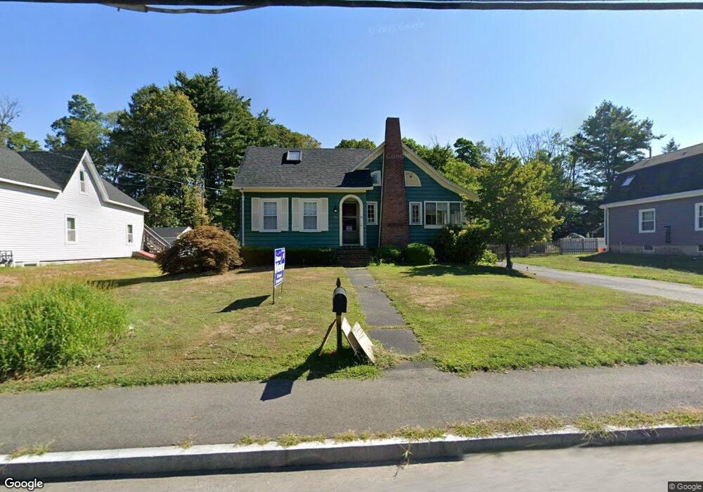
430 County St Taunton, MA 02780
Weir Village NeighborhoodEstimated Value: $473,000 - $571,000
3
Beds
1
Bath
2,011
Sq Ft
$264/Sq Ft
Est. Value
About This Home
This home is located at 430 County St, Taunton, MA 02780 and is currently estimated at $530,248, approximately $263 per square foot. 430 County St is a home located in Bristol County with nearby schools including Elizabeth Pole School, Taunton High School, and John F. Parker Middle School.
Ownership History
Date
Name
Owned For
Owner Type
Purchase Details
Closed on
Aug 21, 1997
Sold by
King Christopher E and King Kerry A
Bought by
Carvalho Brian G and Carvalho Lisa D
Current Estimated Value
Home Financials for this Owner
Home Financials are based on the most recent Mortgage that was taken out on this home.
Original Mortgage
$123,487
Interest Rate
7.42%
Mortgage Type
Purchase Money Mortgage
Purchase Details
Closed on
Apr 7, 1993
Sold by
Pring James E and Pring Joyce E
Bought by
King Christopher E and King Kerry A
Create a Home Valuation Report for This Property
The Home Valuation Report is an in-depth analysis detailing your home's value as well as a comparison with similar homes in the area
Home Values in the Area
Average Home Value in this Area
Purchase History
| Date | Buyer | Sale Price | Title Company |
|---|---|---|---|
| Carvalho Brian G | $125,000 | -- | |
| King Christopher E | $90,000 | -- |
Source: Public Records
Mortgage History
| Date | Status | Borrower | Loan Amount |
|---|---|---|---|
| Open | King Christopher E | $157,800 | |
| Closed | King Christopher E | $133,000 | |
| Closed | King Christopher E | $123,487 |
Source: Public Records
Tax History Compared to Growth
Tax History
| Year | Tax Paid | Tax Assessment Tax Assessment Total Assessment is a certain percentage of the fair market value that is determined by local assessors to be the total taxable value of land and additions on the property. | Land | Improvement |
|---|---|---|---|---|
| 2025 | $4,966 | $453,900 | $124,700 | $329,200 |
| 2024 | $4,402 | $393,400 | $124,700 | $268,700 |
| 2023 | $4,271 | $354,400 | $124,700 | $229,700 |
| 2022 | $4,011 | $304,300 | $103,900 | $200,400 |
| 2021 | $3,840 | $270,400 | $94,500 | $175,900 |
| 2020 | $3,608 | $242,800 | $94,500 | $148,300 |
| 2019 | $3,518 | $223,200 | $94,500 | $128,700 |
| 2018 | $3,246 | $206,500 | $95,400 | $111,100 |
| 2017 | $3,321 | $211,400 | $90,500 | $120,900 |
| 2016 | $3,324 | $212,000 | $87,800 | $124,200 |
| 2015 | $3,220 | $214,500 | $87,400 | $127,100 |
| 2014 | $3,051 | $208,800 | $87,400 | $121,400 |
Source: Public Records
Map
Nearby Homes
- 23 Johnson St Unit A
- 23 Johnson St Unit C
- 600 County St
- 600 County St Lot A
- 600
- 59 Linden St Unit 308
- 71 Linden St
- 11 Williams St
- 117 Hart St Unit 5
- 168 Hart St Unit 22
- 1301 Carriage Ln Unit 1301
- 55 Donna Terrace
- 1 Fayal Ave
- 106 Alicia Dr
- 170 Hart St Unit B
- 26 Maynard St Unit A
- 29 Williams Ave
- 800 County St Unit 3-24
- 3 Karena Dr Unit 8
- 28 Barbara Rd
- 424 County St
- 438 County St
- 429 County St
- 437 County St
- 450 County St
- 418 County St
- 35 Johnson St
- 451 County St
- 31 Johnson St
- 37 Johnson St
- 412 County St
- 461 County St
- 459 County St
- 25 Johnson St
- 470 County St Unit 2
- 470 County St
- 470 County St Unit 1
- 42 Johnson St
- 40 Johnson St
- 45 Johnson St Unit A & B