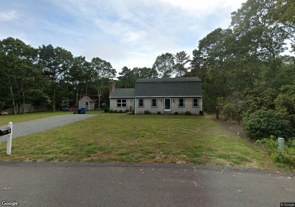
430 Davisville Rd Unit 1 East Falmouth, MA 02536
Estimated Value: $538,000 - $643,316
2
Beds
2
Baths
1,606
Sq Ft
$378/Sq Ft
Est. Value
About This Home
This home is located at 430 Davisville Rd Unit 1, East Falmouth, MA 02536 and is currently estimated at $607,079, approximately $378 per square foot. 430 Davisville Rd Unit 1 is a home located in Barnstable County with nearby schools including East Falmouth Elementary School, Morse Pond School, and Lawrence School.
Ownership History
Date
Name
Owned For
Owner Type
Purchase Details
Closed on
Mar 31, 2014
Sold by
Meany Richard C and Meany Cherie H
Bought by
Meany Richard C
Current Estimated Value
Home Financials for this Owner
Home Financials are based on the most recent Mortgage that was taken out on this home.
Original Mortgage
$118,000
Outstanding Balance
$89,465
Interest Rate
4.27%
Mortgage Type
New Conventional
Estimated Equity
$517,614
Purchase Details
Closed on
Aug 30, 1994
Sold by
Butts Bruce D
Bought by
Meany Richard C and Meany Cheri H
Home Financials for this Owner
Home Financials are based on the most recent Mortgage that was taken out on this home.
Original Mortgage
$115,000
Interest Rate
8.65%
Mortgage Type
Purchase Money Mortgage
Create a Home Valuation Report for This Property
The Home Valuation Report is an in-depth analysis detailing your home's value as well as a comparison with similar homes in the area
Home Values in the Area
Average Home Value in this Area
Purchase History
| Date | Buyer | Sale Price | Title Company |
|---|---|---|---|
| Meany Richard C | -- | -- | |
| Meany Richard C | $125,000 | -- |
Source: Public Records
Mortgage History
| Date | Status | Borrower | Loan Amount |
|---|---|---|---|
| Open | Meany Richard C | $118,000 | |
| Previous Owner | Meany Richard C | $115,000 |
Source: Public Records
Tax History Compared to Growth
Tax History
| Year | Tax Paid | Tax Assessment Tax Assessment Total Assessment is a certain percentage of the fair market value that is determined by local assessors to be the total taxable value of land and additions on the property. | Land | Improvement |
|---|---|---|---|---|
| 2025 | $3,486 | $593,900 | $0 | $593,900 |
| 2024 | $3,527 | $561,700 | $0 | $561,700 |
| 2023 | $3,632 | $524,900 | $0 | $524,900 |
| 2022 | $3,970 | $493,200 | $0 | $493,200 |
| 2021 | $4,009 | $471,700 | $0 | $471,700 |
| 2020 | $4,052 | $471,700 | $0 | $471,700 |
| 2019 | $3,884 | $453,700 | $0 | $453,700 |
| 2018 | $3,636 | $422,800 | $0 | $422,800 |
| 2017 | $3,732 | $437,500 | $0 | $437,500 |
| 2016 | $3,658 | $437,000 | $0 | $437,000 |
| 2015 | $3,579 | $437,000 | $0 | $437,000 |
| 2014 | $3,645 | $447,200 | $0 | $447,200 |
Source: Public Records
Map
Nearby Homes
- 472 & 474 Davisville Rd
- 473 Davisville Rd
- LOTA Commodore Ln
- 37 Seashell Ln
- 16A Pacheco Path
- 16 Pacheco Path Unit 1-A100-B
- 16 Pacheco Path
- 23 N Bournes Pond Rd
- 23 N Bournes Pond Rd
- 241 Davisville Rd
- 84 Portside Cir
- 53 Eel River Rd
- 21 Kilmer Rd
- 58 Striper Ln
- 26 Sanddollar Cir
- 15 Beach St
- Lot 2 Pine Grove Ave
- 0 Tobey Ln
- 224 Menauhant Rd
- 27 Harborview Dr
- 430 Davisville Rd Unit 4
- 430 Davisville Rd Unit 3
- 430 Davisville Rd Unit 2
- 430 Davisville Rd
- 44 Oyster Shell Ln
- 45 Captain Davis Ln
- 52 Oyster Shell Ln
- 52 Oyster Shell Ln
- 37 Captain Davis Ln
- 31 Captain Davis Ln
- 27 Captain Davis Ln
- 32 Oyster Shell Ln
- 49 Captain Davis Ln
- 45 Oyster Shell Ln
- 37 Oyster Shell Ln
- 51 Oyster Shell Ln
- 46 Captain Davis Ln
- 21 Captain Davis Ln
- 40 Captain Davis Ln
- 50 Captain Davis Ln