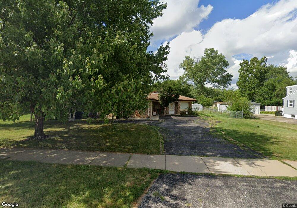
430 E Nerge Rd Roselle, IL 60172
South Schaumburg NeighborhoodEstimated Value: $364,000 - $467,000
3
Beds
2
Baths
1,807
Sq Ft
$234/Sq Ft
Est. Value
About This Home
This home is located at 430 E Nerge Rd, Roselle, IL 60172 and is currently estimated at $423,401, approximately $234 per square foot. 430 E Nerge Rd is a home located in Cook County with nearby schools including Frederick Nerge Elementary School, Margaret Mead Junior High School, and J B Conant High School.
Ownership History
Date
Name
Owned For
Owner Type
Purchase Details
Closed on
Apr 28, 2003
Sold by
Patel Dhirubhai T and Patel Jyotiben D
Bought by
Arcangel Ramon and Arcangel Zenaida
Current Estimated Value
Home Financials for this Owner
Home Financials are based on the most recent Mortgage that was taken out on this home.
Original Mortgage
$200,970
Outstanding Balance
$84,798
Interest Rate
5.87%
Mortgage Type
FHA
Estimated Equity
$338,603
Create a Home Valuation Report for This Property
The Home Valuation Report is an in-depth analysis detailing your home's value as well as a comparison with similar homes in the area
Home Values in the Area
Average Home Value in this Area
Purchase History
| Date | Buyer | Sale Price | Title Company |
|---|---|---|---|
| Arcangel Ramon | $219,000 | Git | |
| Arcangel Ramon | $219,000 | Git |
Source: Public Records
Mortgage History
| Date | Status | Borrower | Loan Amount |
|---|---|---|---|
| Open | Arcangel Ramon | $200,970 | |
| Closed | Arcangel Ramon | $200,970 |
Source: Public Records
Tax History
| Year | Tax Paid | Tax Assessment Tax Assessment Total Assessment is a certain percentage of the fair market value that is determined by local assessors to be the total taxable value of land and additions on the property. | Land | Improvement |
|---|---|---|---|---|
| 2025 | $8,389 | $40,000 | $9,000 | $31,000 |
| 2024 | $8,389 | $33,000 | $8,000 | $25,000 |
| 2023 | $8,083 | $33,000 | $8,000 | $25,000 |
| 2022 | $8,083 | $33,000 | $8,000 | $25,000 |
| 2021 | $6,905 | $25,858 | $22,500 | $3,358 |
| 2020 | $6,847 | $25,858 | $22,500 | $3,358 |
| 2019 | $6,858 | $28,732 | $22,500 | $6,232 |
| 2018 | $8,018 | $30,173 | $19,000 | $11,173 |
| 2017 | $7,889 | $30,173 | $19,000 | $11,173 |
| 2016 | $7,614 | $30,173 | $19,000 | $11,173 |
| 2015 | $7,224 | $26,829 | $16,000 | $10,829 |
| 2014 | $7,143 | $26,829 | $16,000 | $10,829 |
| 2013 | $6,947 | $26,829 | $16,000 | $10,829 |
Source: Public Records
Map
Nearby Homes
- 620 S Point Dr
- 518 E Niagara Ave
- 380 Ventura Club Dr
- 1100 Boston Harbor Unit 7004
- 366 Ventura Club Dr
- 1323 S Roselle Rd
- 1055 Hampton Harbor Unit 1055
- 677 Cumberland Trail Unit 2B
- 647 Cumberland Trail Unit AA1
- 826 Thornton Ct Unit 2AL
- 1630 Myrtle Park St
- 970 Yosemite Trail Unit A5
- 411 Drake Cir Unit 401B
- 100 Pratt Blvd
- 455 E Granville Ave
- 615 Newberry Dr
- 1500 Illinois St
- 219 N Prospect St
- 134 Lunt Ave
- 539 Newberry Dr
- 436 E Nerge Rd
- 1531 Sunset Dr
- 1531 Sunset Dr
- 1523 Sunset Dr
- 804 Blackhawk Dr
- 1515 Sunset Dr
- 1516 Blackhawk Dr
- 1528 Sunset Dr
- 1530 Sunset Dr
- 1511 Sunset Dr
- 1520 Sunset Dr
- 411 E Nerge Rd
- 1533 Blackhawk Dr
- 1508 Blackhawk Dr
- 1516 Sunset Dr
- 368 Jennifer Ln
- 368 Jennifer Ln Unit 368
- 1523 Blackhawk Dr
- 1517 Blackhawk Dr
- 1510 Sunset Dr
Your Personal Tour Guide
Ask me questions while you tour the home.