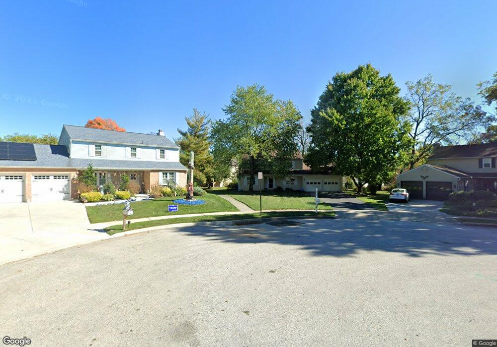
430 Langdale Ct King of Prussia, PA 19406
Estimated Value: $600,732 - $630,000
4
Beds
3
Baths
2,064
Sq Ft
$300/Sq Ft
Est. Value
About This Home
This home is located at 430 Langdale Ct, King of Prussia, PA 19406 and is currently estimated at $618,183, approximately $299 per square foot. 430 Langdale Ct is a home located in Montgomery County with nearby schools including Candlebrook Elementary School, Upper Merion Middle School, and Upper Merion High School.
Ownership History
Date
Name
Owned For
Owner Type
Purchase Details
Closed on
Jan 15, 2025
Sold by
Bradway Robert B and Bradway Christine K
Bought by
Bradway Robert B
Current Estimated Value
Purchase Details
Closed on
Oct 4, 2004
Sold by
Not Provided
Bought by
Bradway Robert B and Bradway Christine K
Home Financials for this Owner
Home Financials are based on the most recent Mortgage that was taken out on this home.
Original Mortgage
$0
Interest Rate
5.81%
Purchase Details
Closed on
Sep 10, 2004
Sold by
Not Provided
Bought by
Bradway Robert B and Bradway Christine K
Home Financials for this Owner
Home Financials are based on the most recent Mortgage that was taken out on this home.
Original Mortgage
$0
Interest Rate
5.81%
Create a Home Valuation Report for This Property
The Home Valuation Report is an in-depth analysis detailing your home's value as well as a comparison with similar homes in the area
Home Values in the Area
Average Home Value in this Area
Purchase History
| Date | Buyer | Sale Price | Title Company |
|---|---|---|---|
| Bradway Robert B | -- | None Listed On Document | |
| Bradway Robert B | -- | -- | |
| Bradway Robert B | -- | -- |
Source: Public Records
Mortgage History
| Date | Status | Borrower | Loan Amount |
|---|---|---|---|
| Previous Owner | Bradway Robert B | $0 | |
| Closed | Bradway Robert B | $0 |
Source: Public Records
Tax History Compared to Growth
Tax History
| Year | Tax Paid | Tax Assessment Tax Assessment Total Assessment is a certain percentage of the fair market value that is determined by local assessors to be the total taxable value of land and additions on the property. | Land | Improvement |
|---|---|---|---|---|
| 2025 | $5,404 | $175,350 | $56,210 | $119,140 |
| 2024 | $5,404 | $175,350 | $56,210 | $119,140 |
| 2023 | $5,212 | $175,350 | $56,210 | $119,140 |
| 2022 | $4,989 | $175,350 | $56,210 | $119,140 |
| 2021 | $4,835 | $175,350 | $56,210 | $119,140 |
| 2020 | $4,620 | $175,350 | $56,210 | $119,140 |
| 2019 | $4,541 | $175,350 | $56,210 | $119,140 |
| 2018 | $4,542 | $175,350 | $56,210 | $119,140 |
| 2017 | $4,378 | $175,350 | $56,210 | $119,140 |
| 2016 | $4,311 | $175,350 | $56,210 | $119,140 |
| 2015 | $4,151 | $175,350 | $56,210 | $119,140 |
| 2014 | $4,151 | $175,350 | $56,210 | $119,140 |
Source: Public Records
Map
Nearby Homes
- 610 Charles Dr
- 418 Springhouse Rd
- 625 W Valley Forge Rd
- 391 Prince Frederick St
- 338 Rees Dr
- 245 Chapel Ln Unit 80B
- 227 Crossfield Rd
- 251 Chapel Ln Unit 83B
- 501 W Dekalb Pike
- 243 Chapel Ln Unit 79A
- 413 Brandywine Ln
- 735 Champlain Dr
- 243 Jasper Rd
- 545 Kingwood Rd
- 548 Susan Dr
- 422 Bluebuff Rd
- 108 Anderson Rd
- 191 Gunport Rd
- 137 River Trail Cir Unit 19
- 612 Brewster Alley Unit 74
- 440 Langdale Ct
- 480 James St
- 420 Langdale Ct
- 470 James St
- 562 Crossfield Rd
- 490 James St
- 450 Langdale Ct
- 554 Crossfield Rd
- 570 Crossfield Rd
- 546 Crossfield Rd
- 410 Langdale Ct
- 500 James St
- 460 Langdale Ct
- 534 Keebler Rd Unit C
- 534 Keebler Rd
- 538 Crossfield Rd
- 460 James St
- 470 Langdale Ct
- 586 Crossfield Rd
- 510 James St