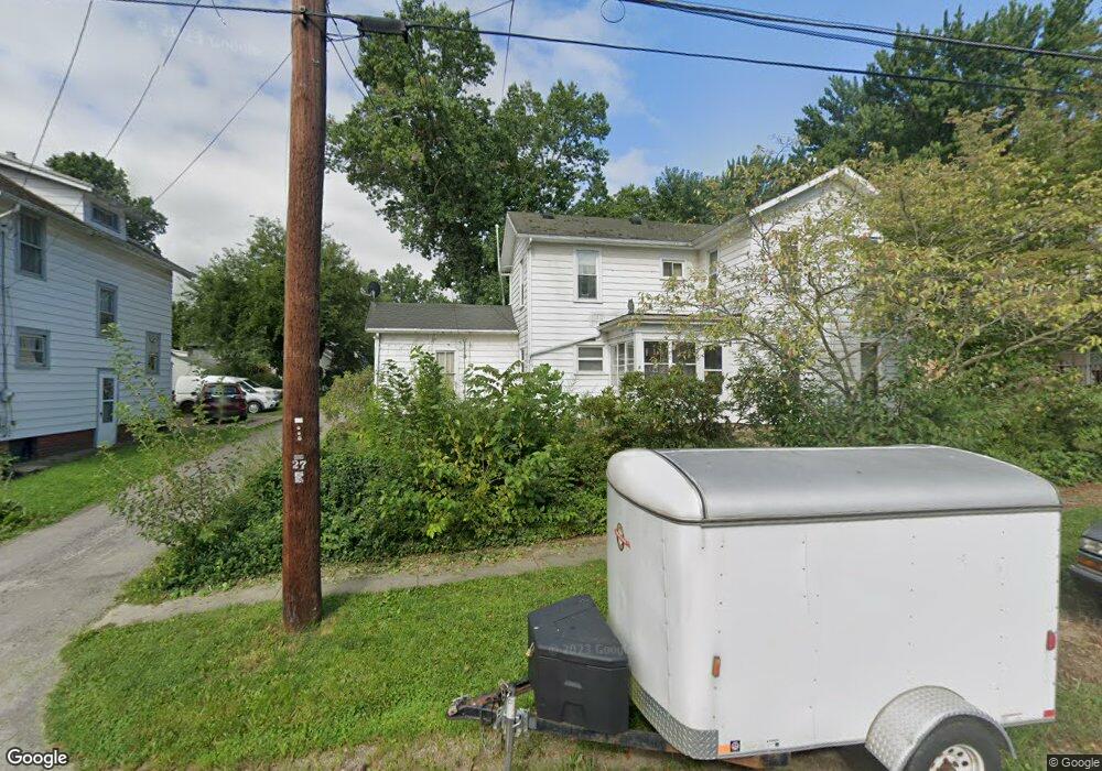
430 McDonald St Wooster, OH 44691
Estimated Value: $165,000 - $182,583
3
Beds
2
Baths
1,598
Sq Ft
$109/Sq Ft
Est. Value
About This Home
This home is located at 430 McDonald St, Wooster, OH 44691 and is currently estimated at $173,896, approximately $108 per square foot. 430 McDonald St is a home located in Wayne County with nearby schools including Parkview Elementary School, Edgewood Middle School, and Wooster High School.
Ownership History
Date
Name
Owned For
Owner Type
Purchase Details
Closed on
Feb 17, 2010
Sold by
Fisk Ruth Carroll
Bought by
Amstutz Harold G and Amstutz Crystal R
Current Estimated Value
Home Financials for this Owner
Home Financials are based on the most recent Mortgage that was taken out on this home.
Original Mortgage
$68,632
Outstanding Balance
$48,632
Interest Rate
6.5%
Mortgage Type
FHA
Estimated Equity
$125,264
Purchase Details
Closed on
Jan 14, 2010
Sold by
Fisk Ruth Carroll
Bought by
Amstutz Harold G and Amstutz Crystal R
Home Financials for this Owner
Home Financials are based on the most recent Mortgage that was taken out on this home.
Original Mortgage
$68,632
Outstanding Balance
$48,632
Interest Rate
6.5%
Mortgage Type
FHA
Estimated Equity
$125,264
Purchase Details
Closed on
Jan 1, 1987
Bought by
Fisk Ruth Carroll
Create a Home Valuation Report for This Property
The Home Valuation Report is an in-depth analysis detailing your home's value as well as a comparison with similar homes in the area
Home Values in the Area
Average Home Value in this Area
Purchase History
| Date | Buyer | Sale Price | Title Company |
|---|---|---|---|
| Amstutz Harold G | -- | Wayne County Title | |
| Amstutz Harold G | -- | Wayne County Title | |
| Fisk Ruth Carroll | -- | -- |
Source: Public Records
Mortgage History
| Date | Status | Borrower | Loan Amount |
|---|---|---|---|
| Open | Amstutz Harold G | $68,632 | |
| Closed | Amstutz Harold G | $68,632 |
Source: Public Records
Tax History Compared to Growth
Tax History
| Year | Tax Paid | Tax Assessment Tax Assessment Total Assessment is a certain percentage of the fair market value that is determined by local assessors to be the total taxable value of land and additions on the property. | Land | Improvement |
|---|---|---|---|---|
| 2024 | $1,574 | $47,730 | $9,780 | $37,950 |
| 2023 | $1,574 | $47,730 | $9,780 | $37,950 |
| 2022 | $1,886 | $36,160 | $7,410 | $28,750 |
| 2021 | $1,476 | $36,160 | $7,410 | $28,750 |
| 2020 | $1,400 | $36,160 | $7,410 | $28,750 |
| 2019 | $921 | $26,030 | $6,740 | $19,290 |
| 2018 | $923 | $26,030 | $6,740 | $19,290 |
| 2017 | $920 | $26,030 | $6,740 | $19,290 |
| 2016 | $939 | $25,020 | $6,480 | $18,540 |
| 2015 | $922 | $25,020 | $6,480 | $18,540 |
| 2014 | $922 | $25,020 | $6,480 | $18,540 |
| 2013 | $1,037 | $26,790 | $6,760 | $20,030 |
Source: Public Records
Map
Nearby Homes
- 429 Woodland Ave
- 412 Emerick St
- 450 N Grant St
- 323 N Grant St
- 349 W North St
- 537 N Grant St
- 406 N Walnut St
- 227 N Walnut St
- 229 N Walnut St
- 423 N Market St
- 534 N Buckeye St
- 143 Park Ave
- 329 E Bowman St
- 708 N Bever St
- 657 N Bever St
- 900 Quinby Ave
- 336 Spring St
- 554 Nold Ave
- 1117 Quinby Ave
- 1123 Quinby Ave
- 438 McDonald St
- 420 McDonald St
- 444 McDonald St
- 416 McDonald St
- 515 Saybolt Ave
- 450 McDonald St
- 437 Woodland Ave
- 421 Woodland Ave
- 427 McDonald St
- 421 McDonald St
- 501 Saybolt Ave
- 433 McDonald St
- 415 Woodland Ave
- 441 Woodland Ave
- 456 McDonald St
- 451 Saybolt Ave
- 445 Woodland Ave
- 439 McDonald St
- 447 Woodland Ave
- 449 McDonald St