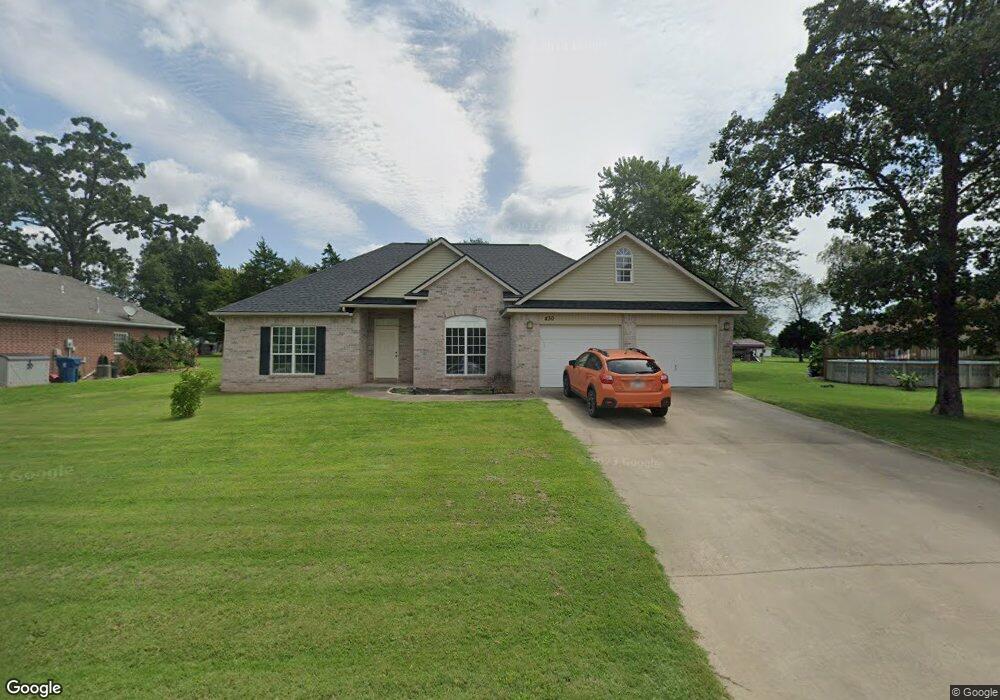
430 N Robin Rd Gentry, AR 72734
Estimated Value: $309,000 - $407,000
--
Bed
2
Baths
1,774
Sq Ft
$191/Sq Ft
Est. Value
About This Home
This home is located at 430 N Robin Rd, Gentry, AR 72734 and is currently estimated at $339,319, approximately $191 per square foot. 430 N Robin Rd is a home located in Benton County with nearby schools including Gentry Intermediate School, Gentry Primary School, and Gentry Middle School.
Ownership History
Date
Name
Owned For
Owner Type
Purchase Details
Closed on
Apr 26, 2013
Sold by
Wood Sherry and Wood Carl
Bought by
Dickinson Tim and Dickinson Marci
Current Estimated Value
Purchase Details
Closed on
Nov 15, 2006
Sold by
Eads Lance R and Neal Micah S
Bought by
Dickinson Tim and Dickinson Marci
Home Financials for this Owner
Home Financials are based on the most recent Mortgage that was taken out on this home.
Original Mortgage
$139,000
Interest Rate
6.37%
Mortgage Type
Purchase Money Mortgage
Purchase Details
Closed on
Mar 24, 2005
Sold by
Wood Sherry
Bought by
Eads Lance R and Neal Micah S
Create a Home Valuation Report for This Property
The Home Valuation Report is an in-depth analysis detailing your home's value as well as a comparison with similar homes in the area
Home Values in the Area
Average Home Value in this Area
Purchase History
| Date | Buyer | Sale Price | Title Company |
|---|---|---|---|
| Dickinson Tim | -- | Rtc | |
| Dickinson Tim | $169,000 | Rt | |
| Eads Lance R | -- | Heritage Land Title Siloam S |
Source: Public Records
Mortgage History
| Date | Status | Borrower | Loan Amount |
|---|---|---|---|
| Previous Owner | Dickinson Tim | $139,000 |
Source: Public Records
Tax History Compared to Growth
Tax History
| Year | Tax Paid | Tax Assessment Tax Assessment Total Assessment is a certain percentage of the fair market value that is determined by local assessors to be the total taxable value of land and additions on the property. | Land | Improvement |
|---|---|---|---|---|
| 2025 | $2,201 | $64,391 | $7,000 | $57,391 |
| 2024 | $2,078 | $64,391 | $7,000 | $57,391 |
| 2023 | $1,979 | $41,450 | $5,000 | $36,450 |
| 2022 | $1,621 | $41,450 | $5,000 | $36,450 |
| 2021 | $1,525 | $41,450 | $5,000 | $36,450 |
| 2020 | $1,442 | $31,110 | $1,800 | $29,310 |
| 2019 | $1,442 | $31,110 | $1,800 | $29,310 |
| 2018 | $1,396 | $31,110 | $1,800 | $29,310 |
| 2017 | $1,244 | $31,110 | $1,800 | $29,310 |
| 2016 | $1,244 | $31,110 | $1,800 | $29,310 |
| 2015 | $1,438 | $26,000 | $1,800 | $24,200 |
| 2014 | $1,088 | $26,000 | $1,800 | $24,200 |
Source: Public Records
Map
Nearby Homes
- 12041 N Robin Rd
- 1392 E Crawford St
- 1400 Shankles Rd
- . S Highway 59
- 1298 E Main St
- 9.09 Acres E 3rd St Hwy 12
- 00 Highway 12
- 1508 Taylor Orchard Rd
- 19161 Old Springtown Rd
- 317 Whitten Ave
- 229 Whitten Ave
- 221 Whitten Ave
- 213 Whitten Ave
- TBD Lot 3 The Preserve
- 122 S Collins Ave
- 12041 S Robin Rd
- 311 S Rust Ave
- 18955 Shankle Rd
- 513 N Byers Ave
- 302 W Fulton St
- 1302 Crawford St
- 470 N Robin Rd
- 1314 Crawford St
- 1322 Crawford St
- 390 N Robin Rd
- 523 N Robin Rd
- 600 N Robin Rd
- 1336 E Crawford St
- 1354 Crawford St
- 384 N Robin Rd
- 1381 Crawford St
- 1381 Crawford St
- 1100 Crawford St
- 1100 E Crawford St
- 348 N Robin Rd
- 1401 Crawford St
- 4.5AC Lot 7 E Crawford Rd
- 0 E Crawford St
- 4.82AC E Crawford St
- 320 N Robin Rd