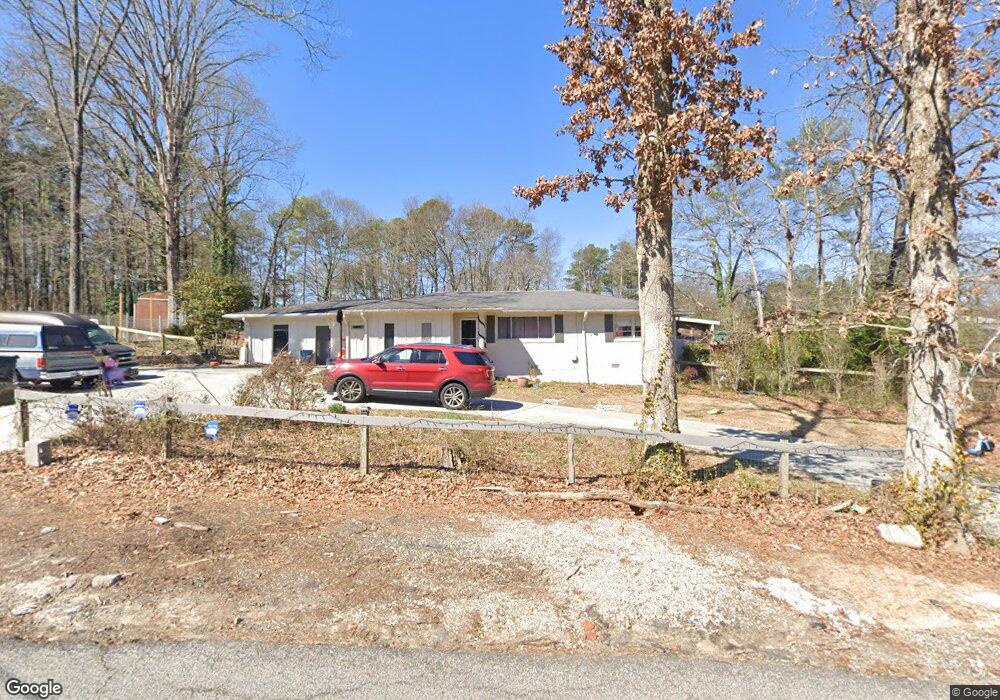
430 Nash Cir SW Mableton, GA 30126
Estimated Value: $186,000 - $282,000
3
Beds
1
Bath
1,262
Sq Ft
$189/Sq Ft
Est. Value
About This Home
This home is located at 430 Nash Cir SW, Mableton, GA 30126 and is currently estimated at $238,197, approximately $188 per square foot. 430 Nash Cir SW is a home located in Cobb County with nearby schools including Clay-Harmony Leland Elementary School, Lindley Middle School, and Pebblebrook High School.
Ownership History
Date
Name
Owned For
Owner Type
Purchase Details
Closed on
Jul 28, 2006
Sold by
Swofford Janice F
Bought by
Brice Claudia M
Current Estimated Value
Purchase Details
Closed on
Jan 13, 1995
Sold by
Daniel Norris V
Bought by
Swofford Janice F
Home Financials for this Owner
Home Financials are based on the most recent Mortgage that was taken out on this home.
Original Mortgage
$65,550
Interest Rate
9.14%
Mortgage Type
FHA
Create a Home Valuation Report for This Property
The Home Valuation Report is an in-depth analysis detailing your home's value as well as a comparison with similar homes in the area
Home Values in the Area
Average Home Value in this Area
Purchase History
| Date | Buyer | Sale Price | Title Company |
|---|---|---|---|
| Brice Claudia M | $85,000 | -- | |
| Swofford Janice F | $66,000 | -- |
Source: Public Records
Mortgage History
| Date | Status | Borrower | Loan Amount |
|---|---|---|---|
| Previous Owner | Swofford Janice F | $65,550 |
Source: Public Records
Tax History Compared to Growth
Tax History
| Year | Tax Paid | Tax Assessment Tax Assessment Total Assessment is a certain percentage of the fair market value that is determined by local assessors to be the total taxable value of land and additions on the property. | Land | Improvement |
|---|---|---|---|---|
| 2025 | $3,433 | $113,928 | $20,000 | $93,928 |
| 2024 | $2,723 | $90,320 | $10,000 | $80,320 |
| 2023 | $2,723 | $90,320 | $10,000 | $80,320 |
| 2022 | $2,741 | $90,320 | $10,000 | $80,320 |
| 2021 | $948 | $31,236 | $7,200 | $24,036 |
| 2020 | $948 | $31,236 | $7,200 | $24,036 |
| 2019 | $948 | $31,236 | $7,200 | $24,036 |
| 2018 | $948 | $31,236 | $7,200 | $24,036 |
| 2017 | $864 | $30,036 | $6,000 | $24,036 |
| 2016 | $864 | $30,036 | $6,000 | $24,036 |
| 2015 | $838 | $28,452 | $6,000 | $22,452 |
| 2014 | $845 | $28,452 | $0 | $0 |
Source: Public Records
Map
Nearby Homes
- 6365 Susan Dr SW
- 364 Waterbluff Dr SW
- 368 Waterbluff Dr SW
- 365 Waterbluff Dr SW
- 369 Waterbluff Dr SW
- 373 Waterbluff Dr SW
- 377 Waterbluff Dr SW
- 361 Gordon Valley Ln SW
- 6511 Gordon Hills Dr SW
- 496 Elizabeth Ln SW
- 537 Elizabeth Ln SW
- 6650 Valley Hill Dr SW
- 6649 Valley Hill Dr SW
- 317 Community Dr SW
- 6264 Godfrey Dr SW
- 6722 Armonia Dr
- 6714 Armonia Dr
- 6500 Dodgen Rd SW
- 6696 Armonia Dr
- 6692 Armonia Dr
- 420 Nash Cir SW
- 440 Nash Cir SW
- 6386 Susan Dr SW
- 6420 Susan Dr SW
- 450 Nash Cir SW
- 411 Nash Cir SW
- 6375 Susan Dr SW
- 400 Nash Cir SW
- 6370 Susan Dr SW
- 460 Nash Cir SW
- 375 Nash Cir SW
- 470 Nash Cir SW Unit 30
- 470 Nash Cir SW
- 394 Nash Cir SW
- 6387 Factory Shoals Rd SW
- 6355 Susan Dr SW
- 6440 Susan Dr SW
- 480 Nash Cir SW
- 371 Nash Cir SW
- 6512 Mitchell Ln SW