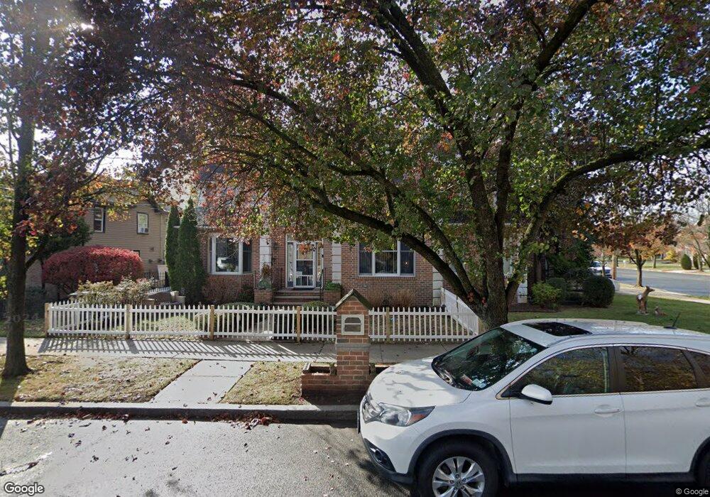
430 Poillon Ave Staten Island, NY 10312
Huguenot NeighborhoodEstimated Value: $1,193,274 - $1,474,000
--
Bed
4
Baths
3,300
Sq Ft
$408/Sq Ft
Est. Value
About This Home
This home is located at 430 Poillon Ave, Staten Island, NY 10312 and is currently estimated at $1,345,319, approximately $407 per square foot. 430 Poillon Ave is a home located in Richmond County with nearby schools including P.S. 5 - Huguenot, I.S. 007 Elias Bernstein, and Tottenville High School.
Ownership History
Date
Name
Owned For
Owner Type
Purchase Details
Closed on
May 14, 2024
Sold by
Helen Bregulla Family Trust and Walter Stojanowski Family Trust
Bought by
Petersburg Estates Llc
Current Estimated Value
Purchase Details
Closed on
Jan 12, 2009
Sold by
Sanguinedo Dorothy
Bought by
Dorothy Sanguinedo Personal Residence Tr
Purchase Details
Closed on
Jul 19, 2007
Sold by
Stojanowski Walter
Bought by
Sanguinedo Dorothy
Purchase Details
Closed on
Aug 22, 1996
Sold by
Bregulla Helen
Bought by
Sanguinedo Dorothy
Create a Home Valuation Report for This Property
The Home Valuation Report is an in-depth analysis detailing your home's value as well as a comparison with similar homes in the area
Home Values in the Area
Average Home Value in this Area
Purchase History
| Date | Buyer | Sale Price | Title Company |
|---|---|---|---|
| Petersburg Estates Llc | $485,000 | None Listed On Document | |
| Lynch Street Estates Llc | $485,000 | Stewart Title Insurance Compan | |
| Dorothy Sanguinedo Personal Residence Tr | -- | None Available | |
| Sanguinedo Dorothy | -- | None Available | |
| Sanguinedo Dorothy | -- | -- |
Source: Public Records
Tax History Compared to Growth
Tax History
| Year | Tax Paid | Tax Assessment Tax Assessment Total Assessment is a certain percentage of the fair market value that is determined by local assessors to be the total taxable value of land and additions on the property. | Land | Improvement |
|---|---|---|---|---|
| 2025 | $10,199 | $67,020 | $14,459 | $52,561 |
| 2024 | $10,211 | $59,880 | $15,267 | $44,613 |
| 2023 | $9,713 | $49,226 | $13,032 | $36,194 |
| 2022 | $8,984 | $66,780 | $17,520 | $49,260 |
| 2021 | $9,470 | $68,940 | $17,520 | $51,420 |
| 2020 | $9,460 | $64,500 | $17,520 | $46,980 |
| 2019 | $8,803 | $64,500 | $17,520 | $46,980 |
| 2018 | $7,703 | $41,022 | $13,848 | $27,174 |
| 2017 | $7,243 | $38,700 | $17,520 | $21,180 |
| 2016 | $8,483 | $45,540 | $17,520 | $28,020 |
| 2015 | $9,282 | $51,540 | $14,580 | $36,960 |
| 2014 | $9,282 | $51,540 | $14,580 | $36,960 |
Source: Public Records
Map
Nearby Homes
- 5 Nicolosi Dr
- 84 Discala Ln
- 393 Philip Ave
- 350 Poillon Ave
- 389 Philip Ave
- 16 Nicolosi Loop
- 383 Philip Ave
- 344 Poillon Ave
- 52 Nicolosi Loop
- 59 Newton St
- 311 Bertram Ave
- 161 Boardwalk Ave
- 304 Bertram Ave
- 381 Arbutus Ave
- 21 Allen Place
- 140 Nicolosi Dr
- 155 Nicolosi Dr
- 545 Arbutus Ave
- 115 Jansen St
- 262 Noel St
- 210 Kenwood Ave
- 438 Poillon Ave
- 477 Philip Ave
- 446 Poillon Ave
- 489 Philip Ave
- 412 Poillon Ave
- 211 Kenwood Ave
- 0 Kenwood Ave
- 9 Zephyr Ave
- 219 Kenwood Ave
- 501 Philip Ave
- 404 Poillon Ave
- 478 Philip Ave
- 480 Philip Ave
- 474 Philip Ave
- 488 Philip Ave
- 451 Philip Ave
- 398 Poillon Ave
- 460 Philip Ave
- 31 Zephyr Ave