Estimated Value: $681,000 - $793,222
Studio
--
Bath
1
Sq Ft
$715,556/Sq Ft
Est. Value
About This Home
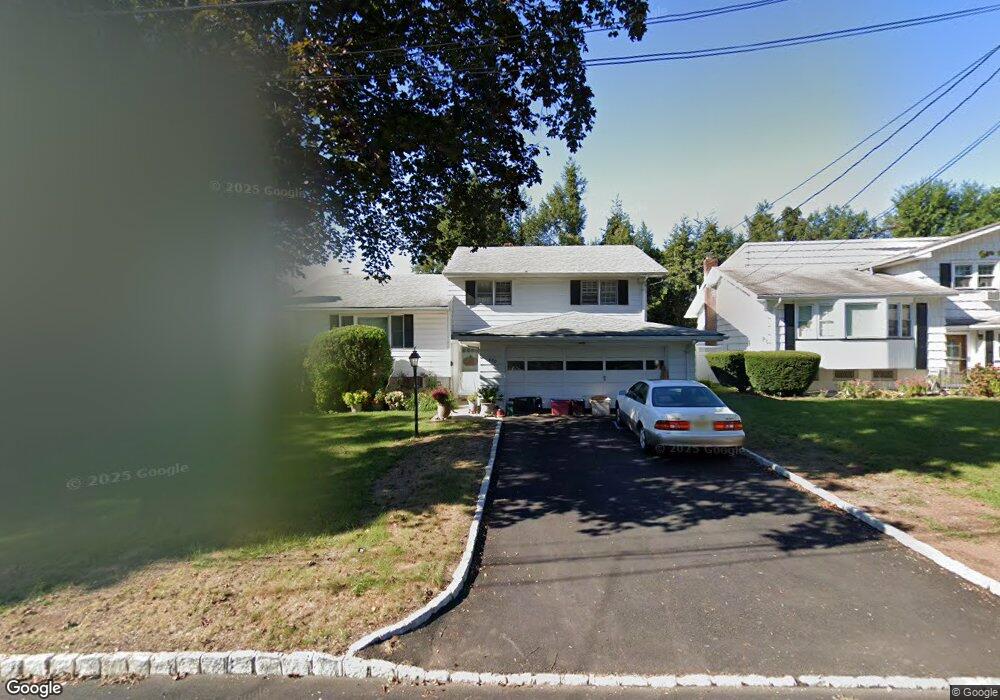
This home is located at 430 Prescott Rd, Union, NJ 07083 and is currently estimated at $715,556, approximately $715,556 per square foot. 430 Prescott Rd is a home located in Union County with nearby schools including Livingston Elementary School, Union High School, and Kindercare Learning Center.
Ownership History
Date
Name
Owned For
Owner Type
Purchase Details
Closed on
Jul 25, 2002
Sold by
Frutiger Estelle
Bought by
Barton Phillip and Bartone Lorraine
Current Estimated Value
Home Financials for this Owner
Home Financials are based on the most recent Mortgage that was taken out on this home.
Original Mortgage
$250,000
Outstanding Balance
$105,228
Interest Rate
6.61%
Estimated Equity
$610,328
Purchase Details
Closed on
Mar 11, 1998
Sold by
Frutiger Keith E and Frutiger Estelle L
Bought by
Frutiger Estelle L
Purchase Details
Closed on
Jul 31, 1996
Sold by
Frutiger Keith E and Frutiger Estelle L
Bought by
Frutiger Keith E and Frutiger Estelle L
Create a Home Valuation Report for This Property
The Home Valuation Report is an in-depth analysis detailing your home's value as well as a comparison with similar homes in the area
Home Values in the Area
Average Home Value in this Area
Purchase History
| Date | Buyer | Sale Price | Title Company |
|---|---|---|---|
| Barton Phillip | $315,000 | -- | |
| Frutiger Estelle L | -- | -- | |
| Frutiger Keith E | -- | -- |
Source: Public Records
Mortgage History
| Date | Status | Borrower | Loan Amount |
|---|---|---|---|
| Open | Barton Phillip | $250,000 |
Source: Public Records
Tax History
| Year | Tax Paid | Tax Assessment Tax Assessment Total Assessment is a certain percentage of the fair market value that is determined by local assessors to be the total taxable value of land and additions on the property. | Land | Improvement |
|---|---|---|---|---|
| 2025 | $12,293 | $55,000 | $21,500 | $33,500 |
| 2024 | $11,918 | $55,000 | $21,500 | $33,500 |
Source: Public Records
Map
Nearby Homes
- 365 Broadwell Ave
- 545 Homer Terrace
- 578 Winchester Ave
- 381 Dogwood Dr
- 377 Lum Ave
- 461 Thoreau Terrace
- 569 Scotland Rd
- 401 Burroughs Terrace
- 404 Burroughs Terrace
- 587 Thoreau Terrace
- 362 Crawford Terrace
- 875 Salem Rd
- 950 Carteret Ave
- 1453 Morris Ave
- 318 Delaware Ave
- 399 Martin Rd
- 393 Huntington Rd
- 277 Newark Ave
- 369 Bergen St
- 969 Arnet Ave
- 426 Prescott Rd
- 434 Prescott Rd
- 10 Lancaster Rd
- 422 Prescott Rd
- 611 Colonial Ave
- 438 Prescott Rd
- 14 Lancaster Rd
- 429 Prescott Rd
- 435 Prescott Rd
- 425 Prescott Rd
- 607 Colonial Ave
- 18 Lancaster Rd
- 419 Prescott Rd
- 23 Lancaster Rd
- 410 Prescott Rd
- 415 Prescott Rd
- 434 Wayne Terrace
- 22 Lancaster Rd
- 430 Wayne Terrace
- 426 Wayne Terrace
Your Personal Tour Guide
Ask me questions while you tour the home.