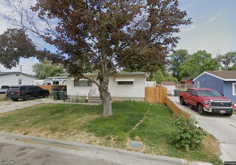
430 Roosevelt Ave Pocatello, ID 83201
Downtown Pocatello NeighborhoodEstimated Value: $260,000 - $296,000
3
Beds
2
Baths
1,716
Sq Ft
$166/Sq Ft
Est. Value
About This Home
This home is located at 430 Roosevelt Ave, Pocatello, ID 83201 and is currently estimated at $284,137, approximately $165 per square foot. 430 Roosevelt Ave is a home located in Bannock County with nearby schools including Lewis & Clark Elementary School, Kinport Academy, and Pocatello High School.
Ownership History
Date
Name
Owned For
Owner Type
Purchase Details
Closed on
Aug 31, 2017
Sold by
Bringhurst Joseph and Bringhurst Samantha
Bought by
Humpherys Brenden P
Current Estimated Value
Home Financials for this Owner
Home Financials are based on the most recent Mortgage that was taken out on this home.
Original Mortgage
$117,826
Outstanding Balance
$97,994
Interest Rate
3.75%
Mortgage Type
FHA
Estimated Equity
$186,143
Purchase Details
Closed on
Feb 26, 2013
Sold by
Baer Jeanette M
Bought by
Bringhurst Joseph and Johnson Samanth
Purchase Details
Closed on
Jul 20, 2005
Sold by
Kirby Jeanette
Bought by
Kirby Chris
Create a Home Valuation Report for This Property
The Home Valuation Report is an in-depth analysis detailing your home's value as well as a comparison with similar homes in the area
Home Values in the Area
Average Home Value in this Area
Purchase History
| Date | Buyer | Sale Price | Title Company |
|---|---|---|---|
| Humpherys Brenden P | -- | Amerititle | |
| Bringhurst Joseph | -- | First American Title Company | |
| Kirby Chris | -- | -- |
Source: Public Records
Mortgage History
| Date | Status | Borrower | Loan Amount |
|---|---|---|---|
| Open | Humpherys Brenden P | $117,826 |
Source: Public Records
Tax History Compared to Growth
Tax History
| Year | Tax Paid | Tax Assessment Tax Assessment Total Assessment is a certain percentage of the fair market value that is determined by local assessors to be the total taxable value of land and additions on the property. | Land | Improvement |
|---|---|---|---|---|
| 2024 | $1,297 | $198,978 | $55,000 | $143,978 |
| 2023 | $1,433 | $220,374 | $55,000 | $165,374 |
| 2022 | $1,433 | $192,301 | $45,446 | $146,855 |
| 2021 | $1,645 | $174,655 | $45,446 | $129,209 |
| 2020 | $1,370 | $171,486 | $37,872 | $133,614 |
| 2019 | $1,448 | $147,405 | $37,872 | $109,533 |
| 2018 | $1,339 | $118,722 | $27,444 | $91,278 |
| 2017 | $2,207 | $99,777 | $25,614 | $74,163 |
| 2016 | $1,114 | $99,777 | $25,614 | $74,163 |
| 2015 | $1,125 | $0 | $0 | $0 |
| 2012 | -- | $97,990 | $25,614 | $72,376 |
Source: Public Records
Map
Nearby Homes
- 532 Roosevelt Ave
- 270 Taft Ave
- 230 Roosevelt Ave
- 441 Packard Ave
- 241 Wilson Ave
- 646 Packard Ave
- TBD Mckinley Ave
- 676 Packard Ave
- 687 Warren Ave
- 575 Marlu St
- 770 Grace Dr
- 506 E Poplar St
- 843 Wilson Ave
- 727 Washington Ave
- 189 Washington Ave
- 734 Cherry St
- 787 Willard Ave
- 765 Cherry St
- 757 Hemlock St
- 715 Dahl Ave
- 444 Roosevelt Ave
- 424 Roosevelt Ave
- 414 Roosevelt Ave
- 429 Taft Ave
- 470 Roosevelt Ave
- 413 Taft Ave
- 429 Roosevelt Ave
- 445 Roosevelt Ave
- 406 Roosevelt Ave
- 409 Taft Ave
- 465 Taft Ave
- 443 Taft Ave
- 0 Roosevelt Ave
- 600 Roosevelt Ave
- 480 Roosevelt Ave
- 421 Roosevelt Ave
- 417 Roosevelt Ave
- 471 Roosevelt Ave
- 396 Roosevelt Ave
- 401 Roosevelt Ave