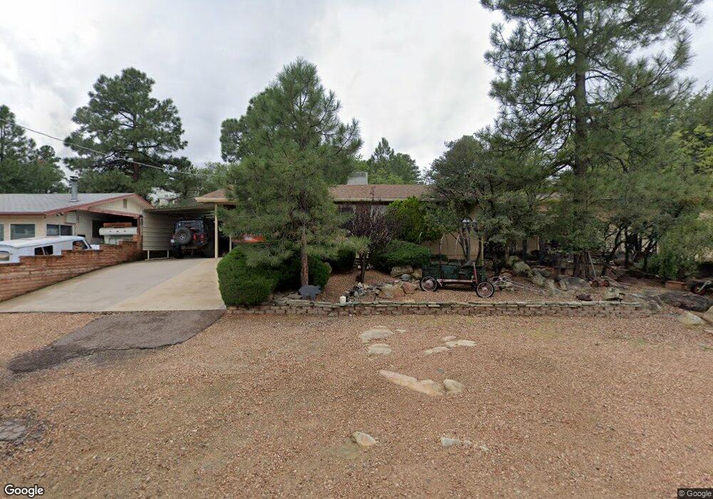
430 S Mccormick St Prescott, AZ 86303
Estimated Value: $486,000 - $644,000
--
Bed
--
Bath
1,146
Sq Ft
$488/Sq Ft
Est. Value
About This Home
This home is located at 430 S Mccormick St, Prescott, AZ 86303 and is currently estimated at $559,414, approximately $488 per square foot. 430 S Mccormick St is a home located in Yavapai County with nearby schools including Lincoln Elementary School, Granite Mountain Middle School, and Prescott Mile High Middle School.
Ownership History
Date
Name
Owned For
Owner Type
Purchase Details
Closed on
Jan 26, 2024
Sold by
Hawley Ted Philip and Hawley Darlene Marie
Bought by
Ted P Hawley And Darlene M Hawley Trust and Hawley
Current Estimated Value
Purchase Details
Closed on
Dec 20, 2017
Sold by
Lorenzen Darrel Henry and Hawley Ted Phillip
Bought by
Hawley Ted Phillip and Hawley Darlene Marie
Home Financials for this Owner
Home Financials are based on the most recent Mortgage that was taken out on this home.
Original Mortgage
$110,000
Interest Rate
3.95%
Mortgage Type
New Conventional
Purchase Details
Closed on
Jul 26, 2017
Sold by
Lorenzen Darrel Henry
Bought by
Lorenzen Darrel Henry
Purchase Details
Closed on
Sep 3, 2015
Sold by
Schnepf Barara Jo
Bought by
Lorenzen Darrel Henry and Hawley Ted Phillip
Create a Home Valuation Report for This Property
The Home Valuation Report is an in-depth analysis detailing your home's value as well as a comparison with similar homes in the area
Home Values in the Area
Average Home Value in this Area
Purchase History
| Date | Buyer | Sale Price | Title Company |
|---|---|---|---|
| Ted P Hawley And Darlene M Hawley Trust | -- | None Listed On Document | |
| Hawley Ted Phillip | -- | Yavapai Title Agency Inc | |
| Lorenzen Darrel Henry | -- | None Available | |
| Lorenzen Darrel Henry | -- | None Available |
Source: Public Records
Mortgage History
| Date | Status | Borrower | Loan Amount |
|---|---|---|---|
| Previous Owner | Hawley Ted Phillip | $110,000 |
Source: Public Records
Tax History Compared to Growth
Tax History
| Year | Tax Paid | Tax Assessment Tax Assessment Total Assessment is a certain percentage of the fair market value that is determined by local assessors to be the total taxable value of land and additions on the property. | Land | Improvement |
|---|---|---|---|---|
| 2026 | $1,147 | $55,635 | -- | -- |
| 2024 | $1,122 | $53,113 | -- | -- |
| 2023 | $1,122 | $47,295 | $0 | $0 |
| 2022 | $1,107 | $39,353 | $9,156 | $30,197 |
| 2021 | $1,188 | $38,734 | $9,035 | $29,699 |
| 2020 | $1,193 | $0 | $0 | $0 |
| 2019 | $1,184 | $0 | $0 | $0 |
| 2018 | $1,132 | $0 | $0 | $0 |
| 2017 | $1,091 | $0 | $0 | $0 |
| 2016 | $1,086 | $0 | $0 | $0 |
| 2015 | $1,053 | $0 | $0 | $0 |
| 2014 | $1,050 | $0 | $0 | $0 |
Source: Public Records
Map
Nearby Homes
- 333 W Leroux St Unit 7
- 513 Ellenwood Dr
- 412 White Spar Rd
- 412 White Spar Rd Unit 1
- 395 Pioneer Dr
- 543 S Hassayampa Dr
- 532 N Hassayampa Dr
- 510 Copper Basin Rd Unit 106
- 510 Copper Basin Rd Unit 100
- 434 S Cortez St
- 280 Looking Glass Dr
- 509 Copper Basin Rd
- 116 E Leroux St
- 320 S Cortez St
- 707 Cherokee Rd
- 829 Alpha Ln Unit 13
- 112 E Aubrey St
- 316 S Cortez St
- 346 S Marina St
- 719 Pima Rd
- 410 S Mccormick St
- 440 S Mccormick St
- 421 Canyon Springs Rd
- 411 Canyon Springs Rd
- 431 Canyon Springs Rd
- 333 W Leroux St Unit H-5
- 333 W Leroux St
- 333 W Leroux St Unit H7
- 333 W Leroux St Unit H6
- 333 W Leroux St Unit 5
- 333 W Leroux St
- 333 W Leroux St Unit H3
- 333 W Leroux St Unit 1
- 333 W Leroux St Unit G8
- 333 W Leroux St Unit G7
- 333 W Leroux St Unit B6
- 333 W Leroux St Unit G5
- 333 W Leroux St Unit 3
- 333 W Leroux St
- 333 W Leroux St Unit G1