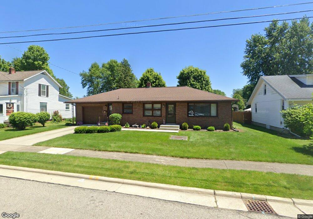
430 Sears St Bucyrus, OH 44820
Estimated Value: $152,000 - $200,000
3
Beds
2
Baths
1,256
Sq Ft
$141/Sq Ft
Est. Value
About This Home
This home is located at 430 Sears St, Bucyrus, OH 44820 and is currently estimated at $176,569, approximately $140 per square foot. 430 Sears St is a home located in Crawford County with nearby schools including Bucyrus Elementary School, Bucyrus Secondary School, and Holy Trinity School.
Ownership History
Date
Name
Owned For
Owner Type
Purchase Details
Closed on
Jul 6, 2021
Sold by
Snavely Cynthia L
Bought by
Belcher Diane K
Current Estimated Value
Home Financials for this Owner
Home Financials are based on the most recent Mortgage that was taken out on this home.
Original Mortgage
$50,000
Outstanding Balance
$38,214
Interest Rate
2.9%
Mortgage Type
Purchase Money Mortgage
Estimated Equity
$138,355
Purchase Details
Closed on
Nov 26, 2014
Sold by
Snavely Betty M
Bought by
Snavely Betty M
Create a Home Valuation Report for This Property
The Home Valuation Report is an in-depth analysis detailing your home's value as well as a comparison with similar homes in the area
Home Values in the Area
Average Home Value in this Area
Purchase History
| Date | Buyer | Sale Price | Title Company |
|---|---|---|---|
| Belcher Diane K | $134,900 | Old Crawford Land Title | |
| Snavely Betty M | -- | Attorney |
Source: Public Records
Mortgage History
| Date | Status | Borrower | Loan Amount |
|---|---|---|---|
| Open | Belcher Diane K | $50,000 |
Source: Public Records
Tax History
| Year | Tax Paid | Tax Assessment Tax Assessment Total Assessment is a certain percentage of the fair market value that is determined by local assessors to be the total taxable value of land and additions on the property. | Land | Improvement |
|---|---|---|---|---|
| 2024 | $1,543 | $45,740 | $4,350 | $41,390 |
| 2023 | $1,579 | $33,020 | $4,350 | $28,670 |
| 2022 | $1,262 | $33,020 | $4,350 | $28,670 |
| 2021 | $1,758 | $33,020 | $4,350 | $28,670 |
| 2020 | $1,646 | $29,300 | $4,350 | $24,950 |
| 2019 | $1,682 | $29,300 | $4,350 | $24,950 |
| 2018 | $1,675 | $29,300 | $4,350 | $24,950 |
| 2017 | $1,600 | $27,010 | $4,350 | $22,660 |
| 2016 | $1,551 | $27,010 | $4,350 | $22,660 |
| 2015 | $1,529 | $27,010 | $4,350 | $22,660 |
| 2014 | $1,001 | $27,010 | $4,350 | $22,660 |
| 2013 | $1,001 | $27,010 | $4,350 | $22,660 |
Source: Public Records
Map
Nearby Homes
- 609 W Perry St
- 885 W Perry St
- 627 W Mansfield St
- 400 W Mansfield St
- 1023 Tiffin St Unit Lot 5
- 1023 Tiffin St Unit 17
- 1023 Tiffin St Unit 30
- 210 N Walnut St
- 223 E Rensselaer St
- 1200 N Sandusky Ave
- 231 E Rensselaer St
- 407 E Mansfield St
- 926 Maple St
- 412 E Rensselaer St
- 545 S Sandusky Ave
- 320 S Lane St
- 112 Iron St
- 118 E Liberty St
- 800 High St
- 1575 N Sandusky Ave
Your Personal Tour Guide
Ask me questions while you tour the home.