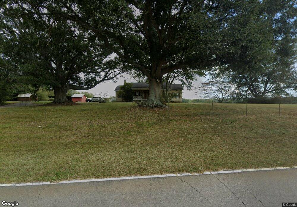
430 Star Point Rd Carrollton, GA 30116
Estimated Value: $362,533 - $462,000
3
Beds
3
Baths
1,996
Sq Ft
$210/Sq Ft
Est. Value
About This Home
This home is located at 430 Star Point Rd, Carrollton, GA 30116 and is currently estimated at $419,383, approximately $210 per square foot. 430 Star Point Rd is a home located in Carroll County with nearby schools including Roopville Elementary School, Central Middle School, and Central High School.
Ownership History
Date
Name
Owned For
Owner Type
Purchase Details
Closed on
Feb 23, 2004
Sold by
Calhoun Amy L and Calhoun Robin E
Bought by
Calhoun Amy L
Current Estimated Value
Purchase Details
Closed on
Aug 21, 2003
Sold by
Calhoun Amy L
Bought by
Calhoun Amy L and Calhoun Robin E
Purchase Details
Closed on
Jul 24, 2003
Sold by
Calhoun Bessa
Bought by
Calhoun Amy L
Create a Home Valuation Report for This Property
The Home Valuation Report is an in-depth analysis detailing your home's value as well as a comparison with similar homes in the area
Home Values in the Area
Average Home Value in this Area
Purchase History
| Date | Buyer | Sale Price | Title Company |
|---|---|---|---|
| Calhoun Amy L | -- | -- | |
| Calhoun Amy L | -- | -- | |
| Calhoun Amy L | -- | -- | |
| Calhoun Amy L | -- | -- | |
| Calhoun Bessa | -- | -- |
Source: Public Records
Tax History Compared to Growth
Tax History
| Year | Tax Paid | Tax Assessment Tax Assessment Total Assessment is a certain percentage of the fair market value that is determined by local assessors to be the total taxable value of land and additions on the property. | Land | Improvement |
|---|---|---|---|---|
| 2023 | $1,928 | $123,326 | $9,678 | $113,648 |
| 2022 | $2,007 | $97,574 | $6,452 | $91,122 |
| 2021 | $1,802 | $83,454 | $5,162 | $78,292 |
| 2020 | $1,646 | $74,692 | $4,692 | $70,000 |
| 2019 | $1,538 | $68,108 | $4,692 | $63,416 |
| 2018 | $1,397 | $59,222 | $4,385 | $54,837 |
| 2017 | $1,400 | $59,222 | $4,385 | $54,837 |
| 2016 | $1,401 | $59,222 | $4,385 | $54,837 |
| 2015 | $1,305 | $50,681 | $6,708 | $43,973 |
| 2014 | $1,311 | $50,681 | $6,708 | $43,973 |
Source: Public Records
Map
Nearby Homes
- 0 Lowell Rd Unit 10640679
- 00 Ringer Rd
- 0 Ringer Rd Unit 10595950
- 1170 Lowell Rd
- 0 Bonner Goldmine Rd Unit 145631
- 0 Bonner Goldmine Rd Unit 10433818
- 500 Coleman Mill Rd
- 221 Valley Ridge Dr
- 484 Carrie Kathleen Terrace
- 1915 Whooping Creek Church Rd
- 472 Carrie Kathleen Terrace
- 2088 Star Point Rd
- 1512 Whooping Creek Church Rd
- 2492 Oak Grove Church Rd
- 1502 Whooping Creek Church Rd
- 1450 Whooping Creek Church Rd
- 1430 Whooping Creek Church Rd
- 465 Star Point Rd
- 350 Star Point Rd
- 515 Star Point Rd
- 541 Star Point Rd
- 520 Star Point Rd
- 160 Star Point Rd
- 320 Star Point Rd
- 597 Star Point Rd
- 672 Ringer Rd
- 565 Lowell Rd
- 654 Star Point Rd
- 725 Star Point Rd
- 785 Star Point Rd
- 732 Star Point Rd
- 485 Lowell Rd
- 437 Lowell Rd
- 435 Lowell Rd
- 795 Star Point Rd
- 536 Lovell Rd
- 778 Ringer Rd