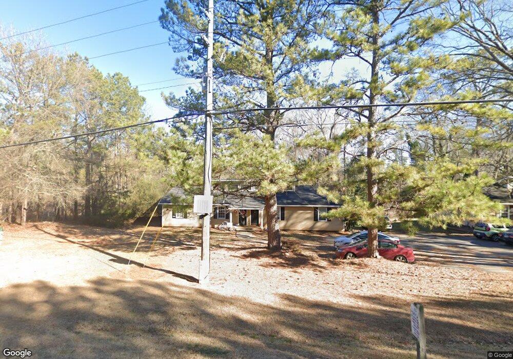
430 Timothy Rd Athens, GA 30606
Berkley Hills NeighborhoodEstimated Value: $262,274 - $393,000
Studio
2
Baths
1,848
Sq Ft
$173/Sq Ft
Est. Value
About This Home
This home is located at 430 Timothy Rd, Athens, GA 30606 and is currently estimated at $319,069, approximately $172 per square foot. 430 Timothy Rd is a home located in Clarke County with nearby schools including Timothy Elementary School, Clarke Middle School, and Clarke Central High School.
Ownership History
Date
Name
Owned For
Owner Type
Purchase Details
Closed on
Apr 21, 1995
Sold by
Porterfield Doris C
Bought by
Thornton Michael A and Thornto Nona K
Current Estimated Value
Purchase Details
Closed on
Sep 26, 1994
Sold by
Porterfield Larry P and Porterfield Doris C
Bought by
Porterfield Doris C
Create a Home Valuation Report for This Property
The Home Valuation Report is an in-depth analysis detailing your home's value as well as a comparison with similar homes in the area
Home Values in the Area
Average Home Value in this Area
Purchase History
| Date | Buyer | Sale Price | Title Company |
|---|---|---|---|
| Thornton Michael A | -- | -- | |
| Porterfield Doris C | -- | -- |
Source: Public Records
Tax History
| Year | Tax Paid | Tax Assessment Tax Assessment Total Assessment is a certain percentage of the fair market value that is determined by local assessors to be the total taxable value of land and additions on the property. | Land | Improvement |
|---|---|---|---|---|
| 2025 | $3,203 | $103,164 | $12,000 | $91,164 |
| 2024 | $3,203 | $98,307 | $12,000 | $86,307 |
| 2023 | $3,072 | $78,441 | $12,000 | $66,441 |
| 2022 | $2,041 | $63,989 | $10,400 | $53,589 |
| 2021 | $1,712 | $50,813 | $10,400 | $40,413 |
| 2020 | $1,604 | $47,602 | $10,400 | $37,202 |
| 2019 | $1,577 | $46,442 | $8,000 | $38,442 |
| 2018 | $1,325 | $39,038 | $8,000 | $31,038 |
| 2017 | $1,214 | $35,754 | $8,000 | $27,754 |
| 2016 | $1,102 | $32,472 | $8,000 | $24,472 |
| 2015 | $1,122 | $32,991 | $8,000 | $24,991 |
| 2014 | $1,126 | $33,062 | $8,000 | $25,062 |
Source: Public Records
Map
Nearby Homes
- 105 Greystone Terrace
- 257 Township Ln
- 340 Dogwood Dr
- 190 Bowles Dr Unit 1
- 190 Bowles Dr
- 205 Heritage Stroll
- 262 Rhodes Dr
- 176 Towns Walk Dr
- 213 Highpointe Ln
- 237 Highpointe Ln
- 645 Parrish Pointe Dr
- 145 Holmes Ave
- 220 Highpointe Ln
- 179 Steepleview Dr
- 237 Towns Walk Dr
- 236 Towns Walk Dr
- 132 Branford Place
- 1365 Ryan Pass
- 3119 Spartan Estates Dr
- 381 Township Ln
- 420 Timothy Rd
- 410 Timothy Rd
- 470 Timothy Rd
- 105 Autumnwood Ave
- 480 Timothy Rd
- 115 Autumnwood Ave
- 110 Autumnwood Ave
- 447 Timothy Rd
- 490 Timothy Rd
- 120 Autumnwood Ave
- 127 Autumnwood Ave
- 500 Timothy Rd
- 130 Autumnwood Ave
- 110 Greystone Terrace
- 120 Greystone Terrace
- 350 Timothy Rd
- 135 Autumnwood Ave
- 520 Timothy Rd
- 140 Autumnwood Ave
- 365 Timothy Rd
Your Personal Tour Guide
Ask me questions while you tour the home.