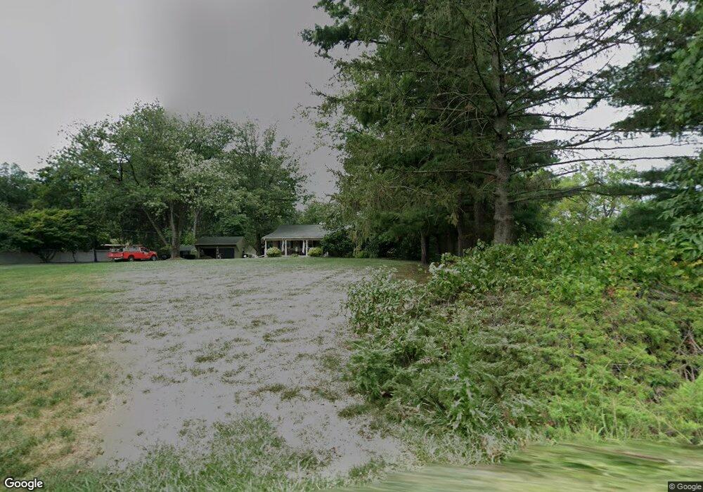
430 Upper Stump Rd Chalfont, PA 18914
Estimated Value: $479,490 - $579,000
3
Beds
2
Baths
1,576
Sq Ft
$336/Sq Ft
Est. Value
About This Home
This home is located at 430 Upper Stump Rd, Chalfont, PA 18914 and is currently estimated at $528,873, approximately $335 per square foot. 430 Upper Stump Rd is a home located in Bucks County with nearby schools including Pennridge High School, Plumstead Christ School Peace Val, and St. Jude Catholic School.
Ownership History
Date
Name
Owned For
Owner Type
Purchase Details
Closed on
Jan 23, 2018
Sold by
Andres Kenneth Er
Bought by
Andress Kenneth R and Vitantonio Andrew Kathleen M
Current Estimated Value
Purchase Details
Closed on
Apr 23, 2016
Sold by
Andress Kenneth R
Bought by
Andress Kenneth R
Purchase Details
Closed on
Oct 11, 2007
Sold by
Andress Patricia Marie
Bought by
Andress Patricia Marie and Andress Kenneth R
Home Financials for this Owner
Home Financials are based on the most recent Mortgage that was taken out on this home.
Original Mortgage
$160,000
Outstanding Balance
$100,930
Interest Rate
6.41%
Mortgage Type
New Conventional
Estimated Equity
$427,943
Purchase Details
Closed on
Apr 15, 1964
Bought by
Andress Thomas R and Andress Patricia M
Create a Home Valuation Report for This Property
The Home Valuation Report is an in-depth analysis detailing your home's value as well as a comparison with similar homes in the area
Home Values in the Area
Average Home Value in this Area
Purchase History
| Date | Buyer | Sale Price | Title Company |
|---|---|---|---|
| Andress Kenneth R | -- | None Available | |
| Andress Kenneth R | -- | None Available | |
| Andress Patricia Marie | -- | None Available | |
| Andress Thomas R | -- | -- |
Source: Public Records
Mortgage History
| Date | Status | Borrower | Loan Amount |
|---|---|---|---|
| Open | Andress Patricia Marie | $160,000 |
Source: Public Records
Tax History Compared to Growth
Tax History
| Year | Tax Paid | Tax Assessment Tax Assessment Total Assessment is a certain percentage of the fair market value that is determined by local assessors to be the total taxable value of land and additions on the property. | Land | Improvement |
|---|---|---|---|---|
| 2025 | $4,938 | $28,800 | $6,120 | $22,680 |
| 2024 | $4,938 | $28,800 | $6,120 | $22,680 |
| 2023 | $4,880 | $28,800 | $6,120 | $22,680 |
| 2022 | $4,880 | $28,800 | $6,120 | $22,680 |
| 2021 | $4,880 | $28,800 | $6,120 | $22,680 |
| 2020 | $4,880 | $28,800 | $6,120 | $22,680 |
| 2019 | $4,852 | $28,800 | $6,120 | $22,680 |
| 2018 | $4,852 | $28,800 | $6,120 | $22,680 |
| 2017 | $4,816 | $28,800 | $6,120 | $22,680 |
| 2016 | $4,816 | $28,800 | $6,120 | $22,680 |
| 2015 | -- | $28,800 | $6,120 | $22,680 |
| 2014 | -- | $28,800 | $6,120 | $22,680 |
Source: Public Records
Map
Nearby Homes
- 744 Broad St
- 1528 Hilltown Pike
- 84 Curley Mill Rd
- 1161 Upper Stump Rd
- 315 Old Limekiln Lot 3 Rd
- 10 Hellberg Ave
- 1212 Revere Dr
- 425 Elm Cir
- 1075 Patrick Place Unit 75
- 622 Welcome House Rd
- 218 Keeley Ave
- 245 Coventry Rd
- 172 Chestnut St
- 9 Dublin Rd
- 165 Township Line Rd
- The Brookhaven Plan at Barclay Hill
- The Brentwood Plan at Barclay Hill
- The Banbury Plan at Barclay Hill
- 346 Maregan Dr
- 105 Barry Rd
- 422 Upper Stump Rd
- 506 Upper Stump Rd
- 427 Upper Stump Rd
- 412 Upper Stump Rd
- 421 Upper Stump Rd
- 405 Skunk Hollow Rd
- 508 Upper Stump Rd
- 501 Upper Stump Rd
- 511 Upper Stump Rd
- 518 Upper Stump Rd
- 415 Upper Stump Rd
- 512 Upper Stump Rd
- 408 Upper Stump Rd
- 431 Upper Stump Rd
- 516 Upper Stump Rd
- 519 Upper Stump Rd
- 429 Upper Stump Rd
- 524 Upper Stump Rd
- 525 Upper Stump Rd
- 402 Upper Stump Rd