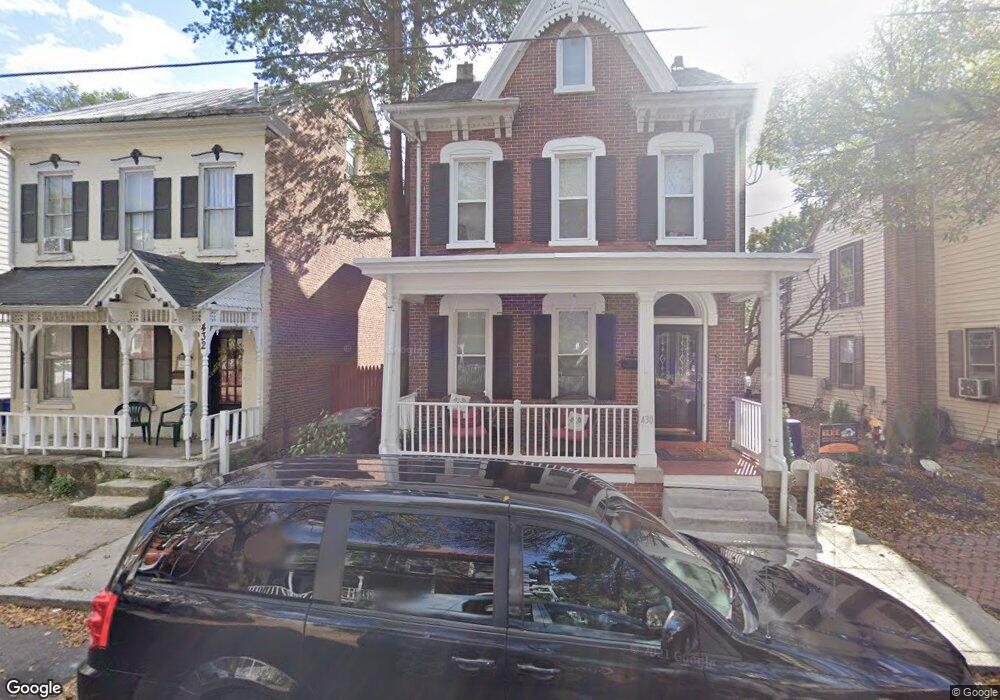
430 Walnut St Pottstown, PA 19464
Downtown Pottstown NeighborhoodEstimated Value: $181,000 - $310,000
4
Beds
3
Baths
1,958
Sq Ft
$120/Sq Ft
Est. Value
About This Home
This home is located at 430 Walnut St, Pottstown, PA 19464 and is currently estimated at $234,236, approximately $119 per square foot. 430 Walnut St is a home located in Montgomery County with nearby schools including Pottstown Middle School, Pottstown Senior High School, and West-Mont Christian Academy.
Ownership History
Date
Name
Owned For
Owner Type
Purchase Details
Closed on
Dec 6, 2016
Sold by
Habitat For Humanity Of Montgomery Count
Bought by
Chambers Thompson Kayann and Thompson Ricardo R
Current Estimated Value
Home Financials for this Owner
Home Financials are based on the most recent Mortgage that was taken out on this home.
Original Mortgage
$35,000
Outstanding Balance
$28,622
Interest Rate
3.94%
Mortgage Type
Purchase Money Mortgage
Estimated Equity
$205,614
Purchase Details
Closed on
Dec 12, 2014
Sold by
Albright Rebecca J
Bought by
Humanity Of Montgomery County Inc
Purchase Details
Closed on
May 25, 2007
Sold by
Hud
Bought by
Albright Rebecca J
Purchase Details
Closed on
Oct 5, 2006
Sold by
Washington Mut Bank
Bought by
Hud
Purchase Details
Closed on
Jul 27, 2006
Sold by
Crowder Mary
Bought by
Washington Mut Bank Na
Create a Home Valuation Report for This Property
The Home Valuation Report is an in-depth analysis detailing your home's value as well as a comparison with similar homes in the area
Home Values in the Area
Average Home Value in this Area
Purchase History
| Date | Buyer | Sale Price | Title Company |
|---|---|---|---|
| Chambers Thompson Kayann | $145,000 | None Available | |
| Humanity Of Montgomery County Inc | -- | None Available | |
| Albright Rebecca J | $73,710 | None Available | |
| Hud | -- | None Available | |
| Washington Mut Bank Na | $1,297 | None Available |
Source: Public Records
Mortgage History
| Date | Status | Borrower | Loan Amount |
|---|---|---|---|
| Open | Chambers Thompson Kayann | $35,000 |
Source: Public Records
Tax History Compared to Growth
Tax History
| Year | Tax Paid | Tax Assessment Tax Assessment Total Assessment is a certain percentage of the fair market value that is determined by local assessors to be the total taxable value of land and additions on the property. | Land | Improvement |
|---|---|---|---|---|
| 2025 | $2,817 | $45,900 | -- | -- |
| 2024 | $2,817 | $45,900 | -- | -- |
| 2023 | $2,778 | $45,900 | $0 | $0 |
| 2022 | $2,764 | $45,900 | $0 | $0 |
| 2021 | $2,733 | $45,900 | $0 | $0 |
| 2020 | $2,685 | $45,900 | $0 | $0 |
| 2019 | $2,623 | $45,900 | $0 | $0 |
| 2018 | $1,865 | $45,900 | $0 | $0 |
| 2017 | $2,453 | $45,900 | $0 | $0 |
| 2016 | $2,436 | $45,900 | $0 | $0 |
| 2015 | $2,434 | $45,900 | $0 | $0 |
| 2014 | $2,420 | $45,900 | $0 | $0 |
Source: Public Records
Map
Nearby Homes