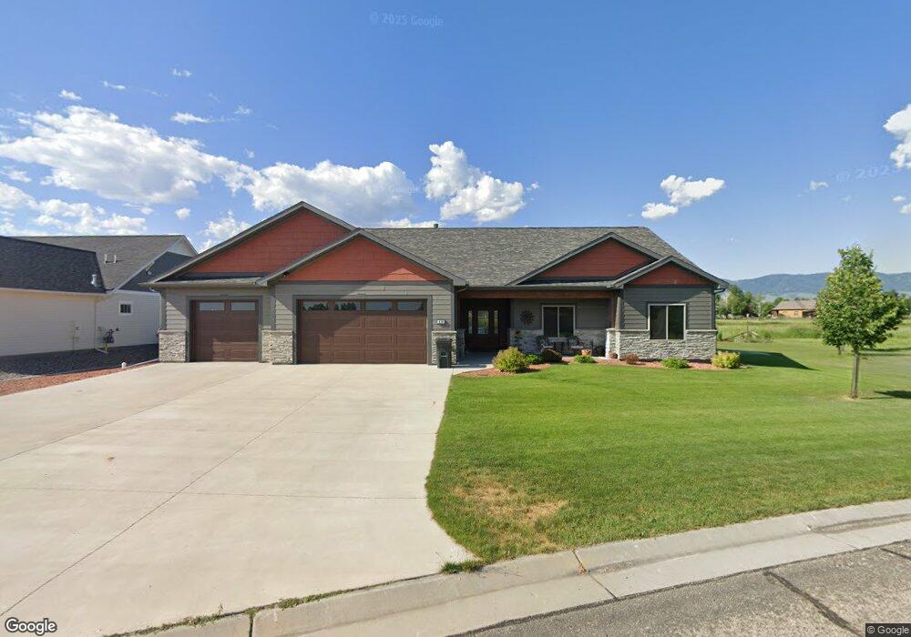
430 Wildflower Cir Sheridan, WY 82801
Estimated Value: $834,421 - $849,000
--
Bed
1
Bath
2,064
Sq Ft
$409/Sq Ft
Est. Value
About This Home
This home is located at 430 Wildflower Cir, Sheridan, WY 82801 and is currently estimated at $844,140, approximately $408 per square foot. 430 Wildflower Cir is a home.
Ownership History
Date
Name
Owned For
Owner Type
Purchase Details
Closed on
Mar 3, 2014
Sold by
Anderson Lester J W and Anderson Janelle L
Bought by
Mcguire Alice M and Alice M Mcguire Revocable Trust
Current Estimated Value
Purchase Details
Closed on
May 30, 2007
Sold by
Worden Wesley N
Bought by
Durladn Leslie Leroy
Home Financials for this Owner
Home Financials are based on the most recent Mortgage that was taken out on this home.
Original Mortgage
$112,500
Interest Rate
7.87%
Mortgage Type
Commercial
Purchase Details
Closed on
Jan 18, 2006
Sold by
Wicks Allan B and Wicks Laurie M
Bought by
The Allan And Laurie Wicks Revocable Tru
Purchase Details
Closed on
May 26, 2005
Sold by
Powder Horn Ranch Llc
Bought by
Anderson Lester and Anderson Nelda
Create a Home Valuation Report for This Property
The Home Valuation Report is an in-depth analysis detailing your home's value as well as a comparison with similar homes in the area
Home Values in the Area
Average Home Value in this Area
Purchase History
| Date | Buyer | Sale Price | Title Company |
|---|---|---|---|
| Mcguire Alice M | -- | None Available | |
| Durladn Leslie Leroy | -- | None Available | |
| The Allan And Laurie Wicks Revocable Tru | -- | None Available | |
| Anderson Lester | -- | None Available |
Source: Public Records
Mortgage History
| Date | Status | Borrower | Loan Amount |
|---|---|---|---|
| Previous Owner | Durladn Leslie Leroy | $112,500 |
Source: Public Records
Tax History Compared to Growth
Tax History
| Year | Tax Paid | Tax Assessment Tax Assessment Total Assessment is a certain percentage of the fair market value that is determined by local assessors to be the total taxable value of land and additions on the property. | Land | Improvement |
|---|---|---|---|---|
| 2025 | $4,926 | $36,738 | $6,423 | $30,315 |
| 2024 | $4,926 | $72,976 | $12,352 | $60,624 |
| 2023 | $4,701 | $69,650 | $11,358 | $58,292 |
| 2022 | $3,764 | $55,763 | $7,568 | $48,195 |
| 2021 | $3,154 | $46,726 | $6,624 | $40,102 |
| 2020 | $3,117 | $46,179 | $6,473 | $39,706 |
| 2019 | $413 | $6,113 | $6,113 | $0 |
| 2018 | $402 | $5,962 | $5,962 | $0 |
| 2017 | $0 | $5,586 | $5,586 | $0 |
| 2015 | -- | $5,586 | $5,586 | $0 |
| 2014 | -- | $5,586 | $5,586 | $0 |
| 2013 | -- | $5,782 | $5,782 | $0 |
Source: Public Records
Map
Nearby Homes
- 8 Buckskin Dr
- 21 Wishbone Way
- Tbd Wagon Wheel Court Lot F11
- Tbd Wagon Wheel Ct Lot F10 & F11
- TBD Wagon Wheel Ct Unit F10
- TBD Wagon Wheel Ct Unit F11
- TBD Wagon Wheel Ct Unit Lot 1
- TBD Wagon Wheel Ct Unit Lot 2
- 91 Wyoming 335
- 3 Thunderbird Dr
- 1 Deer Haven Dr
- 5 Oakmont Ct
- 21 Eagle Ridge Dr
- 96 Canvasback Rd
- TBD Powder Horn Rd
- TBD Powder Horn Rd Unit MNR 24 Lot 1
- 40 Mallard Rd
- 4 Mallard Rd
- 3 Mallard Rd
- TBD Eagle Ridge Dr Unit H-7
- 80 Primrose Ln
- 90 Primrose Ln
- 70 Primrose Ln
- 100 Primrose Ln
- 60 Primrose Ln
- 37 Green Meadows Dr
- 39 Green Meadows Dr
- 35 Green Meadows Dr
- 50 Primrose Ln
- 44 Green Meadows Dr
- 43 Green Meadows Dr
- 33 Green Meadows Dr
- 48 Green Meadows Dr
- 40 Primrose Ln
- TBD Sunrise Rd Unit Lot 2
- 31 Green Meadows Dr
- 270 Wildflower Cir
- 45 Green Meadows Dr
- TBD Wildflower Cir
- TBD Wildflower Cir Unit A 15