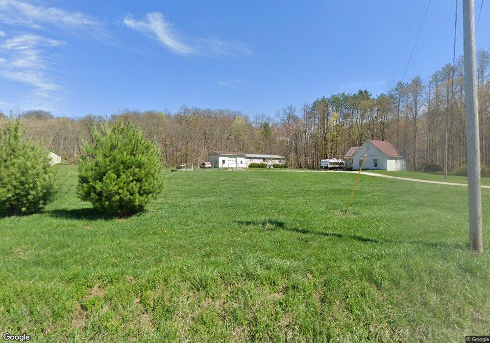
4300 Burnt Mill Rd Chandlersville, OH 43727
Estimated Value: $208,000 - $403,244
1
Bed
1
Bath
854
Sq Ft
$362/Sq Ft
Est. Value
About This Home
This home is located at 4300 Burnt Mill Rd, Chandlersville, OH 43727 and is currently estimated at $309,061, approximately $361 per square foot. 4300 Burnt Mill Rd is a home located in Muskingum County with nearby schools including Philo High School.
Ownership History
Date
Name
Owned For
Owner Type
Purchase Details
Closed on
Aug 17, 2016
Bought by
James A Neff
Current Estimated Value
Purchase Details
Closed on
May 20, 2005
Sold by
Mcconaha Stephen and Mcconaha Roberta L
Bought by
Neff James A
Home Financials for this Owner
Home Financials are based on the most recent Mortgage that was taken out on this home.
Original Mortgage
$60,000
Interest Rate
5.75%
Mortgage Type
Fannie Mae Freddie Mac
Purchase Details
Closed on
Jul 14, 1993
Bought by
Mcconaha Stephen
Create a Home Valuation Report for This Property
The Home Valuation Report is an in-depth analysis detailing your home's value as well as a comparison with similar homes in the area
Home Values in the Area
Average Home Value in this Area
Purchase History
| Date | Buyer | Sale Price | Title Company |
|---|---|---|---|
| James A Neff | -- | -- | |
| Neff James A | $90,000 | -- | |
| Mcconaha Stephen | $4,000 | -- |
Source: Public Records
Mortgage History
| Date | Status | Borrower | Loan Amount |
|---|---|---|---|
| Previous Owner | Neff James A | $60,000 |
Source: Public Records
Tax History Compared to Growth
Tax History
| Year | Tax Paid | Tax Assessment Tax Assessment Total Assessment is a certain percentage of the fair market value that is determined by local assessors to be the total taxable value of land and additions on the property. | Land | Improvement |
|---|---|---|---|---|
| 2024 | $3,437 | $110,950 | $13,860 | $97,090 |
| 2023 | $2,534 | $77,175 | $10,360 | $66,815 |
| 2022 | $2,463 | $77,175 | $10,360 | $66,815 |
| 2021 | $2,422 | $77,175 | $10,360 | $66,815 |
| 2020 | $2,057 | $64,330 | $8,645 | $55,685 |
| 2019 | $2,052 | $64,330 | $8,645 | $55,685 |
| 2018 | $1,050 | $64,330 | $8,645 | $55,685 |
| 2017 | $2,093 | $60,568 | $8,593 | $51,975 |
| 2016 | $2,105 | $87,090 | $11,520 | $75,570 |
| 2015 | $3,072 | $87,090 | $11,520 | $75,570 |
| 2013 | $2,330 | $61,740 | $10,080 | $51,660 |
Source: Public Records
Map
Nearby Homes
- 2640 Red Fox
- 250 Sycamore St
- 8303 Chandlersville Rd
- 135 Front St
- 143 Front St
- 142 Main St
- 252 Front St
- 426 Main St
- 718 3rd St
- 754 3rd St
- 3900 Dietz Ln
- 0 Big Muskie Dr
- 0 Okey Rd Unit 5130633
- 2125 Long Rd
- 4495 Old River Rd
- 7515 Pioneer Dr
- 7979 Old River Rd
- 4145 Old River Rd
- 0 Sealover Hollow Rd
- 8285 Old River Rd
- 4230 Burnt Mill Rd
- 4355 Burnt Mill Rd
- 5965 Westcrest Rd
- 5980 Westcrest Rd
- 4200 Burnt Mill Rd
- 4235 Burnt Mill Rd
- 4490 Burnt Mill Rd
- 4475 Burnt Mill Rd
- 5995 Westcrest Rd
- 4100 Burnt Mill Rd
- 6800 Peterson Ln
- 4605 Burnt Mill Rd
- 3590 Salt Creek Dr
- 3645 Salt Creek Dr
- 6845 Peterson Ln
- 6845 Peterson Ln
- 6555 Westcrest Rd
- 4625 Burnt Mill Rd
- 4625 Burnt Mill Rd
- 3695 Salt Creek Dr