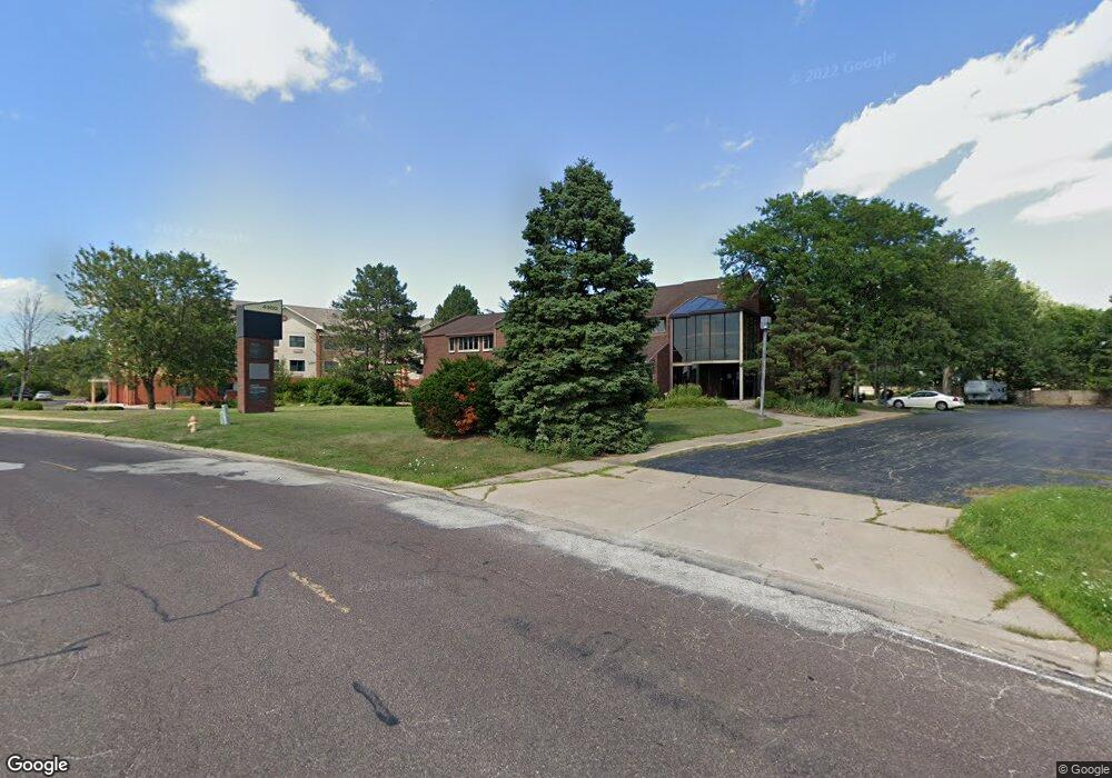
4300 N Brandywine Dr Peoria, IL 61614
North Peoria NeighborhoodEstimated Value: $695,700
--
Bed
--
Bath
--
Sq Ft
1.1
Acres
About This Home
This home is located at 4300 N Brandywine Dr, Peoria, IL 61614 and is currently estimated at $695,700. 4300 N Brandywine Dr is a home located in Peoria County with nearby schools including Dr. C. T. Vivian Primary School, Rolling Acres Middle School, and Richwoods High School.
Ownership History
Date
Name
Owned For
Owner Type
Purchase Details
Closed on
Jul 3, 2018
Sold by
Trust No 21 & 353
Bought by
Knight Medical & Rehab Ctr Ltd
Current Estimated Value
Home Financials for this Owner
Home Financials are based on the most recent Mortgage that was taken out on this home.
Original Mortgage
$540,000
Interest Rate
5.5%
Mortgage Type
New Conventional
Create a Home Valuation Report for This Property
The Home Valuation Report is an in-depth analysis detailing your home's value as well as a comparison with similar homes in the area
Home Values in the Area
Average Home Value in this Area
Purchase History
| Date | Buyer | Sale Price | Title Company |
|---|---|---|---|
| Knight Medical & Rehab Ctr Ltd | $675,000 | Chicago Title Co | |
| Knight Medical & Rehab Center | $675,000 | Chicago Title |
Source: Public Records
Mortgage History
| Date | Status | Borrower | Loan Amount |
|---|---|---|---|
| Closed | Knight Medical & Rehab Center | $540,000 |
Source: Public Records
Tax History Compared to Growth
Tax History
| Year | Tax Paid | Tax Assessment Tax Assessment Total Assessment is a certain percentage of the fair market value that is determined by local assessors to be the total taxable value of land and additions on the property. | Land | Improvement |
|---|---|---|---|---|
| 2024 | $21,698 | $239,880 | $101,110 | $138,770 |
| 2023 | $20,706 | $220,070 | $92,760 | $127,310 |
| 2022 | $20,929 | $216,970 | $90,790 | $126,180 |
| 2021 | $21,570 | $216,970 | $90,790 | $126,180 |
| 2020 | $21,741 | $216,970 | $90,790 | $126,180 |
| 2019 | $22,056 | $221,400 | $92,640 | $128,760 |
| 2018 | $21,557 | $221,350 | $92,600 | $128,750 |
| 2017 | $21,555 | $223,590 | $93,540 | $130,050 |
| 2016 | $30,280 | $323,090 | $93,540 | $229,550 |
| 2015 | $29,499 | $316,760 | $91,710 | $225,050 |
| 2014 | $29,147 | $320,460 | $92,600 | $227,860 |
| 2013 | -- | $320,460 | $92,600 | $227,860 |
Source: Public Records
Map
Nearby Homes
- 4212 N Keenland Ave
- 4808 N Glen Ct
- 1413 W Aire Ave
- 3720 N Saint Michael Ave
- 1412 W Glen Ave
- 4011 N Sterling Ave
- 4023 N University St
- 5003 N Mansfield Dr
- 1910 W Sunnyview Dr
- 5108 N Woodview Ave
- 1123 W Purtscher Dr
- 4426 N Wilco Dr
- 2627 Eugenie Ave
- 2705 W Millbrook Ct
- 2724 W Scenic Dr
- 937 W Kenwick Ln
- 3623 N Sterling Ave Unit b-17
- 2011 W Richwoods Blvd
- 930 W Willow Ln
- 5317 N Woodview Ave
- 4244 N Brandywine Dr
- 4306 N Brandywine Dr
- 1821 W Lamont Ave
- 1820 W Lamont Ave
- 1820 W Baywood Ave
- 1821 W Lake Ave
- 1816 W Lamont Ave
- 4240 N Brandywine Dr
- 1815 W Lamont Ave
- 1814 W Baywood Ave
- 1821 W Baywood Ave
- 1817 W Lake Ave
- 1811 W Lamont Ave
- 1810 W Lamont Ave
- 1817 W Baywood Ave
- 1810 W Baywood Ave
- 1822 W Christine Ave
- 1811 W Lake Ave
- 4232 N Brandywine Dr
- 1811 W Baywood Ave