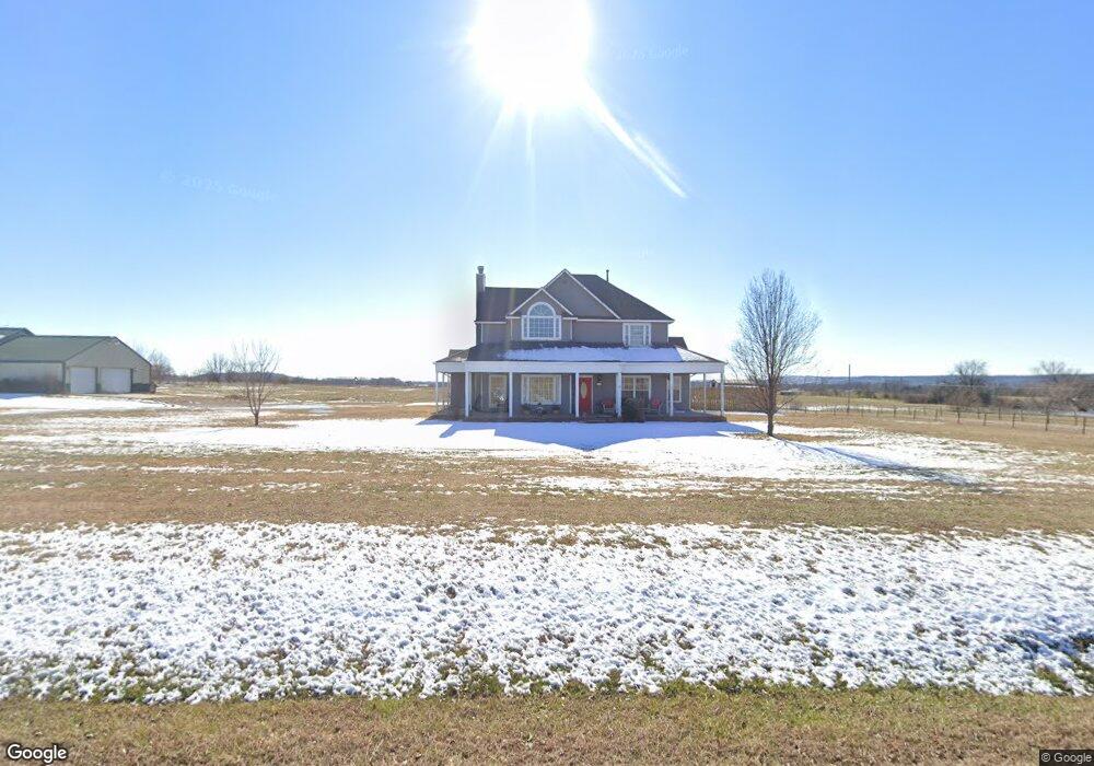
4300 W 141st St Kiefer, OK 74041
Estimated Value: $271,260 - $356,000
4
Beds
3
Baths
2,262
Sq Ft
$142/Sq Ft
Est. Value
About This Home
This home is located at 4300 W 141st St, Kiefer, OK 74041 and is currently estimated at $321,065, approximately $141 per square foot. 4300 W 141st St is a home with nearby schools including Kiefer Elementary School, Rongey Middle School, and Kiefer High School.
Ownership History
Date
Name
Owned For
Owner Type
Purchase Details
Closed on
Nov 9, 2007
Sold by
Boyd David J
Bought by
Blankenship Richard D and Blankenship Marsha L
Current Estimated Value
Home Financials for this Owner
Home Financials are based on the most recent Mortgage that was taken out on this home.
Original Mortgage
$84,000
Interest Rate
6.38%
Mortgage Type
Future Advance Clause Open End Mortgage
Create a Home Valuation Report for This Property
The Home Valuation Report is an in-depth analysis detailing your home's value as well as a comparison with similar homes in the area
Home Values in the Area
Average Home Value in this Area
Purchase History
| Date | Buyer | Sale Price | Title Company |
|---|---|---|---|
| Blankenship Richard D | $22,000 | None Available |
Source: Public Records
Mortgage History
| Date | Status | Borrower | Loan Amount |
|---|---|---|---|
| Closed | Blankenship Richard D | $84,000 |
Source: Public Records
Tax History
| Year | Tax Paid | Tax Assessment Tax Assessment Total Assessment is a certain percentage of the fair market value that is determined by local assessors to be the total taxable value of land and additions on the property. | Land | Improvement |
|---|---|---|---|---|
| 2025 | $2,465 | $24,714 | $3,000 | $21,714 |
| 2024 | $2,390 | $23,994 | $3,000 | $20,994 |
| 2023 | $2,390 | $23,296 | $3,000 | $20,296 |
| 2022 | $2,168 | $22,617 | $3,000 | $19,617 |
| 2021 | $2,199 | $21,958 | $3,000 | $18,958 |
| 2020 | $2,170 | $22,233 | $3,000 | $19,233 |
| 2019 | $2,185 | $21,765 | $3,000 | $18,765 |
| 2018 | $1,987 | $19,826 | $2,899 | $16,927 |
| 2017 | $1,840 | $18,882 | $2,793 | $16,089 |
| 2016 | $1,758 | $17,983 | $2,692 | $15,291 |
| 2015 | -- | $17,126 | $2,596 | $14,530 |
| 2014 | -- | $16,311 | $2,505 | $13,806 |
Source: Public Records
Map
Nearby Homes
- 14507 S 49th West Ave
- 0 33rd West Ave
- 14508 S Justin Ave
- 13706 Peabody Dr
- 14559 S Justin Ave
- 13435 S Garrett St
- 14716 S Justin Ave
- 10917 33rd West Ave
- 14560 Jordan Ct
- 12933 S 33rd West Ave
- 112 Stark St
- 810 W 150th St
- 311 E Indiana
- 14603 S Xenophon Ave
- 14921 Jordan Ct
- 463 W 147th St
- 6355 Rockwood Cir N
- 571 W 149th Place
- 115 Stiller Ave
- 15375 S 26th West Ave
- 4230 W 141st St S
- 0 141st St
- 16855 141st St
- 141.AA Sapulpa Rt 4
- 4390 W 141st St S
- 4390 W 141st St
- 4302 W 141st St
- 14537 S 49th West Ave
- 14225 S 49th West Ave
- 4604 W 144th St
- 14273 S 49th West Ave
- 14321 S 49th West Ave
- 14337 S 49th Ave W
- 14337 S 49th West Ave
- 14506 S 49th West Ave
- 14411 S 49th West Ave
- 0 131st St
- 14407 S 49th West Ave
- 14270 S 49th West Ave
- 14445 S 49th West Ave
Your Personal Tour Guide
Ask me questions while you tour the home.