NOT LISTED FOR SALE

4301 Riverside Dr Pearlington, MS 39572

Estimated Value: $28,617

0.31 Acre
$92,313 Price per Acre
13,504 Sq Ft Lot

Last Sold November 13, 2023

Current estimated payment $185/month

485 Days on Market

Highlights

  • Pier
  • Pier or Dock
  • No HOA
  • Boat or Launch Ramp
  • Property fronts a bayou

About This Lot

As of November 2023

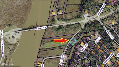
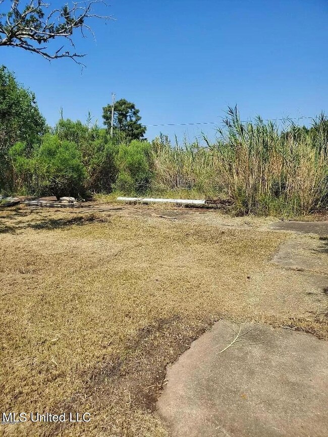
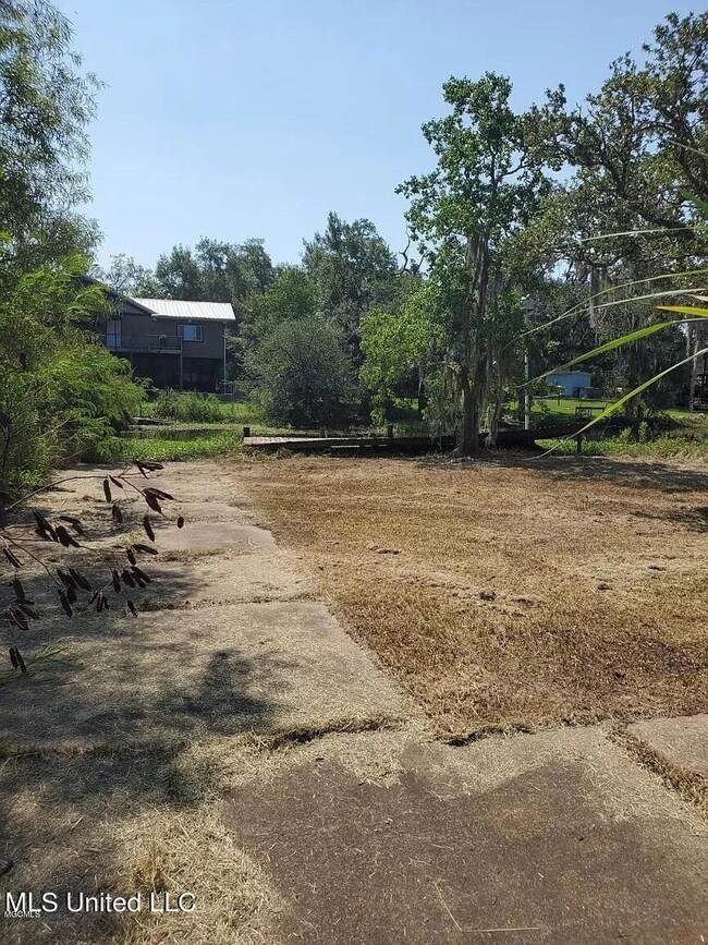
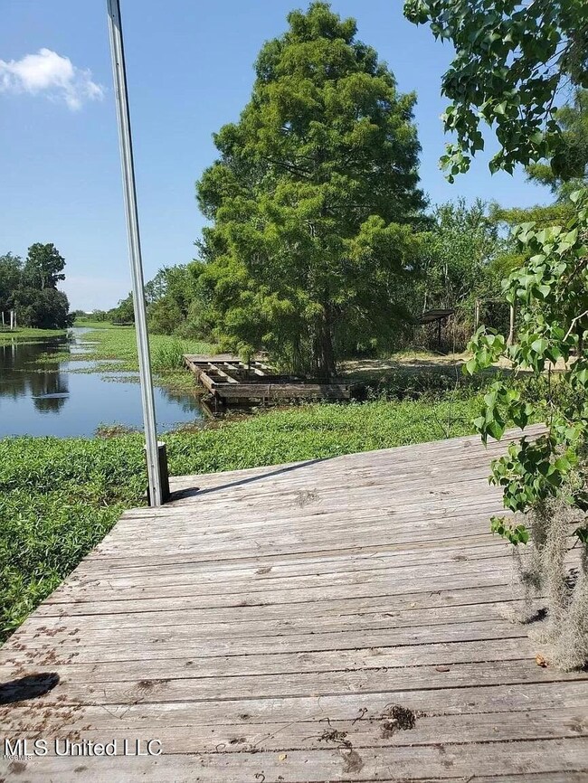
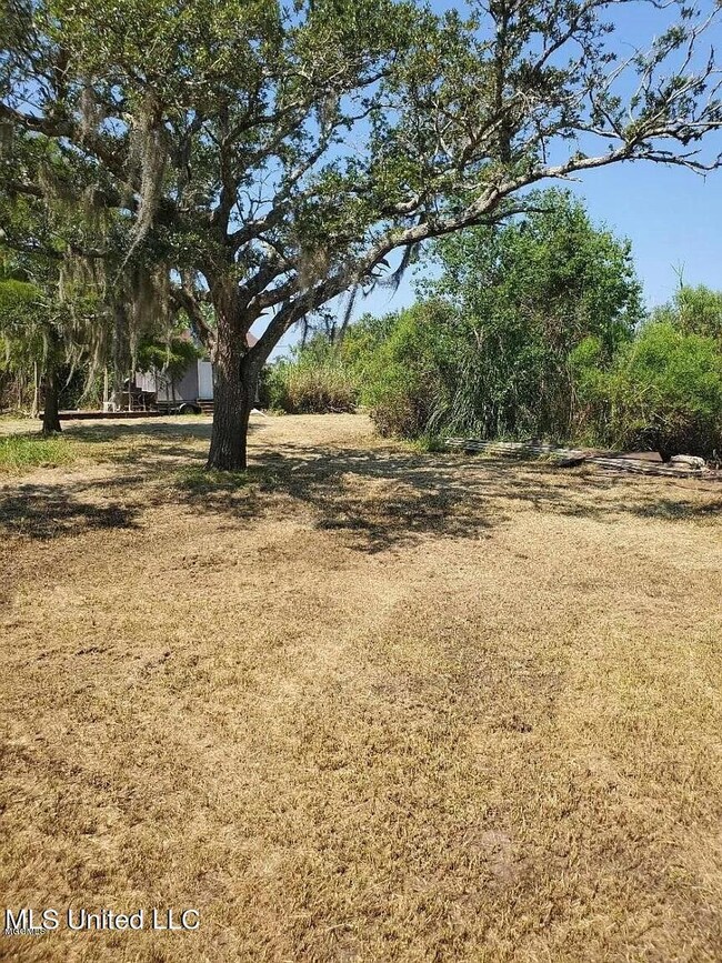
Are you looking for a place to build your camp or home? I got it and it's already cleared. Close to the Pearl River and Gulf of Mexico. You can fish both Mississippi and Louisiana water. Lot has piers on it but need a little TLC. Owner financing available. STOP DROP & CALL TODAY for your private showing.

Last Listed By

JASON WINDHAM

eAgent Solutions License #S52170 Listed on: 08/27/2023

Property Details

Property Type

  • Land

Est. Annual Taxes

  • $314

Lot Details

  • 0.31 Acre Lot
  • Property fronts a bayou
  • Cleared Lot

Listing and Financial Details

  • Assessor Parcel Number 189a-2-28-001.000

Community Details

Overview

  • No Home Owners Association
  • Belle Isle Subdivision

Recreation

  • Pier or Dock
  • Community Boat Launch
  • Pier
  • Boat or Launch Ramp

Property Details

Property Type

Land

Est. Annual Taxes

$314

Lot Details

0

Listing Details

  • Lot Size: .32
  • Property Sub Type: Single Family Residence Lot
  • Prop. Type: Land
  • Lot Size Acres: 0.31
  • Subdivision Name: Belle Isle
  • New Construction: No
  • Special Features: None

Interior Features

  • Possible Use: Residential, Vacant

Exterior Features

  • Lot Features: Cleared
  • Waterfront Features: Bayou, Boat Launch, Pier
  • WaterfrontFeaturesWaterfront: Yes
  • Waterfront: Yes
  • Lot Features:Cleared: Yes
  • Waterfront Features:Bayou: Yes
  • Waterfront Features:Boat Launch: Yes
  • Waterfront Features:Pier: Yes

Utilities

  • Sewer: Unknown
  • Utilities: Electricity Available, Water Available
  • Water Source: Community

Association/Amenities

  • HorseAmenitiesHorseAmenities: No
  • Tax and Financial Information:Association: No

Lot Info

  • Current Use: Vacant
  • Parcel #: 189a-2-28-001.000
  • Lot Size Sq Ft: 13503.6
  • ResoLotSizeUnits: Acres

Tax Info

  • Tax Annual Amount: 314.0
  • Tax Year: 2021

Range of Values:

Collateral Analytics

Collateral Analytics Collateral Analytics AVMs (Automated Valuation Model) employ a number of statistical approaches combined with neighborhood-specific comparable selection guarantees the most up-to-date and precise valuations.

Not Available

Collateral Analytics does not have data for the current month. Please view the chart for historical values.

ICE

ICE Mortgage Technology ICE Mortgage Technology’s AVM (Automated Valuation Model) is a state-of-the-art online residential property valuation tool that provides a quick and accurate estimate of the value of almost any home in the U.S.

Not Available

ICE Mortgage Technology does not have data for the current month. Please view the chart for historical values.

First American

First American First American Data & Analytics’ next-generation AVM combines unrivaled data assets with a blended ensemble of valuation models to produce highly accurate, reliable valuations you can trust.

Not Available

First American does not have data for the current month. Please view the chart for historical values.

Quantarium

Quantarium Quantarium’s valuation service, repeatedly proven the industry’s most accurate and comprehensive, is supercharged with a self-learning and auto-tuning AI engine that continually becomes smarter and more accurate as it processes daily inputs from the industry’s leading RE data lake.

Not Available

Quantarium does not have data for the current month. Please view the chart for historical values.

Average Value
Not Available
List Price
Sold Price
Create a Home Valuation Report for This Property
The Home Valuation Report is an in-depth analysis detailing your home's value as well as a comparison with similar homes in the area

Home Values in the Area

Source: Public Records

Average Home Value in this Area


Source: Public Records

Mortgage History

Date Status Borrower Loan Amount
Closed Pisciotta Zachary $20,250
Source: Public Records

Property History

Date Event Price Change Sq Ft Price
11/13/2023 11/13/23 Sold -- -- --
10/21/2023 10/21/23 Pending -- -- --
08/27/2023 08/27/23 For Sale $45,000 0.0% --
12/31/2022 12/31/22 Off Market -- -- --
10/26/2022 10/26/22 For Sale $45,000 0.0% --
10/20/2022 10/20/22 Pending -- -- --
10/14/2022 10/14/22 Price Changed $45,000 -18.2% --
06/22/2022 06/22/22 For Sale $55,000 -- --
Source: MLS United

Tax History Compared to Growth

Source: Public Records

Tax History

Year Tax Paid Tax Assessment Tax Assessment Total Assessment is a certain percentage of the fair market value that is determined by local assessors to be the total taxable value of land and additions on the property. Land Improvement
2024 $314 $3,300 $3,300 $0
2023 $314 $3,300 $3,300 $0
2022 $314 $3,300 $3,300 $0
2021 $314 $3,300 $3,300 $0
2020 $326 $3,300 $3,300 $0
2019 $326 $3,300 $3,300 $0
2018 $326 $3,300 $3,300 $0
2017 $326 $3,300 $3,300 $0
2016 $318 $3,300 $3,300 $0
2015 $302 $3,300 $3,300 $0
2014 $295 $3,300 $3,300 $0
2013 $285 $3,300 $3,300 $0
Source: Public Records

Agents Affiliated with this Home

  • Section Image
  • Section Image
See All Agents

Map

Similar Property in Pearlington, MS

  • 5065 N Daytona Dr, Pearlington, MS 39572

    $32,000

    • Land
    • 0.27 Acre
    • $118,519 per Acre
    • 5065 N Daytona Dr
    • Pearlington, MS

    Vacant Land in Oak Harbor development with existing chain wall foundation. Property is not cleared and is sold As Is. FEMA flood zone AE. Positioned on Mulatto Bayou that connects to PEarl River. Located within a 45 minute drive to New Orleans, 20 minute dive to Stennis and 30 minute drive to Bay St Louis attractions. There is no existing survey and no existing elevation certificate.

    DANNY AKERS Reve Realtors

    Section Image

Source: MLS United

MLS Number: 4021384

MLS United

APN: 189A-2-28-001.000