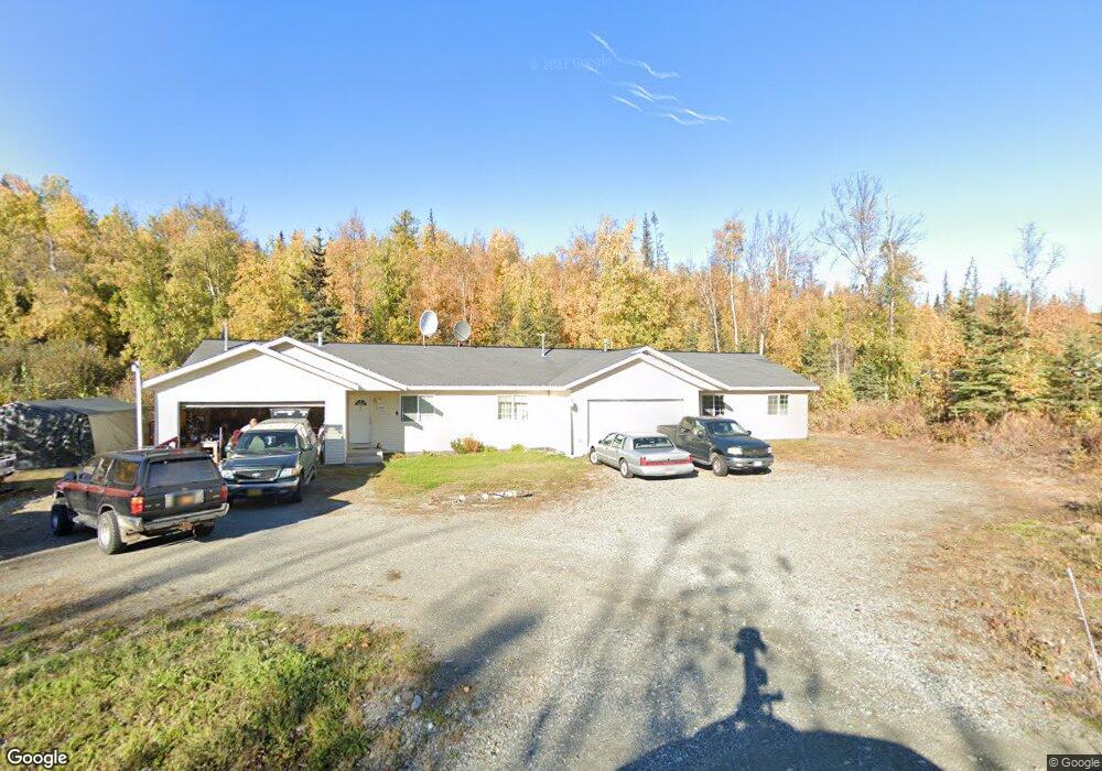
4301 W Memory Dr Unit A Wasilla, AK 99623
Estimated Value: $448,000 - $622,000
3
Beds
2
Baths
1,260
Sq Ft
$404/Sq Ft
Est. Value
About This Home
This home is located at 4301 W Memory Dr Unit A, Wasilla, AK 99623 and is currently estimated at $509,015, approximately $403 per square foot. 4301 W Memory Dr Unit A is a home located in Matanuska-Susitna Borough with nearby schools including Goose Bay Elementary School, Wasilla Middle School, and Wasilla High School.
Ownership History
Date
Name
Owned For
Owner Type
Purchase Details
Closed on
Oct 7, 2011
Sold by
Federal National Mortgage Association
Bought by
Geraghty Bruce R
Current Estimated Value
Home Financials for this Owner
Home Financials are based on the most recent Mortgage that was taken out on this home.
Original Mortgage
$238,920
Outstanding Balance
$161,769
Interest Rate
3.95%
Mortgage Type
FHA
Estimated Equity
$347,246
Purchase Details
Closed on
Nov 2, 2005
Sold by
Mersdorf Dennis
Bought by
Thibault David R and Thibault Gloria J
Home Financials for this Owner
Home Financials are based on the most recent Mortgage that was taken out on this home.
Original Mortgage
$259,200
Interest Rate
5.74%
Mortgage Type
New Conventional
Create a Home Valuation Report for This Property
The Home Valuation Report is an in-depth analysis detailing your home's value as well as a comparison with similar homes in the area
Home Values in the Area
Average Home Value in this Area
Purchase History
| Date | Buyer | Sale Price | Title Company |
|---|---|---|---|
| Geraghty Bruce R | -- | Fatic | |
| Thibault David R | -- | Mat Su Title Ins Agency Inc |
Source: Public Records
Mortgage History
| Date | Status | Borrower | Loan Amount |
|---|---|---|---|
| Open | Geraghty Bruce R | $238,920 | |
| Previous Owner | Thibault David R | $259,200 |
Source: Public Records
Tax History Compared to Growth
Tax History
| Year | Tax Paid | Tax Assessment Tax Assessment Total Assessment is a certain percentage of the fair market value that is determined by local assessors to be the total taxable value of land and additions on the property. | Land | Improvement |
|---|---|---|---|---|
| 2025 | $3,033 | $468,400 | $37,000 | $431,400 |
| 2024 | $3,033 | $460,400 | $37,000 | $423,400 |
| 2023 | $2,825 | $438,500 | $37,000 | $401,500 |
| 2022 | $2,781 | $398,100 | $37,000 | $361,100 |
| 2021 | $2,808 | $363,700 | $37,000 | $326,700 |
| 2020 | $5,429 | $341,400 | $37,000 | $304,400 |
| 2019 | $5,261 | $328,200 | $37,000 | $291,200 |
| 2018 | $5,147 | $322,700 | $37,000 | $285,700 |
| 2017 | $5,053 | $316,800 | $37,000 | $279,800 |
| 2016 | $4,638 | $297,700 | $21,000 | $276,700 |
| 2015 | $4,270 | $295,000 | $21,000 | $274,000 |
| 2014 | $4,270 | $277,800 | $21,000 | $256,800 |
Source: Public Records
Map
Nearby Homes
- 4190 W Overby St
- 3762 S Lansing Rd
- 3590 S Caryshea St
- 2840 S Red Birch Dr
- 5047 Cardiff Ln
- 4751 W Monument Cir
- 3431 S Phenix Ave
- 4668 W New Larkspur Loop
- 4686 W Gloryview Cir
- 5601 Cape Birch Dr
- 2745 S Hatcher Pass St
- 2851 S Old Knik Cir
- 3120 W Riverdell Dr
- 4344 S Pinnacle Peak Dr
- 5035 Mollies Cir
- 5550 W Limberlost Ave
- 2534 S Saindon St
- 5153 Kelsi Loop
- 5089 Kelsi Loop
- 5123 Kelsi Loop
- 4301 W Memory Dr
- L3 B4 Country Dr
- L7 W Memory Dr
- 4350 W Memory Dr
- 4351 W Memory Dr
- 4251 W Memory Dr
- 4251 W Memory Dr Unit B
- 4251 W Memory Dr Unit A
- 4298 W Memory Dr
- 4250 W Memory Dr
- 3800 S Country Dr
- 3851 W Memory Dr Unit 1
- 4240 W Memory Dr
- 4364 W Memory Dr
- 3751 S Monthome Cir
- 4100 S Memory Dr
- L6 W Memory Dr
- 4320 W Memory Dr
- 4201 W Memory Dr
- 4300 W Memory Dr