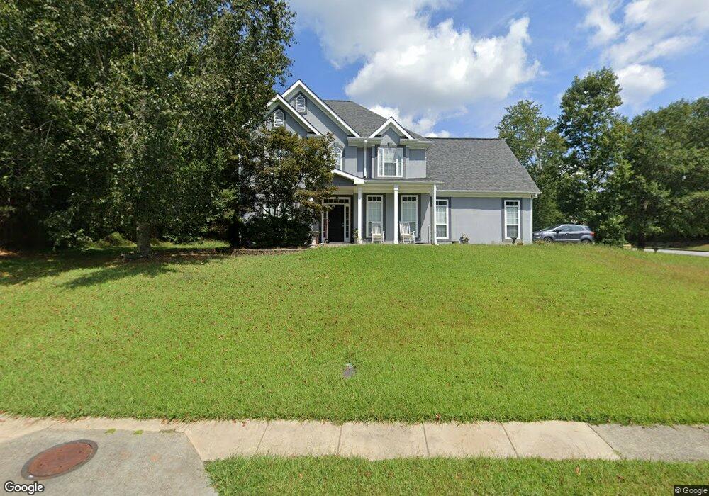
4302 Bond St Hoschton, GA 30548
Estimated Value: $399,000 - $417,000
4
Beds
3
Baths
2,012
Sq Ft
$202/Sq Ft
Est. Value
About This Home
This home is located at 4302 Bond St, Hoschton, GA 30548 and is currently estimated at $407,202, approximately $202 per square foot. 4302 Bond St is a home located in Gwinnett County with nearby schools including Duncan Creek Elementary School, Frank N. Osborne Middle School, and Mill Creek High School.
Ownership History
Date
Name
Owned For
Owner Type
Purchase Details
Closed on
Mar 14, 2022
Sold by
Flery Investment Llc
Bought by
Mch Sfr Property Owner 3 Llc
Current Estimated Value
Purchase Details
Closed on
Jul 26, 2017
Sold by
Talarek Randall S
Bought by
Flery Investment Llc
Purchase Details
Closed on
Aug 30, 2002
Sold by
Talarek Randall S
Bought by
Talarek Randall S and Talarek Patricia M
Home Financials for this Owner
Home Financials are based on the most recent Mortgage that was taken out on this home.
Original Mortgage
$129,750
Interest Rate
11.22%
Mortgage Type
New Conventional
Purchase Details
Closed on
Oct 1, 1996
Sold by
Brentwood Homes
Bought by
Talarek Randall S
Create a Home Valuation Report for This Property
The Home Valuation Report is an in-depth analysis detailing your home's value as well as a comparison with similar homes in the area
Home Values in the Area
Average Home Value in this Area
Purchase History
| Date | Buyer | Sale Price | Title Company |
|---|---|---|---|
| Mch Sfr Property Owner 3 Llc | $384,500 | -- | |
| Flery Investment Llc | $192,500 | -- | |
| Talarek Randall S | -- | -- | |
| Talarek Randall S | $134,000 | -- |
Source: Public Records
Mortgage History
| Date | Status | Borrower | Loan Amount |
|---|---|---|---|
| Previous Owner | Talarek Randall S | $129,750 | |
| Closed | Talarek Randall S | $0 |
Source: Public Records
Tax History Compared to Growth
Tax History
| Year | Tax Paid | Tax Assessment Tax Assessment Total Assessment is a certain percentage of the fair market value that is determined by local assessors to be the total taxable value of land and additions on the property. | Land | Improvement |
|---|---|---|---|---|
| 2024 | $5,897 | $153,360 | $29,200 | $124,160 |
| 2023 | $5,897 | $153,360 | $29,200 | $124,160 |
| 2022 | $5,047 | $130,320 | $29,200 | $101,120 |
| 2021 | $3,804 | $94,160 | $19,920 | $74,240 |
| 2020 | $3,825 | $94,160 | $19,920 | $74,240 |
| 2019 | $3,681 | $94,160 | $19,920 | $74,240 |
| 2018 | $3,082 | $77,000 | $17,200 | $59,800 |
| 2016 | $2,960 | $73,040 | $17,200 | $55,840 |
| 2015 | $2,781 | $67,280 | $12,800 | $54,480 |
| 2014 | -- | $67,280 | $12,800 | $54,480 |
Source: Public Records
Map
Nearby Homes
- 1661 Silver Crest Way
- 1785 Dartford Way
- 4415 Mulberry Ridge Ln Unit 1
- 4335 Braselton Hwy Unit tax parcel R3003 327
- 4539 Braselton Hwy
- 4335 Magpie Dr
- 0 Georgia 124 Unit 10590221
- 4657 Water Mill Dr NE
- 4777 Waxwing St
- 4849 Lily Stem Dr
- 4457 Water Mill Dr
- 4271 Haywater Cove
- 4909 Lily Stem Dr
- 2088 Skybrooke Ct
- 4979 Lily Stem Dr
- 4420 Elvie Way
- 1682 Mineral Springs Rd
- 2206 Spring Stone Ct
- 2013 Skybrooke Ln
- 4280 Kings Cross Way
- 4280 Kings Cross Way NE
- 4312 Bond St
- 4319 Milford Place
- 4290 Kings Cross Way Unit 1
- 4322 Bond St Unit 1
- 4285 Kings Cross Way Unit 1
- 0 Bond St NE Unit 7126400
- 0 Bond St NE Unit 3280408
- 0 Bond St NE Unit 7042760
- 4329 Milford Place
- 4295 Kings Cross Way Unit /104
- 4295 Kings Cross Way
- 4332 Bond St
- 4310 Kings Cross Way
- 4332 Bond St NE
- 4313 Bond St Unit 1
- 4304 Milford Place
- 4401 Dartford Ct
- 4314 Milford Place Unit 1