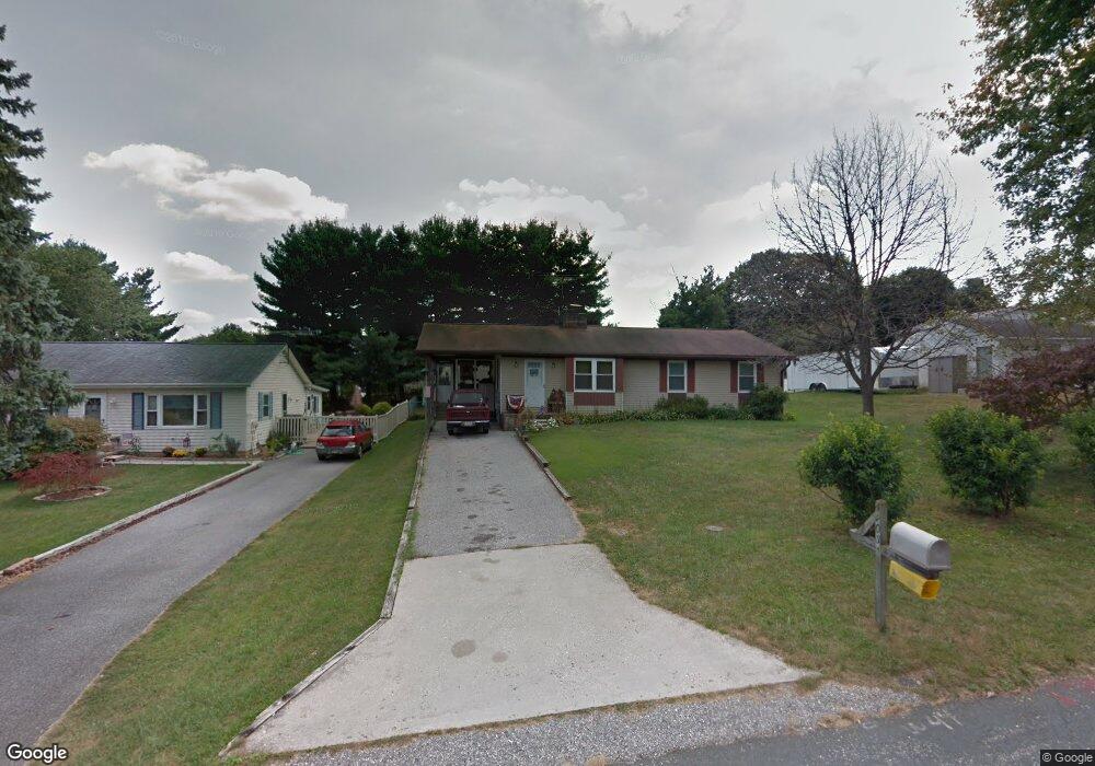
4303 Royal Ave Hampstead, MD 21074
Estimated Value: $341,000 - $397,000
Studio
2
Baths
1,248
Sq Ft
$292/Sq Ft
Est. Value
About This Home
This home is located at 4303 Royal Ave, Hampstead, MD 21074 and is currently estimated at $364,846, approximately $292 per square foot. 4303 Royal Ave is a home located in Carroll County with nearby schools including Spring Garden Elementary School, Shiloh Middle School, and Manchester Valley High School.
Ownership History
Date
Name
Owned For
Owner Type
Purchase Details
Closed on
Nov 9, 2023
Sold by
Mcdonald Philip J and Mcdonald Dawn Renee
Bought by
Philip And Dawn Mcdonald Living Trust and Mcdonald
Current Estimated Value
Purchase Details
Closed on
Nov 4, 1998
Sold by
Weikers Clark O
Bought by
Mcdonald Philip J and Mcdonald Dawn Renee
Purchase Details
Closed on
Dec 14, 1992
Sold by
Gehret Robert Steel
Bought by
Weikers Clark O
Purchase Details
Closed on
Feb 15, 1983
Sold by
Ruby David G
Bought by
Gehret Robert Steel
Create a Home Valuation Report for This Property
The Home Valuation Report is an in-depth analysis detailing your home's value as well as a comparison with similar homes in the area
Home Values in the Area
Average Home Value in this Area
Purchase History
| Date | Buyer | Sale Price | Title Company |
|---|---|---|---|
| Philip And Dawn Mcdonald Living Trust | -- | None Listed On Document | |
| Mcdonald Philip J | $140,900 | -- | |
| Weikers Clark O | $116,000 | -- | |
| Gehret Robert Steel | $61,000 | -- |
Source: Public Records
Tax History
| Year | Tax Paid | Tax Assessment Tax Assessment Total Assessment is a certain percentage of the fair market value that is determined by local assessors to be the total taxable value of land and additions on the property. | Land | Improvement |
|---|---|---|---|---|
| 2025 | $3,129 | $273,600 | $83,000 | $190,600 |
| 2024 | $2,984 | $260,867 | $0 | $0 |
| 2023 | $2,804 | $248,133 | $0 | $0 |
| 2022 | $2,712 | $235,400 | $83,000 | $152,400 |
| 2021 | $5,470 | $229,967 | $0 | $0 |
| 2020 | $2,605 | $224,533 | $0 | $0 |
| 2019 | $2,544 | $219,100 | $83,000 | $136,100 |
| 2018 | $2,522 | $219,100 | $83,000 | $136,100 |
| 2017 | $2,522 | $219,100 | $0 | $0 |
| 2016 | -- | $221,700 | $0 | $0 |
| 2015 | -- | $217,533 | $0 | $0 |
| 2014 | -- | $213,367 | $0 | $0 |
Source: Public Records
Map
Nearby Homes
- 4240 Crystal Ct Unit 2A
- 4290 N Woods Trail
- 4207 Ralph Ave
- 1004 Scarlet Oak Ct Unit 1D
- 4470 Woodsman Dr Unit 731
- 930 Gaming Square
- 4440 N Woods Trail
- 920 N Houcksville Rd
- 740 Spotters Ct
- 3992 Terrace Dr
- 3870 Normandy Dr Unit 2C
- 3860 Normandy Dr Unit 3D
- 1151 Caton Rd
- 4138 Hillcrest Ave
- 820 Wembley Dr Unit 2C
- 820 Wembley Dr Unit 2A
- 820 Wembley Dr Unit 2B
- 820 Wembley Dr Unit 3D
- 820 Wembley Dr Unit 2D
- 820 Wembley Dr Unit 1D
- 4305 Royal Ave
- 4301 Royal Ave
- 801 Clearview Ave
- 4290 Huntsman Trail
- 4288 Huntsman Trail
- 4292 Huntsman Trail
- 4307 Royal Ave
- 4286 Huntsman Trail
- 4294 Huntsman Trail
- 807 Clearview Ave
- 4304 Royal Ave
- 4284 Huntsman Trail
- 4309 Royal Ave
- 4306 Royal Ave
- 4296 Huntsman Trail
- 4308 Royal Ave
- 809 Clearview Ave
- 4287 Huntsman Trail
- 4285 Huntsman Trail
- 4289 Huntsman Trail
Your Personal Tour Guide
Ask me questions while you tour the home.