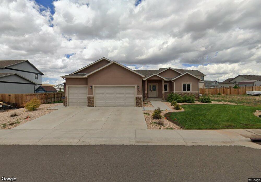
4305 Chippewa Dr Laramie, WY 82072
Estimated Value: $480,000 - $640,000
3
Beds
2
Baths
1,749
Sq Ft
$325/Sq Ft
Est. Value
About This Home
This home is located at 4305 Chippewa Dr, Laramie, WY 82072 and is currently estimated at $568,496, approximately $325 per square foot. 4305 Chippewa Dr is a home with nearby schools including Indian Paintbrush Elementary School, Laramie Middle School, and Laramie High School.
Ownership History
Date
Name
Owned For
Owner Type
Purchase Details
Closed on
Oct 1, 2018
Sold by
Bohan William
Bought by
Nowak Henry Peter
Current Estimated Value
Home Financials for this Owner
Home Financials are based on the most recent Mortgage that was taken out on this home.
Original Mortgage
$114,900
Outstanding Balance
$100,200
Interest Rate
4.5%
Mortgage Type
Commercial
Estimated Equity
$468,296
Purchase Details
Closed on
Jan 11, 2016
Sold by
Pheasant Ridge Developments Llc
Bought by
Bohan William
Home Financials for this Owner
Home Financials are based on the most recent Mortgage that was taken out on this home.
Original Mortgage
$334,400
Interest Rate
3.98%
Mortgage Type
New Conventional
Create a Home Valuation Report for This Property
The Home Valuation Report is an in-depth analysis detailing your home's value as well as a comparison with similar homes in the area
Home Values in the Area
Average Home Value in this Area
Purchase History
| Date | Buyer | Sale Price | Title Company |
|---|---|---|---|
| Nowak Henry Peter | -- | None Available | |
| Bohan William | -- | First American Title |
Source: Public Records
Mortgage History
| Date | Status | Borrower | Loan Amount |
|---|---|---|---|
| Open | Nowak Henry Peter | $114,900 | |
| Previous Owner | Bohan William | $334,400 |
Source: Public Records
Tax History Compared to Growth
Tax History
| Year | Tax Paid | Tax Assessment Tax Assessment Total Assessment is a certain percentage of the fair market value that is determined by local assessors to be the total taxable value of land and additions on the property. | Land | Improvement |
|---|---|---|---|---|
| 2025 | $3,428 | $36,527 | $6,818 | $29,709 |
| 2024 | $3,428 | $46,954 | $8,812 | $38,142 |
| 2023 | $3,343 | $45,789 | $7,903 | $37,886 |
| 2022 | $3,015 | $41,306 | $7,410 | $33,896 |
| 2021 | $2,587 | $36,709 | $6,691 | $30,018 |
| 2020 | $2,640 | $36,158 | $6,560 | $29,598 |
| 2019 | $2,484 | $34,025 | $6,215 | $27,810 |
| 2018 | $2,587 | $35,440 | $6,074 | $29,366 |
| 2017 | $2,493 | $34,148 | $6,074 | $28,074 |
| 2016 | $2,471 | $33,850 | $5,695 | $28,155 |
| 2015 | $316 | $3,193 | $3,193 | $0 |
| 2014 | $316 | $4,328 | $0 | $0 |
Source: Public Records
Map
Nearby Homes
- 4421 Shoshone Dr
- 1050 N Indian Hills Dr
- 4324 Pueblo Dr
- 4420 E Grays Gable Rd
- 4106 Kiowa Dr
- 4341 E Crow Dr
- 3734 Reynolds St
- 1651 Fox Ridge Rd
- TBD Hayford Ave
- 1772 Eaglecrest Ct
- 1071 Duna Dr
- 1062 Bonita Dr
- 2919 Plains St
- 2719 Nighthawk Dr
- 2611 Reynolds St Unit A
- 1766 N 23rd St
- 2130 Edward Dr
- 2122 E Curtis St
- 1554 Henry Dr
- 1501 Arabian Dr
- 4319 Chippewa Dr
- 4221 Chippewa Dr
- 4222 Shoshone Dr
- 1460 Dakota Dr
- 4310 Shoshone Dr
- 4308 Chippewa Dr
- 4215 Chippewa Dr
- 4214 Shoshone Dr
- 4314 Chippewa Dr
- 1456 Dakota Dr
- 4225 Shoshone Dr
- 4320 Shoshone Dr
- 4320 Chippewa Dr
- 4313 Shoshone Dr
- 4307 Navajo Dr
- 1454 Dakota Dr
- 4205 Chippewa Dr
- 4413 Chippewa Dr
- 4311 Navajo Dr
- 4217 Shoshone Dr