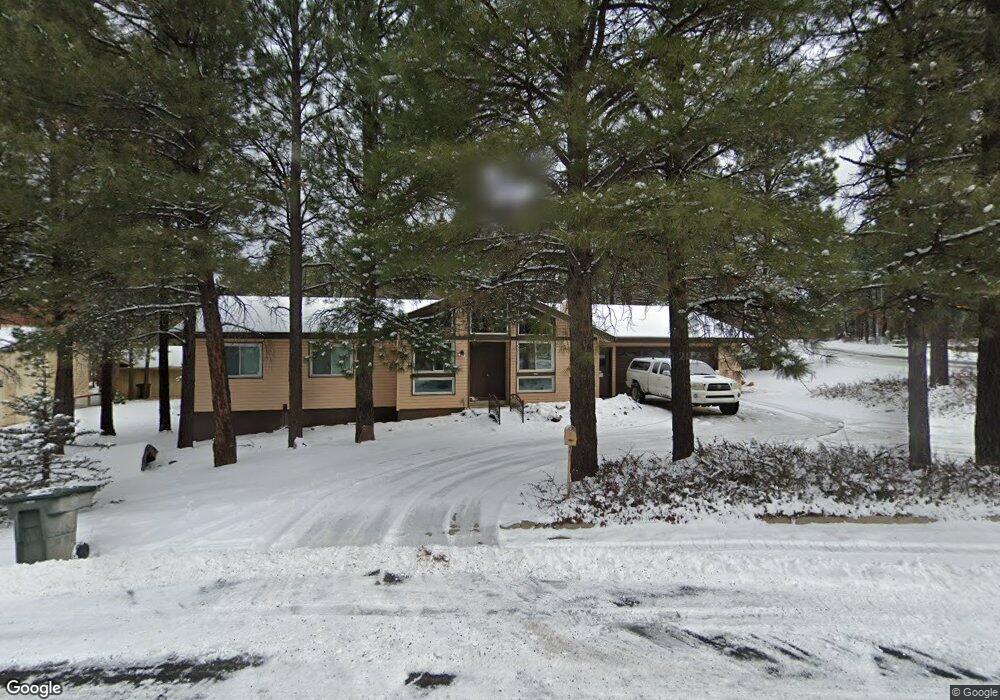
4305 E Burning Tree Loop Flagstaff, AZ 86004
Country Club Estates NeighborhoodEstimated Value: $620,747 - $783,000
--
Bed
--
Bath
1,668
Sq Ft
$426/Sq Ft
Est. Value
About This Home
This home is located at 4305 E Burning Tree Loop, Flagstaff, AZ 86004 and is currently estimated at $710,687, approximately $426 per square foot. 4305 E Burning Tree Loop is a home located in Coconino County with nearby schools including Knoles Elementary School, Coconino High School, and The Peak School.
Ownership History
Date
Name
Owned For
Owner Type
Purchase Details
Closed on
Jan 2, 1994
Sold by
Reed Merlyn L and Reed Nelda L
Bought by
Times Philip H and Times Mernel D R
Current Estimated Value
Home Financials for this Owner
Home Financials are based on the most recent Mortgage that was taken out on this home.
Original Mortgage
$92,335
Interest Rate
4.5%
Mortgage Type
New Conventional
Create a Home Valuation Report for This Property
The Home Valuation Report is an in-depth analysis detailing your home's value as well as a comparison with similar homes in the area
Home Values in the Area
Average Home Value in this Area
Purchase History
| Date | Buyer | Sale Price | Title Company |
|---|---|---|---|
| Times Philip H | $133,500 | First American Title |
Source: Public Records
Mortgage History
| Date | Status | Borrower | Loan Amount |
|---|---|---|---|
| Previous Owner | Times Philip H | $92,335 |
Source: Public Records
Tax History
| Year | Tax Paid | Tax Assessment Tax Assessment Total Assessment is a certain percentage of the fair market value that is determined by local assessors to be the total taxable value of land and additions on the property. | Land | Improvement |
|---|---|---|---|---|
| 2025 | $2,604 | $55,911 | -- | -- |
| 2024 | $2,604 | $58,479 | -- | -- |
| 2023 | $2,504 | $43,622 | $0 | $0 |
| 2022 | $2,351 | $33,456 | $0 | $0 |
| 2021 | $2,285 | $32,728 | $0 | $0 |
| 2020 | $2,222 | $32,797 | $0 | $0 |
| 2019 | $2,179 | $29,918 | $0 | $0 |
| 2018 | $2,120 | $28,195 | $0 | $0 |
| 2017 | $1,994 | $25,959 | $0 | $0 |
| 2016 | $1,983 | $23,755 | $0 | $0 |
| 2015 | $1,494 | $21,296 | $0 | $0 |
Source: Public Records
Map
Nearby Homes
- 4362 E Burning Tree Loop
- 4570 E Flintwood Ln
- 2565 N Rio de Flag Dr
- 4449 E Moonshadow Ln
- 2147 N Belleview Ln
- 4024 N Goodwin Cir
- 1710 N Fairway Dr
- 6200 N Country Club Dr
- 6305 N Country Club Dr
- 5000 E Palomino Ln Unit 23
- 5000 E Palomino Ln Unit 25
- 2958 N Oakmont Dr
- 2700 N Horseshoe St Unit 72
- 3792 E Ramble Wood Dr
- 2900 N Saddleback Way Unit 58
- 4371 E Savannah Cir
- 4150 E Spring Meadows Cir
- 1300 N La Costa Ln
- 3019 N Tam O'Shanter Dr Unit 1
- 1500 N Foxglenn St
- 4317 E Burning Tree Loop
- 2250 N Rio de Flag Dr
- 2251 N Rio de Flag Dr
- 4318 E Burning Tree Loop
- 4329 E Burning Tree Loop
- 2307 N Rio de Flag Dr
- 4600 E Timber Point Way
- 4611 E Timber Point Way Unit 2
- 4510 E Flintwood Ln
- 4330 E Burning Tree Loop
- 2233 N Rio de Flag Dr
- 2200 N Rio de Flag Dr Unit 2
- 4505 E Flintwood Ln
- 4610 E Timber Point Way
- 2311 N Rio de Flag Dr
- 4510 E Red Fox Ln
- 4621 E Timber Point Way
- 4340 E Burning Tree Loop
- 4620 E Timber Point Way
- 2395 N Broken Circle Rd
Your Personal Tour Guide
Ask me questions while you tour the home.