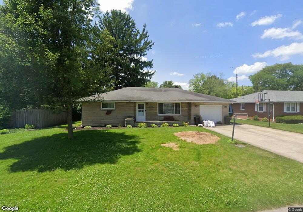
4305 N New York Ave Muncie, IN 47304
Northview NeighborhoodEstimated Value: $151,000 - $177,000
2
Beds
2
Baths
1,673
Sq Ft
$99/Sq Ft
Est. Value
About This Home
This home is located at 4305 N New York Ave, Muncie, IN 47304 and is currently estimated at $165,884, approximately $99 per square foot. 4305 N New York Ave is a home located in Delaware County with nearby schools including North View Elementary School, Muncie Central High School, and Northside Middle School.
Ownership History
Date
Name
Owned For
Owner Type
Purchase Details
Closed on
May 30, 2006
Sold by
Poorman Michael J and Poorman Alison L
Bought by
Hart Jason D and Hart Maria C
Current Estimated Value
Home Financials for this Owner
Home Financials are based on the most recent Mortgage that was taken out on this home.
Original Mortgage
$87,250
Outstanding Balance
$51,611
Interest Rate
6.68%
Mortgage Type
New Conventional
Estimated Equity
$114,273
Create a Home Valuation Report for This Property
The Home Valuation Report is an in-depth analysis detailing your home's value as well as a comparison with similar homes in the area
Home Values in the Area
Average Home Value in this Area
Purchase History
| Date | Buyer | Sale Price | Title Company |
|---|---|---|---|
| Hart Jason D | -- | None Available |
Source: Public Records
Mortgage History
| Date | Status | Borrower | Loan Amount |
|---|---|---|---|
| Open | Hart Jason D | $87,250 |
Source: Public Records
Tax History Compared to Growth
Tax History
| Year | Tax Paid | Tax Assessment Tax Assessment Total Assessment is a certain percentage of the fair market value that is determined by local assessors to be the total taxable value of land and additions on the property. | Land | Improvement |
|---|---|---|---|---|
| 2024 | $1,417 | $129,900 | $17,600 | $112,300 |
| 2023 | $1,355 | $122,700 | $14,700 | $108,000 |
| 2022 | $1,269 | $114,100 | $14,700 | $99,400 |
| 2021 | $1,091 | $96,300 | $14,900 | $81,400 |
| 2020 | $931 | $80,300 | $12,400 | $67,900 |
| 2019 | $889 | $76,100 | $11,300 | $64,800 |
| 2018 | $787 | $68,800 | $11,300 | $57,500 |
| 2017 | $811 | $71,400 | $12,400 | $59,000 |
| 2016 | $832 | $71,400 | $12,400 | $59,000 |
| 2014 | $742 | $73,100 | $12,400 | $60,700 |
| 2013 | -- | $73,000 | $12,400 | $60,600 |
Source: Public Records
Map
Nearby Homes
- 66 Falcon Point Ct
- 70 Falcon Point Ct
- 69 Falcon Point Ct
- 68 Falcon Point Ct
- 67 Falcon Point Ct
- 4115 N Ball Ave
- 0 Emerald Pointe Way Unit 202508714
- 73 Emerald Pointe Way
- 72 Emerald Pointe Way
- 3705 N New York Ave
- 4210 N Oakwood Ave
- 3613 N Locust St
- 3609 N Locust St
- 3509 N Lanewood Dr
- 1901 W Riggin Rd
- 4501 N Wheeling 9b-3 Ave Unit 9B-3
- 4501 N Wheeling Ave Unit 10A-101
- 4501 N Wheeling Ave Unit 5E4
- 4501 N Wheeling Ave Unit 3-106
- 2210 W Christy Ln
- 4309 N New York Ave
- 1400 W Sheffield Dr
- 4304 N Janney Ave
- 4308 N Janney Ave
- 4313 N New York Ave
- 4300 N Janney Ave
- 4304 N New York Ave
- 4308 N New York Ave
- 4312 N Janney Ave
- 1324 W Sheffield Dr
- 4401 N New York Ave
- 4312 N New York Ave
- 1401 W Sheffield Dr
- 4400 N Janney Ave
- 1415 W Sheffield Dr
- 4400 N New York Ave
- 1308 W Sheffield Dr
- 4305 N Janney Ave
- 4405 N New York Ave
- 1500 W Sheffield Dr