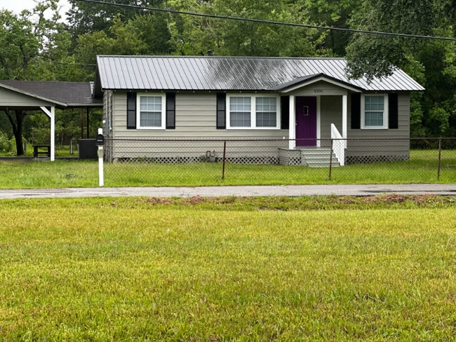
4306 Earl Blvd Moss Point, MS 39563
About This Home
Property Id: 2222818
Thank you for your interest in 4306 Earl Blvd. in Moss Point, Mississippi, brought to you by Cooper Homes LLC. This inviting 1,200 square foot home features three bedrooms and two full bathrooms. It comes equipped with brand new stainless steel appliances and recessed lighting throughout.
The property includes a spacious living room and a separate sitting room adjacent to the kitchen. You'll also find a convenient laundry room with a washer and dryer included. Enjoy peace of mind with a large yard where your children can play safely, as well as a covered carport and a storage unit.
The rent is $1,600 per month, with a $1,000 deposit required. Please note that no pets over 5 pounds are allowed, and Section 8 is accepted.
If you're interested in touring the home or would like to receive an application, please feel free to contact us at . Thank you for your time, and I look forward to speaking with you soon. We can't wait to open the purple door to you!

Map
- 4312 Charles St
- 6401 Frederick St
- 4200 Second St
- 4100 Karen St
- 5619 Grierson St
- 4607 Briggs St
- 3801 Canal St
- 0 Community Unit 4110207
- 0 Community Unit 4110221
- 5736 Eastwood Dr
- 4712 First St
- 4337 Terrace Dr
- 5418 Elder St
- 6109 Shortcut Rd
- 0 Highway 63 Hwy Unit 4047997
- 6519 Linda Cir
- 0 Fairwood Cir
- 0 Fairwood Dr
- 0 Second St Unit 4128441
- 5031 Community Ave
- 4106 2nd St
- 4507 2nd St
- 3831 Morningview Dr
- 3907 Branch St Unit 1-8
- 6525 Jasmine St Unit 4
- 6525 Jasmine St Unit 2
- 6419 Grierson St
- 4830 Saphire Ave
- 4518 Atchison St
- 4924 Dr L D Chapman St
- 4800 Long Ave
- 5201 Monaco Dr
- 3414 Shortcut Rd
- 4148 Magnolia St
- 4121 Castenera Ave
- 4100 Chicot St
- 4315 Orchard Ave
- 5101 Orchard Rd
- 5101 Orchard Ave
- 5111 Orchard Ave


