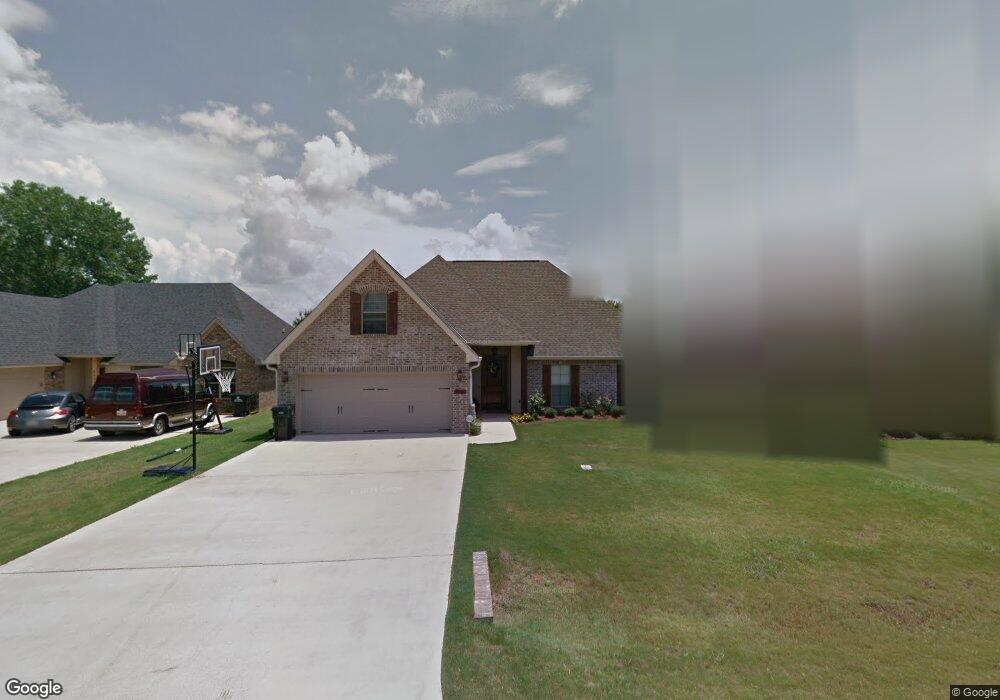
4309 Ava Ln Benton, LA 71006
Estimated Value: $308,000 - $416,000
4
Beds
2
Baths
2,353
Sq Ft
$151/Sq Ft
Est. Value
About This Home
This home is located at 4309 Ava Ln, Benton, LA 71006 and is currently estimated at $356,466, approximately $151 per square foot. 4309 Ava Ln is a home located in Bossier Parish with nearby schools including Legacy Elementary School, Benton Middle School, and Benton High School.
Ownership History
Date
Name
Owned For
Owner Type
Purchase Details
Closed on
Apr 27, 2012
Sold by
Cross James Daniel and Cross Dee Ann
Bought by
Moore Catherine Elizabeth Conger
Current Estimated Value
Home Financials for this Owner
Home Financials are based on the most recent Mortgage that was taken out on this home.
Original Mortgage
$229,500
Outstanding Balance
$160,566
Interest Rate
4.11%
Mortgage Type
Unknown
Estimated Equity
$195,900
Purchase Details
Closed on
Mar 14, 2007
Sold by
Palmetto Group Llc
Bought by
Acadian Concepts Llc
Create a Home Valuation Report for This Property
The Home Valuation Report is an in-depth analysis detailing your home's value as well as a comparison with similar homes in the area
Home Values in the Area
Average Home Value in this Area
Purchase History
| Date | Buyer | Sale Price | Title Company |
|---|---|---|---|
| Moore Catherine Elizabeth Conger | $255,000 | First Commerce Title Inc | |
| Acadian Concepts Llc | $25,000 | None Available |
Source: Public Records
Mortgage History
| Date | Status | Borrower | Loan Amount |
|---|---|---|---|
| Open | Moore Catherine Elizabeth Conger | $229,500 |
Source: Public Records
Tax History Compared to Growth
Tax History
| Year | Tax Paid | Tax Assessment Tax Assessment Total Assessment is a certain percentage of the fair market value that is determined by local assessors to be the total taxable value of land and additions on the property. | Land | Improvement |
|---|---|---|---|---|
| 2024 | $2,594 | $28,871 | $3,500 | $25,371 |
| 2023 | $2,173 | $24,336 | $3,500 | $20,836 |
| 2022 | $2,162 | $24,336 | $3,500 | $20,836 |
| 2021 | $2,128 | $24,336 | $3,500 | $20,836 |
| 2020 | $2,128 | $24,336 | $3,500 | $20,836 |
| 2019 | $2,075 | $23,705 | $2,650 | $21,055 |
| 2018 | $2,074 | $23,700 | $2,650 | $21,050 |
| 2017 | $2,050 | $23,700 | $2,650 | $21,050 |
| 2016 | $2,050 | $23,700 | $2,650 | $21,050 |
| 2015 | $1,918 | $23,550 | $2,650 | $20,900 |
| 2014 | $1,916 | $23,550 | $2,650 | $20,900 |
Source: Public Records
Map
Nearby Homes
- 319 Newport Ln
- 323 Newport Ln
- 4016 Elizabeth Ln
- 113 Park Blvd
- 300 Ansley Cir
- 400 Halifax Cir
- 123 Sherwood Dr
- 502 Hempstead Cir
- 217 Roanoke Cir
- 4618 Palmetto Rd
- 214 Roanoke Cir
- 349 Newport Ln
- 4229 Parkridge Dr
- 210 Sherwood Dr
- 206 Jamestowne Blvd
- 159 Jamestowne Blvd
- 603 Stowe Cir
- 207 Jamestowne Blvd
- 4409 Parkridge Dr
- 193 Jamestowne Blvd
- 4307 Ava Ln
- 4311 Ava Ln
- 4305 Ava Ln
- 204 S Parkridge Dr
- 206 S Parkridge Dr
- 4313 Ava Ln
- 202 S Parkridge Dr
- 208 S Parkridge Dr
- 3935 Le Brooke Ln
- 200 S Parkridge Dr
- 3934 Le Brooke Ln
- 3934 Le Brooke Ln
- 210 S Parkridge Dr
- 3935 Le Brooke Ln
- 4303 Ava Ln
- 212 S Parkridge Dr
- 3933 Le Brooke Ln
- 4405 Ellis Ct
- 3932 Le Brooke Ln
- 4039 Elizabeth Ln