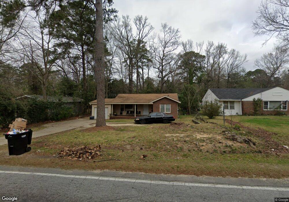
4309 Forrest Rd Columbus, GA 31907
Eastern Columbus NeighborhoodEstimated Value: $89,000 - $110,000
3
Beds
1
Bath
1,104
Sq Ft
$88/Sq Ft
Est. Value
About This Home
This home is located at 4309 Forrest Rd, Columbus, GA 31907 and is currently estimated at $96,859, approximately $87 per square foot. 4309 Forrest Rd is a home located in Muscogee County with nearby schools including Brewer Elementary School, Fort Middle School, and Hardaway High School.
Ownership History
Date
Name
Owned For
Owner Type
Purchase Details
Closed on
Mar 22, 2021
Sold by
Zhang Dahai
Bought by
Bradshaw Steven L
Current Estimated Value
Purchase Details
Closed on
May 9, 2018
Sold by
J B Carter Real Estate Llc
Bought by
Dahai Zhang
Purchase Details
Closed on
Aug 21, 2015
Sold by
Mccraw James L
Bought by
J B Carter Real Estate Llc
Purchase Details
Closed on
Dec 29, 2011
Sold by
Riversouth Properties Inc
Bought by
Mccraw James L and Mccraw Carolyn E
Purchase Details
Closed on
Sep 16, 2011
Sold by
Fuller Debbie
Bought by
Carney Catherine
Create a Home Valuation Report for This Property
The Home Valuation Report is an in-depth analysis detailing your home's value as well as a comparison with similar homes in the area
Home Values in the Area
Average Home Value in this Area
Purchase History
| Date | Buyer | Sale Price | Title Company |
|---|---|---|---|
| Bradshaw Steven L | $120,000 | -- | |
| Dahai Zhang | $47,500 | -- | |
| J B Carter Real Estate Llc | $46,500 | -- | |
| Mccraw James L | $28,500 | -- | |
| Carney Catherine | $27,000 | -- |
Source: Public Records
Tax History Compared to Growth
Tax History
| Year | Tax Paid | Tax Assessment Tax Assessment Total Assessment is a certain percentage of the fair market value that is determined by local assessors to be the total taxable value of land and additions on the property. | Land | Improvement |
|---|---|---|---|---|
| 2025 | $1,042 | $26,612 | $6,108 | $20,504 |
| 2024 | $1,042 | $26,612 | $6,108 | $20,504 |
| 2023 | $1,048 | $26,612 | $6,108 | $20,504 |
| 2022 | $1,122 | $27,488 | $6,108 | $21,380 |
| 2021 | $1,012 | $24,724 | $6,108 | $18,616 |
| 2020 | $1,010 | $24,724 | $6,108 | $18,616 |
| 2019 | $778 | $19,000 | $4,680 | $14,320 |
| 2018 | $1,011 | $24,680 | $6,108 | $18,572 |
| 2017 | $1,042 | $24,680 | $6,108 | $18,572 |
| 2016 | $761 | $18,453 | $2,785 | $15,668 |
| 2015 | $335 | $20,278 | $2,785 | $17,493 |
| 2014 | $839 | $20,278 | $2,785 | $17,493 |
| 2013 | -- | $20,278 | $2,785 | $17,493 |
Source: Public Records
Map
Nearby Homes
- 911 Lamore St
- 4201 Forrest Rd
- 4332 Fay Dr
- 4237 Fort St
- 4268 Yates Dr
- 4248 Yates Dr
- 4312 Old MacOn Rd Unit 6
- 4161 Althea Dr
- 1918 Watkins Dr
- 4160 Spirea Dr
- 1674 Forestside Dr
- 2622 Natchez Dr
- 2608 Juniper Ave
- 2661 Fernwood Ave
- 4418 Gardiner Dr
- 4785 Gardiner Dr
- 3875 Mulberry Dr
- 4630 Gardiner Dr
- 2821 Barbara Rd
- 1618 Forestside Dr
- 4315 Forrest Rd
- 4303 Forrest Rd
- 2214 Reese Rd
- 4325 Forrest Rd
- 4269 Forrest Rd
- 4304 Forrest Rd
- 2215 Reese Rd
- 4300 Pinebrook Dr
- 4306 Pinebrook Dr
- 4312 Forrest Rd
- 4310 Pinebrook Dr
- 4314 Forrest Rd
- 4328 Forrest Rd
- 4265 Forrest Rd
- 4258 Forrest Rd
- 4284 Adams St
- 4314 Pinebrook Dr
- 4333 Forrest Rd
- 4282 Adams St
- 2124 Reese Rd