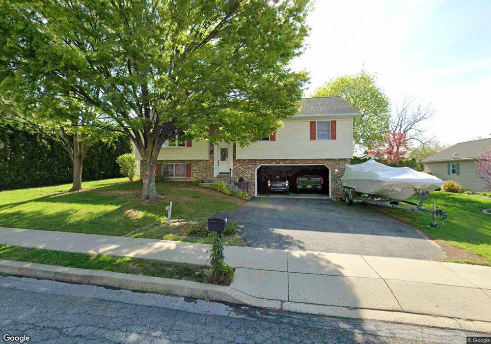
4309 Glenside Dr Reading, PA 19605
Fox Chase NeighborhoodEstimated Value: $331,123 - $398,000
3
Beds
2
Baths
1,948
Sq Ft
$190/Sq Ft
Est. Value
About This Home
This home is located at 4309 Glenside Dr, Reading, PA 19605 and is currently estimated at $369,531, approximately $189 per square foot. 4309 Glenside Dr is a home located in Berks County with nearby schools including C E Cole Intermediate School, Muhlenberg Elementary Center, and Muhlenberg Junior High School.
Ownership History
Date
Name
Owned For
Owner Type
Purchase Details
Closed on
Dec 20, 2002
Sold by
Moyer Larry B and Moyer Michele L
Bought by
Blizniak Allen Catharine D
Current Estimated Value
Home Financials for this Owner
Home Financials are based on the most recent Mortgage that was taken out on this home.
Original Mortgage
$146,501
Outstanding Balance
$59,809
Interest Rate
6.19%
Mortgage Type
FHA
Estimated Equity
$309,722
Create a Home Valuation Report for This Property
The Home Valuation Report is an in-depth analysis detailing your home's value as well as a comparison with similar homes in the area
Home Values in the Area
Average Home Value in this Area
Purchase History
| Date | Buyer | Sale Price | Title Company |
|---|---|---|---|
| Blizniak Allen Catharine D | $150,000 | -- |
Source: Public Records
Mortgage History
| Date | Status | Borrower | Loan Amount |
|---|---|---|---|
| Open | Blizniak Allen Catharine D | $146,501 |
Source: Public Records
Tax History
| Year | Tax Paid | Tax Assessment Tax Assessment Total Assessment is a certain percentage of the fair market value that is determined by local assessors to be the total taxable value of land and additions on the property. | Land | Improvement |
|---|---|---|---|---|
| 2025 | $1,814 | $120,800 | $30,100 | $90,700 |
| 2024 | $5,816 | $120,800 | $30,100 | $90,700 |
| 2023 | $5,459 | $120,800 | $30,100 | $90,700 |
| 2022 | $5,368 | $120,800 | $30,100 | $90,700 |
| 2021 | $5,241 | $120,800 | $30,100 | $90,700 |
| 2020 | $5,241 | $120,800 | $30,100 | $90,700 |
| 2019 | $5,130 | $120,800 | $30,100 | $90,700 |
| 2018 | $5,039 | $120,800 | $30,100 | $90,700 |
| 2017 | $4,945 | $120,800 | $30,100 | $90,700 |
| 2016 | $1,495 | $120,800 | $30,100 | $90,700 |
| 2015 | $1,465 | $120,800 | $30,100 | $90,700 |
| 2014 | $1,465 | $120,800 | $30,100 | $90,700 |
Source: Public Records
Map
Nearby Homes
- 4237 Danor Dr
- 4208 Juniper Dr
- 4324 Danor Dr
- 1018 Georgetown Dr
- 4113 Kinder Dr
- 1162 Tuckerton Rd
- 1005 Landover Dr
- 4008 River Rd
- 4312 Stoudts Ferry Bridge Rd
- 1128 Fredrick Blvd Unit 19D
- 2476 Wilson St
- 1326 Fredrick Blvd
- 816 Lobelia Ave
- 1041 River Crest Dr
- 817 Beach St
- 5213 Stoudts Ferry Bridge Rd
- 1025 Yarrow Ave
- 1079 Sage Ave
- 1007 Bowman St
- 1018 Bowman St
- 1001 Hilldale Ct
- 4305 Glenside Dr
- 1005 Hilldale Ct
- 4245 Danor Dr
- 4316 Glenside Dr
- 4312 Glenside Dr
- 1009 Hilldale Ct
- 4241 Danor Dr
- 4249 Danor Dr
- 4308 Glenside Dr
- 4317 Glenside Dr
- 4304 Glenside Dr
- 1108 Bernard Dr
- 1101 Bernard Dr
- 4233 Danor Dr
- 4300 Glenside Dr
- 1013 Hilldale Ct
- 1004 Hilldale Ct
- 1116 Bernard Dr
- 4232 Danor Dr
Your Personal Tour Guide
Ask me questions while you tour the home.