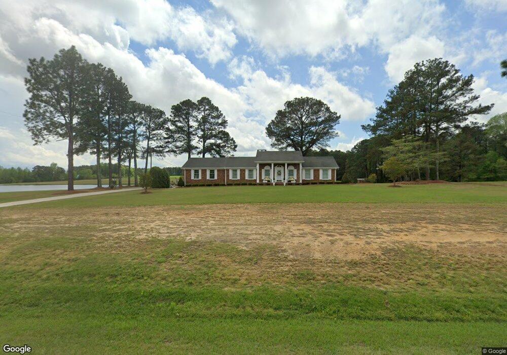
4309 Nc 55 W Angier, NC 27501
Estimated Value: $337,000 - $414,000
3
Beds
2
Baths
1,864
Sq Ft
$203/Sq Ft
Est. Value
About This Home
This home is located at 4309 Nc 55 W, Angier, NC 27501 and is currently estimated at $378,323, approximately $202 per square foot. 4309 Nc 55 W is a home located in Harnett County with nearby schools including Angier Elementary School, North Harnett Primary School, and Harnett Central Middle School.
Ownership History
Date
Name
Owned For
Owner Type
Purchase Details
Closed on
Feb 22, 2022
Sold by
Hedgepeth Danny L and Hedgepeth Frances W
Bought by
Right Of Way Group Llc
Current Estimated Value
Purchase Details
Closed on
Feb 11, 2022
Sold by
Hedgepeth Danny L and Hedgepeth Frances W
Bought by
Right Of Way Group Llc
Purchase Details
Closed on
Dec 1, 1997
Bought by
Hedgepeth Danny L
Create a Home Valuation Report for This Property
The Home Valuation Report is an in-depth analysis detailing your home's value as well as a comparison with similar homes in the area
Home Values in the Area
Average Home Value in this Area
Purchase History
| Date | Buyer | Sale Price | Title Company |
|---|---|---|---|
| Right Of Way Group Llc | $19,850 | None Listed On Document | |
| Right Of Way Group Llc | $19,850 | None Listed On Document | |
| Right Of Way Group Llc | $18,015 | None Listed On Document | |
| Right Of Way Group Llc | $18,015 | None Listed On Document | |
| Hedgepeth Danny L | -- | -- |
Source: Public Records
Tax History Compared to Growth
Tax History
| Year | Tax Paid | Tax Assessment Tax Assessment Total Assessment is a certain percentage of the fair market value that is determined by local assessors to be the total taxable value of land and additions on the property. | Land | Improvement |
|---|---|---|---|---|
| 2025 | $1,962 | $277,672 | $0 | $0 |
| 2024 | $1,962 | $277,672 | $0 | $0 |
| 2023 | $1,934 | $277,672 | $0 | $0 |
| 2022 | $1,399 | $293,452 | $0 | $0 |
| 2021 | $1,399 | $160,300 | $0 | $0 |
| 2020 | $1,399 | $160,300 | $0 | $0 |
| 2019 | $1,384 | $160,300 | $0 | $0 |
| 2018 | $1,384 | $160,300 | $0 | $0 |
| 2017 | $1,384 | $160,300 | $0 | $0 |
| 2016 | $1,221 | $140,380 | $0 | $0 |
| 2015 | $1,162 | $140,380 | $0 | $0 |
| 2014 | $1,162 | $133,180 | $0 | $0 |
Source: Public Records
Map
Nearby Homes
- 24 Roll Tide Ct
- 71 Roll Tide Ct
- 4167 Old Stage Rd N
- 4251 Old Stage Rd N
- 80 Nailsworth St
- 78 Burford Way
- 93 Begonia St
- 419 Mabry Rd
- 120 Alden Way
- 49 Alden Way
- 29 Croatoke Ct
- 63 Pinon Divide
- 176 Alden Way
- Drayton Plan at Campbell Ridge
- Norris Plan at Campbell Ridge
- Cooper 3 Plan at Campbell Ridge
- Townsend Plan at Campbell Ridge
- Middleton Plan at Campbell Ridge
- Elmhurst Plan at Campbell Ridge
- Jordan Plan at Campbell Ridge