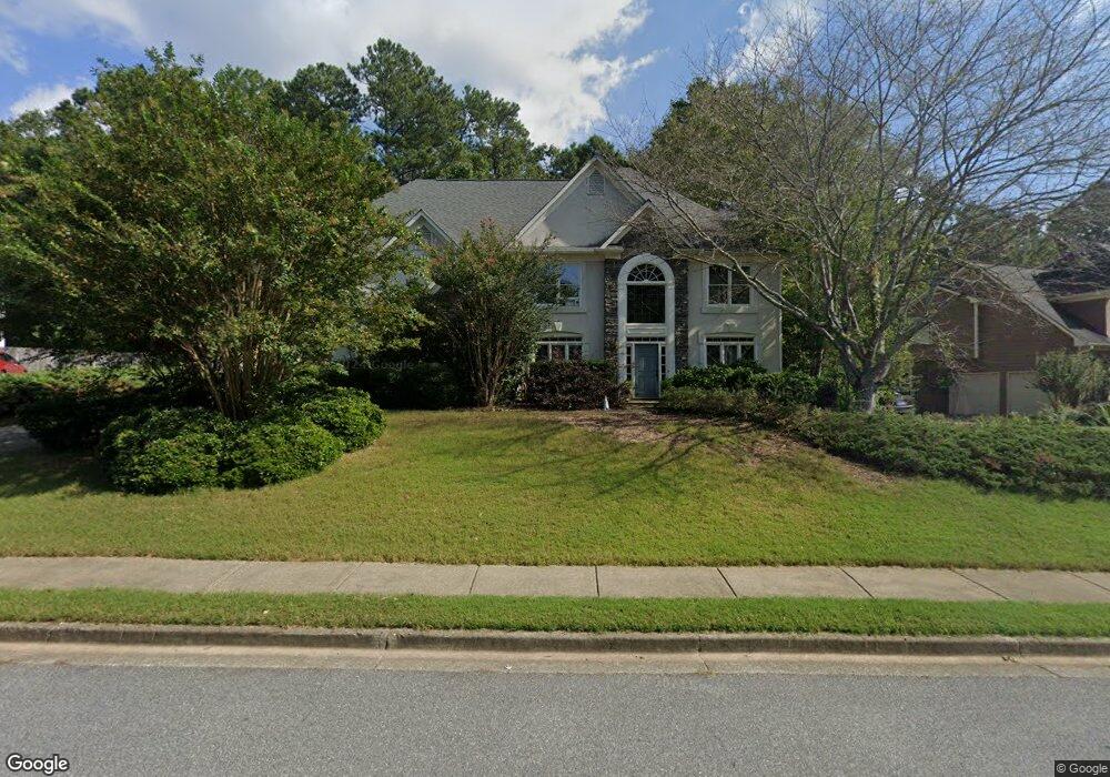
4309 Silver Peak Pkwy Unit 1 Suwanee, GA 30024
Estimated Value: $587,408 - $618,000
4
Beds
3
Baths
2,659
Sq Ft
$226/Sq Ft
Est. Value
About This Home
This home is located at 4309 Silver Peak Pkwy Unit 1, Suwanee, GA 30024 and is currently estimated at $600,602, approximately $225 per square foot. 4309 Silver Peak Pkwy Unit 1 is a home located in Gwinnett County with nearby schools including Level Creek Elementary School, North Gwinnett Middle School, and North Gwinnett High School.
Ownership History
Date
Name
Owned For
Owner Type
Purchase Details
Closed on
Jun 19, 2015
Sold by
Adams Robert Stacey
Bought by
Chaffin-Adams Kathryn
Current Estimated Value
Purchase Details
Closed on
Sep 29, 1999
Sold by
Roberts Jodo D and Roberts Joseph E
Bought by
Adams Robert S
Home Financials for this Owner
Home Financials are based on the most recent Mortgage that was taken out on this home.
Original Mortgage
$161,200
Interest Rate
7.89%
Purchase Details
Closed on
Nov 24, 1998
Sold by
Kane Elena S
Bought by
Roberts Jody D Ferrari
Home Financials for this Owner
Home Financials are based on the most recent Mortgage that was taken out on this home.
Original Mortgage
$190,500
Interest Rate
6.77%
Mortgage Type
VA
Purchase Details
Closed on
Dec 31, 1996
Sold by
Sharp Dev Inc
Bought by
Kane Elena S
Create a Home Valuation Report for This Property
The Home Valuation Report is an in-depth analysis detailing your home's value as well as a comparison with similar homes in the area
Home Values in the Area
Average Home Value in this Area
Purchase History
| Date | Buyer | Sale Price | Title Company |
|---|---|---|---|
| Chaffin-Adams Kathryn | -- | -- | |
| Adams Robert S | $201,500 | -- | |
| Roberts Jody D Ferrari | $190,500 | -- | |
| Kane Elena S | $173,900 | -- |
Source: Public Records
Mortgage History
| Date | Status | Borrower | Loan Amount |
|---|---|---|---|
| Previous Owner | Adams Robert S | $161,200 | |
| Previous Owner | Roberts Jody D Ferrari | $190,500 | |
| Closed | Kane Elena S | $0 |
Source: Public Records
Tax History
| Year | Tax Paid | Tax Assessment Tax Assessment Total Assessment is a certain percentage of the fair market value that is determined by local assessors to be the total taxable value of land and additions on the property. | Land | Improvement |
|---|---|---|---|---|
| 2025 | $4,887 | $219,640 | $44,080 | $175,560 |
| 2024 | $4,533 | $194,600 | $39,200 | $155,400 |
| 2023 | $4,533 | $194,600 | $39,200 | $155,400 |
| 2022 | $5,087 | $174,520 | $39,200 | $135,320 |
| 2021 | $3,707 | $120,800 | $35,600 | $85,200 |
| 2020 | $3,737 | $120,800 | $35,600 | $85,200 |
| 2019 | $2,763 | $124,600 | $35,600 | $89,000 |
| 2018 | $2,778 | $103,520 | $32,400 | $71,120 |
| 2016 | $2,668 | $97,342 | $27,540 | $69,802 |
| 2015 | $2,796 | $101,960 | $27,000 | $74,960 |
| 2014 | $2,810 | $101,960 | $27,000 | $74,960 |
Source: Public Records
Map
Nearby Homes
- 792 Village Field Ct
- 793 Village Field Ct
- 4434 Lassen Ct
- 909 Biscayne Way
- 4529 Silver Peak Pkwy Unit 2
- 4262 Goldfield Trace
- 1116 Bartlett Trace
- 4422 Grove Field Park
- 4718 Arbor Crest Place
- 4629 Arbor Crest Place Unit 3
- 755 Amberton Close Unit 2
- 754 Urban Grange Way
- 890 Lakefaire Landing
- 1309 Bennett Creek Overlook
- 4460 Suwanee Dam Rd
- 1011 Crofton Landing Unit 1
- 821 Scales Rd
- 3450 Commander
- 4321 Baverton Dr
- 4465 Settles Bridge Rd
- 4289 Silver Peak Pkwy
- 4319 Silver Peak Pkwy
- 685 Silver Peak Ct
- 675 Silver Peak Ct Unit 1
- 695 Silver Peak Ct Unit 1
- 4279 Silver Peak Pkwy
- 4304 Silver Peak Pkwy Unit 1
- 4314 Silver Peak Pkwy Unit 1
- 4329 Silver Peak Pkwy
- 4284 Silver Peak Pkwy
- 4334 Silver Peak Pkwy
- 665 Silver Peak Ct
- 705 Silver Peak Ct
- 4274 Silver Peak Pkwy Unit 1
- 4339 Silver Peak Pkwy
- 725 Silver Peak Ct Unit 14
- 725 Silver Peak Ct Unit 1
- 4344 Silver Peak Pkwy Unit 1
- 680 Silver Peak Ct Unit 1
- 4264 Silver Peak Pkwy
Your Personal Tour Guide
Ask me questions while you tour the home.