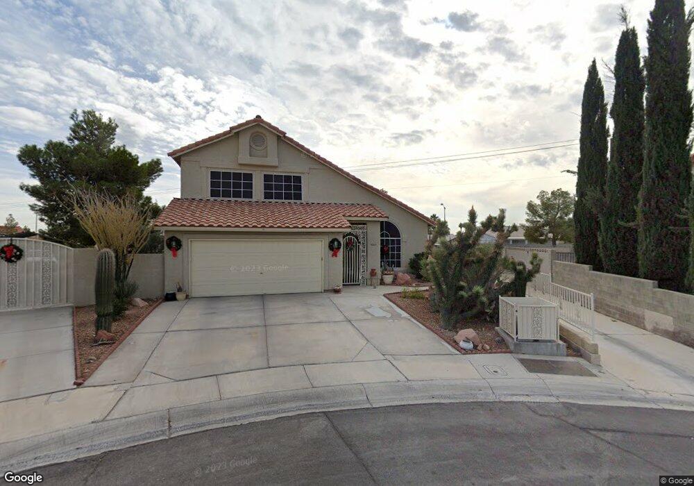
4309 Twin Peaks Dr North Las Vegas, NV 89032
Cheyenne NeighborhoodEstimated Value: $448,367 - $470,000
4
Beds
3
Baths
1,965
Sq Ft
$234/Sq Ft
Est. Value
About This Home
This home is located at 4309 Twin Peaks Dr, North Las Vegas, NV 89032 and is currently estimated at $459,592, approximately $233 per square foot. 4309 Twin Peaks Dr is a home located in Clark County with nearby schools including Claude & Stella Parson Elementary School, Theron L Swainston Middle School, and Cheyenne High School.
Ownership History
Date
Name
Owned For
Owner Type
Purchase Details
Closed on
Jul 8, 2010
Sold by
Perritte Dorothy C
Bought by
Perritte Dorothy C and Dorothy C Perritte Revocable Trust
Current Estimated Value
Purchase Details
Closed on
Nov 4, 1998
Sold by
Akins Mark Alan
Bought by
Perritte William M and Perritte Dorothy C
Home Financials for this Owner
Home Financials are based on the most recent Mortgage that was taken out on this home.
Original Mortgage
$129,200
Outstanding Balance
$28,822
Interest Rate
6.84%
Estimated Equity
$430,770
Purchase Details
Closed on
Mar 1, 1994
Sold by
Akins Terri Lee
Bought by
Akins Mark Alan
Create a Home Valuation Report for This Property
The Home Valuation Report is an in-depth analysis detailing your home's value as well as a comparison with similar homes in the area
Home Values in the Area
Average Home Value in this Area
Purchase History
| Date | Buyer | Sale Price | Title Company |
|---|---|---|---|
| Perritte Dorothy C | -- | None Available | |
| Perritte William M | $161,500 | Old Republic Title Company | |
| Akins Mark Alan | -- | -- |
Source: Public Records
Mortgage History
| Date | Status | Borrower | Loan Amount |
|---|---|---|---|
| Open | Perritte William M | $129,200 |
Source: Public Records
Tax History Compared to Growth
Tax History
| Year | Tax Paid | Tax Assessment Tax Assessment Total Assessment is a certain percentage of the fair market value that is determined by local assessors to be the total taxable value of land and additions on the property. | Land | Improvement |
|---|---|---|---|---|
| 2025 | $1,689 | $87,461 | $35,035 | $52,426 |
| 2024 | $1,641 | $87,461 | $35,035 | $52,426 |
| 2023 | $1,641 | $84,315 | $33,880 | $50,435 |
| 2022 | $1,593 | $74,548 | $28,105 | $46,443 |
| 2021 | $1,547 | $71,863 | $27,335 | $44,528 |
| 2020 | $1,499 | $69,060 | $24,640 | $44,420 |
| 2019 | $1,455 | $65,860 | $21,945 | $43,915 |
| 2018 | $1,413 | $60,793 | $18,480 | $42,313 |
| 2017 | $1,987 | $59,222 | $16,170 | $43,052 |
| 2016 | $1,339 | $52,400 | $11,935 | $40,465 |
| 2015 | $1,335 | $39,624 | $7,700 | $31,924 |
| 2014 | $1,293 | $38,506 | $7,700 | $30,806 |
Source: Public Records
Map
Nearby Homes
- 4335 Twin Peaks Dr
- 4108 Dove Creek Rd
- 4115 Tatum Ct
- 3938 Redfield Ave
- 3830 Passionfruit St
- 4230 Valley Spruce Way
- 3904 Six Gun Rd
- 4013 Extenso Dr
- 4524 Denali Ave
- 4508 W San Miguel Ave
- 3784 Nerine Pass Way
- 4002 Extenso Dr
- 3928 Biddle St
- 4076 Topaz Hills Dr
- 3937 Jamison Park Ln
- 3930 Burma Rd
- 4341 San Mateo St
- 3816 Sunking St
- 3519 Trotting Horse Rd
- 3820 Alpine Track Ave
- 4012 Dove Creek Rd
- 4315 Twin Peaks Dr
- 4016 Dove Creek Rd
- 4323 Twin Peaks Dr
- 4312 Cobblehill Way
- 4009 Stockman St
- 4005 Stockman St
- 4013 Stockman St
- 4020 Dove Creek Rd
- 4311 Cobblehill Way
- 4311 Cobblehill Way Unit none
- 4320 Twin Peaks Dr Unit 3
- 4017 Stockman St
- 4024 Dove Creek Rd
- 4021 Dove Creek Rd
- 4021 Stockman St
- 4328 Twin Peaks Dr
- 4302 Bitterroot Dr
- 4322 Cobblehill Way