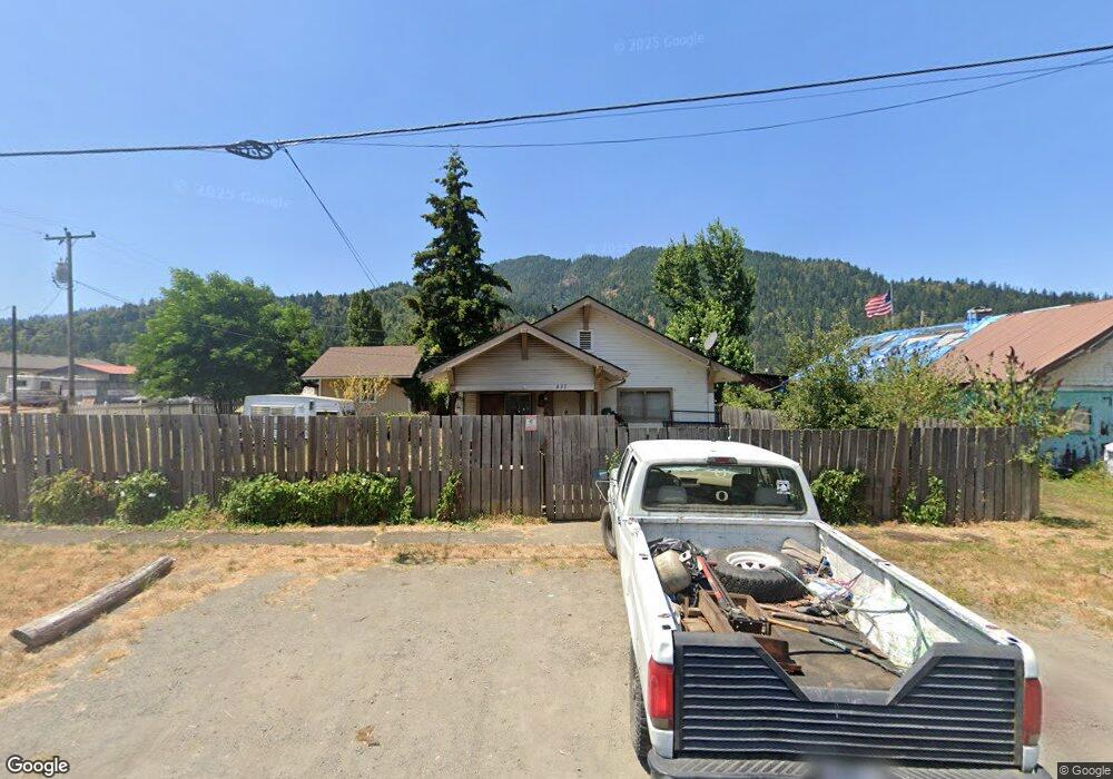
431 3rd Ave Powers, OR 97466
Estimated Value: $190,712 - $191,000
3
Beds
1
Bath
1,248
Sq Ft
$153/Sq Ft
Est. Value
About This Home
This home is located at 431 3rd Ave, Powers, OR 97466 and is currently estimated at $190,856, approximately $152 per square foot. 431 3rd Ave is a home located in Coos County with nearby schools including Powers High School.
Ownership History
Date
Name
Owned For
Owner Type
Purchase Details
Closed on
Jun 13, 2011
Sold by
Arnold Stephen R and Gabbard Carla
Bought by
Rector Craig J
Current Estimated Value
Purchase Details
Closed on
Mar 9, 2006
Sold by
Skallerud Carrie and Burns Carrie
Bought by
Arnold Stephen R and Gabbard Carla
Purchase Details
Closed on
Jul 23, 2004
Sold by
Stimbra Mikko Walter
Bought by
Stimbra Michael Walter and Stimbra Beverly Jean
Purchase Details
Closed on
Jul 21, 2004
Sold by
Stimbra Michael Walter and Stimbra Beverly Jean
Bought by
Burns Samuel L
Create a Home Valuation Report for This Property
The Home Valuation Report is an in-depth analysis detailing your home's value as well as a comparison with similar homes in the area
Purchase History
| Date | Buyer | Sale Price | Title Company |
|---|---|---|---|
| Rector Craig J | $42,500 | Fidelity National Title Co | |
| Arnold Stephen R | $100,000 | Fidelity National Title Co | |
| Stimbra Michael Walter | -- | Fidelity National Title Co | |
| Burns Samuel L | $55,000 | Fidelity National Title Co |
Source: Public Records
Tax History
| Year | Tax Paid | Tax Assessment Tax Assessment Total Assessment is a certain percentage of the fair market value that is determined by local assessors to be the total taxable value of land and additions on the property. | Land | Improvement |
|---|---|---|---|---|
| 2025 | $1,218 | $75,570 | -- | -- |
| 2024 | $1,156 | $73,370 | -- | -- |
| 2023 | $1,123 | $71,240 | $0 | $0 |
| 2022 | $1,105 | $69,170 | $0 | $0 |
| 2021 | $1,073 | $67,160 | $0 | $0 |
| 2020 | $1,022 | $67,160 | $0 | $0 |
| 2019 | $980 | $63,320 | $0 | $0 |
| 2018 | $952 | $61,480 | $0 | $0 |
| 2017 | $926 | $59,690 | $0 | $0 |
| 2016 | $898 | $57,960 | $0 | $0 |
| 2015 | $836 | $56,280 | $0 | $0 |
| 2014 | $836 | $54,650 | $0 | $0 |
Source: Public Records
Map
Nearby Homes
- 410 3rd Ave
- 510 Fir St
- 141 Poplar St
- 309 4th Ave
- 631 2nd Ave
- 130 E Date St
- 173 E Date St
- 815 E Ave
- 930 C Ave
- 889 H Ave
- 711 H Ave
- 45651 Johnson Mountain Rd
- 0 Johnson Mt Rd Unit 600 168667991
- 41308 S Powers Rd
- 46255 Highway 242
- 51014 Dement Creek Rd
- 15779 Oregon 42
- 000 Eden Valley Rd Unit 600
- 20191 Highway 42
- 16855 Highway 42
Your Personal Tour Guide
Ask me questions while you tour the home.