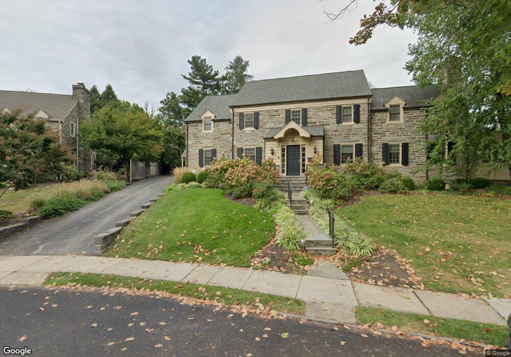
431 Bolsover Rd Wynnewood, PA 19096
Lower Merion NeighborhoodEstimated Value: $1,154,000 - $1,488,000
4
Beds
5
Baths
5,138
Sq Ft
$258/Sq Ft
Est. Value
About This Home
This home is located at 431 Bolsover Rd, Wynnewood, PA 19096 and is currently estimated at $1,324,024, approximately $257 per square foot. 431 Bolsover Rd is a home located in Montgomery County with nearby schools including Penn Valley School, Welsh Valley Middle School, and Lower Merion High School.
Ownership History
Date
Name
Owned For
Owner Type
Purchase Details
Closed on
Oct 14, 2016
Sold by
Bernstein Daniel I and Bernstein Sarah A
Bought by
Harwood Marc I and Harwood Lisa Perlman
Current Estimated Value
Home Financials for this Owner
Home Financials are based on the most recent Mortgage that was taken out on this home.
Original Mortgage
$960,000
Outstanding Balance
$770,595
Interest Rate
3.5%
Mortgage Type
New Conventional
Estimated Equity
$553,429
Purchase Details
Closed on
Dec 29, 2005
Sold by
Wachovia Bank Na and Rapp William
Bought by
Bernstein Daniel I and Bernstein Sarah A
Home Financials for this Owner
Home Financials are based on the most recent Mortgage that was taken out on this home.
Original Mortgage
$803,400
Interest Rate
6.28%
Create a Home Valuation Report for This Property
The Home Valuation Report is an in-depth analysis detailing your home's value as well as a comparison with similar homes in the area
Home Values in the Area
Average Home Value in this Area
Purchase History
| Date | Buyer | Sale Price | Title Company |
|---|---|---|---|
| Harwood Marc I | $1,200,000 | Trident Land Transfer | |
| Bernstein Daniel I | $605,000 | -- |
Source: Public Records
Mortgage History
| Date | Status | Borrower | Loan Amount |
|---|---|---|---|
| Open | Harwood Marc I | $960,000 | |
| Previous Owner | Bernstein Daniel I | $803,400 |
Source: Public Records
Tax History Compared to Growth
Tax History
| Year | Tax Paid | Tax Assessment Tax Assessment Total Assessment is a certain percentage of the fair market value that is determined by local assessors to be the total taxable value of land and additions on the property. | Land | Improvement |
|---|---|---|---|---|
| 2025 | $17,452 | $417,870 | -- | -- |
| 2024 | $17,452 | $417,870 | -- | -- |
| 2023 | $16,724 | $417,870 | $0 | $0 |
| 2022 | $16,414 | $417,870 | $0 | $0 |
| 2021 | $16,040 | $417,870 | $0 | $0 |
| 2020 | $15,648 | $417,870 | $0 | $0 |
| 2019 | $15,372 | $417,870 | $0 | $0 |
| 2018 | $15,372 | $417,870 | $0 | $0 |
| 2017 | $14,807 | $417,870 | $0 | $0 |
| 2016 | $14,644 | $417,870 | $0 | $0 |
| 2015 | $14,158 | $417,870 | $0 | $0 |
| 2014 | $13,654 | $417,870 | $0 | $0 |
Source: Public Records
Map
Nearby Homes
- 1334 Montgomery Ave Unit G-3
- 521 Homewood Ave
- 9 Hansen Ct
- 23 Sabine Ave
- 414 Mcclenaghan Mill Rd
- 330 Dudley Ave
- 314 Dudley Ave Unit 25
- 222 E Montgomery Ave Unit 304
- 121 Conway Ave
- 226 Mcclenaghan Mill Rd
- 603 Old Gulph Rd
- 13 Elmwood Ave
- 216 N Narberth Ave
- 239 Old Gulph Rd
- 383 Lakeside Rd Unit G2
- 383 Lakeside Rd Unit 105
- 30 Old Gulph Rd
- 1219 W Wynnewood Rd Unit 311
- 142 Merion Ave
- 146 Merion Ave